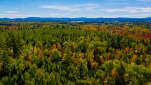
Tracking the Effects of Forest Disturbances and Climate Change on Headwater Streams in Northern Maine
 Institution: University of Maine
Sponsor: Maine Water Resources Research Institute (WRRI 104b, 2021)
Project Summary
University of Maine System researchers are partnering with northern Maine woodland stakeholders to assemble headwater stream diagnostic information for use in watershed management decision-making.
The coldwater streams of northern Maine have not been well-studied in terms of their responses to the interconnected, cumulative effects of watershed disturbances and climate change. Little information has been collected on the interplay of forestry operations, road construction, and climate changes in headwater streams in this region.
This project, funded by the Maine WRRI, is a response to this important knowledge gap. The goal is to guide assembly and use of headwater stream diagnostic information for use in watershed management decision-making in areas experiencing forest harvest operations, road-building activities, and climate change effects.
Many northern Maine areas with a history of large-scale forest harvest operations are now experiencing rapid changes in climate conditions. Ongoing changes in climate and forest management practices can influence how water moves within and through stream networks, potentially altering channel dynamics and habitat conditions. This study aims to develop collaborative approaches for assembling baseline watershed information, interpreting stream conditions and dynamics, diagnosing vulnerabilities related to freshwater flows and aquatic habitat, and identifying ways to manage headwater stream systems in the region.
Businesses in the forest products and recreation industries, natural resource management organizations, government agencies, and rural communities have mutual interests in protecting high-quality headwater stream conditions. A notable challenge for stakeholders in the region is to consistently meet watershed management objectives over shorter (decadal) and longer (centurial) time scales while sustaining businesses and activities important to communities…all in the midst of a rapidly changing climate. This solutions-driven project focuses on supporting multi-objective watershed management decision-making over the long term.
This collaborative effort involves stakeholders from Maine state agencies, Irving Woodlands LLC, LandVest, Inc., and Seven Islands Land Company with an interdisciplinary team of researchers from the University of Maine System (UMS). The UMS team includes Dr. Neil Thompson from the Applied Forest Management program at University of Maine Fort Kent, Dr. Sean Smith from the School of Earth and Climate Sciences at the University of Maine (UMaine), Dr. Adam Daigneault from the School of Forest Resources at UMaine, and multiple undergraduate and graduate students.
Project Update
This project is a University of Maine collaboration with stakeholders in northern Maine including state agencies, forest products businesses, and other landowners. The research goal is diagnostic methods for long term watershed and stream management. The focus was on streams in northern Maine watersheds where forest harvesting occurs. Project outcomes provide examples to managers of the effects of watershed forest harvest activities. Baseline information for more detailed research on stream system disturbances also resulted from the study. Funding supported measurement and analyses of watershed and stream conditions, with research connecting watersheds and streams to geography, disturbances, climate, and forest management. Stream diagnostics derived from this research provide a basis for watershed management decision-making.
Research Team
- Team Leader: Neil Thompson, Irving Woodlands Forestry Professor, Applied Forest Management program, University of Maine Fort Kent
- Sean Smith, Associate Professor, School of Earth and Climate Sciences, UMaine
- Adam Daigneault, E.L. Giddings Associate Professor of Forest Policy & Economics, School of Forest Resources, UMaine
Products
- Van Dam, B. 2022. Quick guide to ArcMap basics. Technical Guidance Series, Watershed Process and Estuary Sustainability Research Group.
- Van Dam, B. 2022. Quick guide to ArcMap hydrology toolset. Technical Guidance Series, Watershed Process and Estuary Sustainability Research Group.
- Van Dam, B. 2022. Quick guide to total station field surveys. Technical Guidance Series, Watershed Process and Estuary Sustainability Research Group.
- Van Dam, B. 2022. Quick guide to topographic survey controls with base station receiver. Technical Guidance Series, Watershed Process and Estuary Sustainability Research Group.
- Van Dam, B. 2022. Survey point adjustment workbook. Technical Guidance Series, Watershed Process and Estuary Sustainability Research Group.
- Smith, S.M.C. and B. Van Dam. 2022. Stream channel mapping protocols. Technical Guidance Series, Watershed Process and Estuary Sustainability Research Group.
- Smith, S.M.C., N. Thompson, B. Van Dam, C. King, H. Libby, M. Oehler, A. Casella, and S. Roberts. In Preparation. Geomorphic reconnaissance of Smith Brook Aroostook County, Maine. Data Report. Watershed Process and Estuary Sustainability Research Group.
- Thompson, N., S.M.C. Smith, B. Van Dam, C. King, H. Libby, M. Oehler, A. Casella, and S. Roberts. In Preparation. Geomorphic reconnaissance of Smith Brook Aroostook County, Maine. Technical Report. Watershed Process and Estuary Sustainability Research Group.
