The Maine-eDNA Co-PIs: Kate Beard
By Attis Bielecki, ME EPSCoR Student Writer
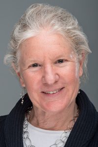
 Kate Beard is a professor in the School of Computing and Information Science at the University of Maine as well as a Co-PI on the Maine EPSCoR Track-1 grant, Maine-eDNA. She received her PhD in Geographic information systems (GIS) at the University of Wisconsin. This background is very valuable when it comes to the index site sampling collection program on the Maine-eDNA grant, and determining how the data can be visualized for researchers on the project.
The point of the index sites themselves is to provide a statewide database of eDNA samples. Beard is leading the program’s GIS efforts in order to catalog all of the collected samples over the course of the five year, Maine-eDNA grant.
GIS presents a mechanism to gather, manage, and analyze data. For the Maine-eDNA program, GIS is applied to gathering information pertaining to the location that the samples have been collected from, as well as organizing the eDNA data into a comprehensive system that allows for them to be effectively analyzed across the program.
Beard explains “GIS has really broad applications; everything takes place in space and time, so how do we analyze particular patterns, like human activity patterns or animal movement patterns that make up what we might be looking at?”
There is also a visualization aspect of GSI, as there are many ways to “map” out the data. According to Beard, “There are many patterns we may want to visualize like space and time. We also take into consideration how a person may want to see the information, so we look into the best way to format it based on how peoples’ research may need it.”
It’s important to record conditions the sample was collected in.
“We have an application that supports the graduate students’ data collection, and it keeps track of several other variables; for example, ‘what was the weather like on the day you collected the sample?’” Beard describes. “And there’s also simpler stuff like water temperature and solidity.”
This would all equate to showing short-term changes and possible long-term changes over the full five years of sampling. This information will help when considering questions like how the distribution of some species seems to be shifting northwards in the Gulf of Maine.
“In the grand scheme of things, five years doesn’t seem like all that long, but with consistent gathering of information during that duration, and with many details being observed, it could be a great future reference,” Beard says. “It’s also forming a dictionary-like tool for graduate students to use for their research. This is foundational information that my educational background helps build.”
