UMaine researcher will digitize thousands of historical photos to understand changes in the Northern Forest Region
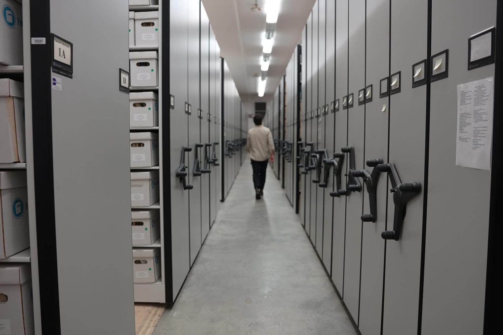
Tucked away in a quiet, climate-controlled building on the University of Maine campus is a collection of old film. Donated to Fogler Library’s Special Collections by the James W. Sewall Company (Sewall) in 2019, the collection includes over 3,000 large canisters, each with a bright yellow “Kodak” sticker on the front and 250 photos contained within.
Taken from airplanes between 1946 and 2015 for land surveying purposes, much of the photo collection tells a story of the forest spanning the northeastern United States — Maine, New Hampshire, Vermont and beyond. They have sat mostly unused since their donation, waiting for a student with the right academic background to come along and figure out how to use them — and for what purpose.
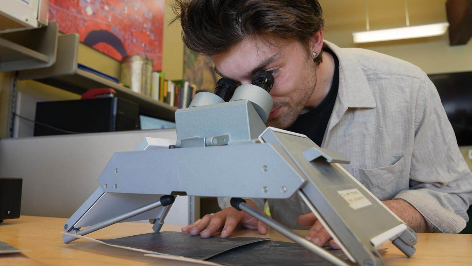
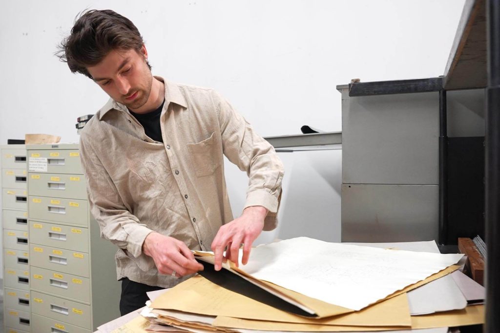
Peter Howe, a Ph.D. student in the School of Forest Resources at UMaine, will be working with the photographs to create the Northern Forest Historical Atlas. The project, which Howe is working on in collaboration with Paul Smitherman, a library specialist in Special Collections, will result in the digitization of tens of thousands of photos into mosaics made with photogrammetry software.
Howe, who has an undergraduate degree in geography from Middlebury College in Vermont, was raised in central New Hampshire and spent his formative years studying, working and adventuring around the woods of New England. There he nurtured a passion for mapping and ecology that led him to work with historical photographs as a window into the past. He graduated from Middlebury in 2018 and worked as a freelance GIS consultant and cartographer before starting the Ph.D. program at UMaine in fall 2023.
During his time at Middlebury, Howe produced novel maps of historical tree line shift in the White Mountains of New Hampshire dating back to 1943.
“I had gotten into this kind of niche area of mapping and working with historical photographs, using them as a record of the historical landscape and to understand change across time,” he said.
When Daniel Hayes, associate professor of geospatial analysis and remote sensing, learned of Howe’s interests, the Sewall film immediately came to mind — decades after film photography had largely been abandoned for modern digital imagery, a student’s expertise and interest would bring the collection back into the light.
With support from Jennifer Swalec in UMaine’s Office of Research Development, Howe secured a grant from the Northeastern State Research Cooperative to begin what has become his graduate research project: digitizing the Sewall collection and bringing the historical forest to life.
“I think the interdisciplinarity of this project holds extreme appeal. There’s a huge range of applications that are going to be made possible by this work,” Swalec said.
Howe’s goal is to make the photographs available for researchers to better understand how the Maine woods and broader Northern Forest Region have changed over time.
“It’s particularly interesting and exciting because in remote sensing, which is using aerial imagery and maps to understand the landscape, what we’re working with only goes back to the 1980s, in terms of digital imagery. But this imagery goes all the way back to the 1940s,” he said.
Howe has already had conversations with organizations interested in using the digitized photographs and mosaics for research related to forest dynamics, composition and structure. Historical photographs such as these will help produce data for researchers to analyze, including land classification and land cover analysis. They may also help foresters make more informed management decisions by applying longer-term land use history and site history, which can help parse out climate-driven versus human-impacted change.
“One of the big goals for us is making a public [digital] archive — making the photographs available to everyone. But then we also want to be able to produce data that researchers can work with,” Howe said. “It’s been fun to get feedback from people along the way about how it could be useful for them — researchers as well as land managers. We’ve heard from foresters ‘Oh, I would really love to know where this historical fire occurred, or where and when this harvest occurred in this year.’”
Howe views the storytelling power of these photos as perhaps their most important legacy. Alone, each photo is simply a snapshot of the past. Collectively, they create a vast visual record of natural and human communities, shaping and being shaped by one another over time.
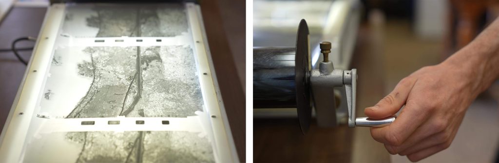
Howe works closely with faculty and staff in the Wheatland Geospatial Lab in the School of Forest Resources and will start chipping away at digitizing the Sewall collection this summer with the help of Special Collections staff. The process starts with examining each roll of film before using a specialized film scanner to produce a high-quality digital image. He will then use photogrammetry software to create photo mosaics — photos that have been pieced together into larger composite images — that offer a comprehensive look at the forest from an aerial perspective.
Photogrammetry involves taking overlapping photographs of an object, structure or space and converting them into 2D or 3D digital models. By overlaying a digital map of Maine on the mosaic, he will be able to see changes in the forest over time.
Once complete, the Northern Forest Historical Atlas will showcase how research can be applied to digital humanities, a scholarly pursuit that brings together technology and humanities disciplines.
For Howe and Hayes, this project is only the beginning — with more grant applications submitted, the two hope to continue their pursuit of digital humanities for the benefit of those in Maine and beyond.
Contact: Shelby Hartin, shelby.hartin@maine.edu