Tree Throws, Puddles, and Ponded Water
Bea Van Dam awarded first place for graduate student poster
For her Master’s research project, School of Earth & Climate Sciences and Mitchell Center student Bea Van Dam has been peering at high-resolution elevation models of the Earth’s surface created using Light Detection and Ranging (LiDAR) technology—in search of puddles of water.
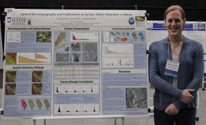
For the work, Van Dam was awarded first place for her graduate student poster at the 2018 Maine Sustainability and Water Conference held March 29 in Augusta.
The remote sensing work has been part of the Safe Beaches and Shellfish Beds project—the first project of the New England Sustainability Consortium or NEST. The major thrust of the project has been investigating water quality and public health issues for coastal communities.
Working with Sean Smith, associate professor, School of Earth & Climate Sciences and the Mitchell Center, and Kate Beard-Tisdale, professor, School of Computing & Information Science, and Mitchell Center faculty fellow, Van Dam’s specific focus has been putting numbers on how much water from storm events could be detained in depressions largely created by fallen trees—tree throw pits—and how that affects both the amount of water and materials it contains flowing into stream systems.
These small-scale or “micro” topographic features, a notable characteristic of Maine’s forested landscape, are often on the scale of single meters wide and decimeters to a meter in depth and appear as puddles in the landscape during intense or high-magnitude precipitation events.
The puddles, it turns out, can detain substantial amounts of water and, in turn, decrease or delay runoff into stream systems, helping limit the rise of floodwaters during large storms, and provide much-needed filtration of nutrients and dangerous pollutants such as fecal coliform bacteria that can wash off the land surface and lead to the closure of clam flats.
For example, she notes that one watershed she analyzed off Route 2 in Orono “is about 465 acres and has something like 800,000 gallons of water that could potentially be detained by these pits, which is a lot, and that’s not a huge watershed.”
According to Van Dam, estimates of surface water storage capacity have been summarized in textbooks for different landscape conditions, but little is known about how microtopography and related water storage varies in Maine as a function of land slope, surface geology, and land cover conditions.
With the increasing availability of high resolution elevation data, such as the LiDAR imagery, it has become possible to remotely evaluate the extent of these depressions and quantify the total upland storage capacity they may represent. Results thus far highlight that human interventions acutely and chronically alter microtopography and water flow by smoothing the landscape for farming and development and through forestry practices that result in fewer large trees being left to topple and form tree throw pits at the end of their life cycles.
Says Van Dam, “The fact that we now have the LiDAR elevation data is helpful, but even with that we’re right at the resolution edge of the data, so part of what we’re trying to do is tease out any data errors, and that’s been an ongoing process.”
She adds, “And our efforts to find these small depressions can also help inform the work of other researchers, in particular Aram Calhoun and her team who look for depressions that support vernal pool habitats. The improved knowledge of the location and storage capacity of these critical features, as well as the conditions that lead to their formation, is important outside the academic community as well.”
For example, planners in flood-prone areas obviously have an interest in understanding the landscape natural resilience in the face of large runoff events. Forestry and development practices can to be reexamined to encourage protection of microtopography in vulnerable areas. The shellfishing community, despite being geographically removed from the upland hillslopes where the features are most prominent, has an interest in preserving their water filtration capacity to protect the health of the coastal flats downstream.
“Again, this just shows the importance of these features to hydrology and aquatic habitat in Maine’s landscape,” Van Dam says.
—David Sims