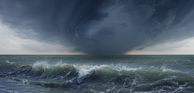
Scientists Seek to Improve Prediction of Extreme Weather Events
University of Maine scientists are partnering with multiple agencies to improve the accuracy of forecasts of hurricanes, superstorms, blizzards and floods that endanger people and animals and destroy property.
UMaine received $1.5 million of the National Oceanic and Atmospheric Administration’s $5.5 million award to increase the precision of predictions of extreme weather events and coastal flooding in the northeastern United States.
“This project allows us to develop rapid response capability and deploy ocean observing assets before extreme weather events, and use these targeted observations to constrain ocean models and issue timely forecasts for coastal cities and towns in the Northeast United States,” says Fei Chai, professor and director of UMaine’s School of Marine Sciences, and one of four university co-investigators taking part.
The three other UMaine co-investigators are Neal Pettigrew, professor of oceanography; Mary Jane Perry, professor of oceanography and interim director of the University of Maine Darling Marine Center; and Huijie Xue, professor of oceanography. In addition, program manager Linda Magnum, research associate Ivona Cetinic, graduate student Mark Neary and postdoctoral researcher Saswati Deb, will take part in the project.
The UMaine faculty and researchers are among the 39 researchers engaged in the two-year study. The group will build, deploy, garner and analyze data from state-of the-art outfitted floats, gliders and moorings during two winter storms and two summer storms that hit the Gulf of Maine or the area from Cape Cod, Massachusetts to Cape Hatteras, North Carolina.
As a severe storm approaches, aircraft will deploy 15 miniature, expendable floats along the forecasted storm track and launch four reusable gliders in the middle of the shallow continental shelf. Researchers will also anchor 10 portable buoy moorings near estuary mouths where storm surge causes significant flooding and damage.
The floats, gliders and moorings are designed to collect three new levels of ocean observations. The new data will be integrated into computer models that predict currents, sea level and turbulent mixing of cold sub-surface water with the surface ocean.
Meteorologists will be provided with a more complete picture about sea surface temperature and upper-ocean heat content, which will result in better-informed storm forecasting, say the scientists.
In addition, more targeted ocean surface data (air pressure, air and sea temperature, ocean waves, sea-level, etc.) collected by the moorings, in conjunction with current coastal flooding models, should enhance forecasting of flooding, they say.
Pettigrew is taking part in the design and manufacturing of the moorings for atmosphere and surface ocean measurements and he and Perry are in charge of glider deployments and data analysis. Chai is heading up ocean ensemble modeling and Xue is specializing in coastal flood modeling.
“Integrated Rapid-Response Observations and Ocean Ensemble Optimization to Improve Storm Intensity Forecasts in the Northeast U.S.” is the name of the study, which is being led by Glen Gawarkiewicz, senior scientist in the Physical Oceanography Department at Woods Hole Oceanographic Institution.
The Gulf of Maine Research Institute, Rutgers University and the University of Maryland Center for Environmental Science are partners, and the Cooperative Institute for the North Atlantic Region (CINAR) is the cooperating institute.
Contact: Beth Staples, 207.581.3777