Research
WPES members are involved in collaborative research and natural resource management projects inspired by the need for science-based, stakeholder-guided solutions to modern watershed, lake, river, stream, and coastal estuary problems. Our research typically centers on identifying and quantifying watershed and estuary characteristics and the processes that affect their dynamics.
A major goal of our research is to develop new types of information and management decision tools that can be used by natural resource managers, engineers, public safety and health professionals, and communities. To accomplish this, WPES projects draw on expertise from various disciplines, including geomorphology, hydrology, biology, sociology, and civil engineering. Given the stakeholder motivations for much of our work, we put substantial effort into science communication.
Use the dropdowns below to learn more about the topics and projects we have been working on here in Maine and around the world, beginning at the coast and working upstream to the headwaters.
Estuaries and Coasts
Complex dynamics where fresh and salt water meet in tidal estuaries govern the movement of waterborne pollution that poses ecological, economic, and cultural challenges, including threats to the state’s important coastal shellfisheries.
Coastal estuaries are complex meeting zones of fresh water from terrestrial rivers and salty ocean water, with flow dynamics that are driven by interactions between river discharge, tidal cycles, salt gradients and other forcings and influenced by the morphometry of the estuary and its bed.
These dynamics also control the transport of sediment, nutrients, bacteria, micro-plastics, and other pollutants that are washed from the landscape and carried downstream to coastal estuaries. Some of the pollutants can cause public health problems, create ecological impairments, necessitate closure of shellfishing areas, cause algal blooms that can harm humans and wildlife, and affect coastal communities. In order to manage pollution causes and develop solutions to related problems, it is important to develop and understanding of how and why some coastal areas show more vulnerability to pollution than others.
WPES members are involved in interdisciplinary research involving biology, hydrology, hydrodynamics, and sociology with a goal of developing better prediction and decision support tools for coastal pollution management. The research is primarily conducted at both the Gulf of Maine and “reference” estuary-watershed scales.
If you would like to hear about WPES land – sea connection research related to coastal pollution problems in Maine, an overview is provided in a seminar by Drs. Lauren Ross and Sean Smith recorded on October 19, 2020 at the Sen. George J. Mitchell Center for Sustainability Solutions, then explore specific coastal projects using the tabs at left.
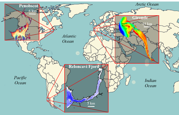
To answer the question of what salt has to do with estuary dynamics, WPES researchers are comparing exchange flow and mixing in estuaries around the world with varying levels of river input and tidal conditions:
- Penobscot River Estuary, Maine
- Gironde Estuary, France
- Reloncavi Fjord, Chile
Visit our What’s Salt Got to do With It? page to learn more about this project!
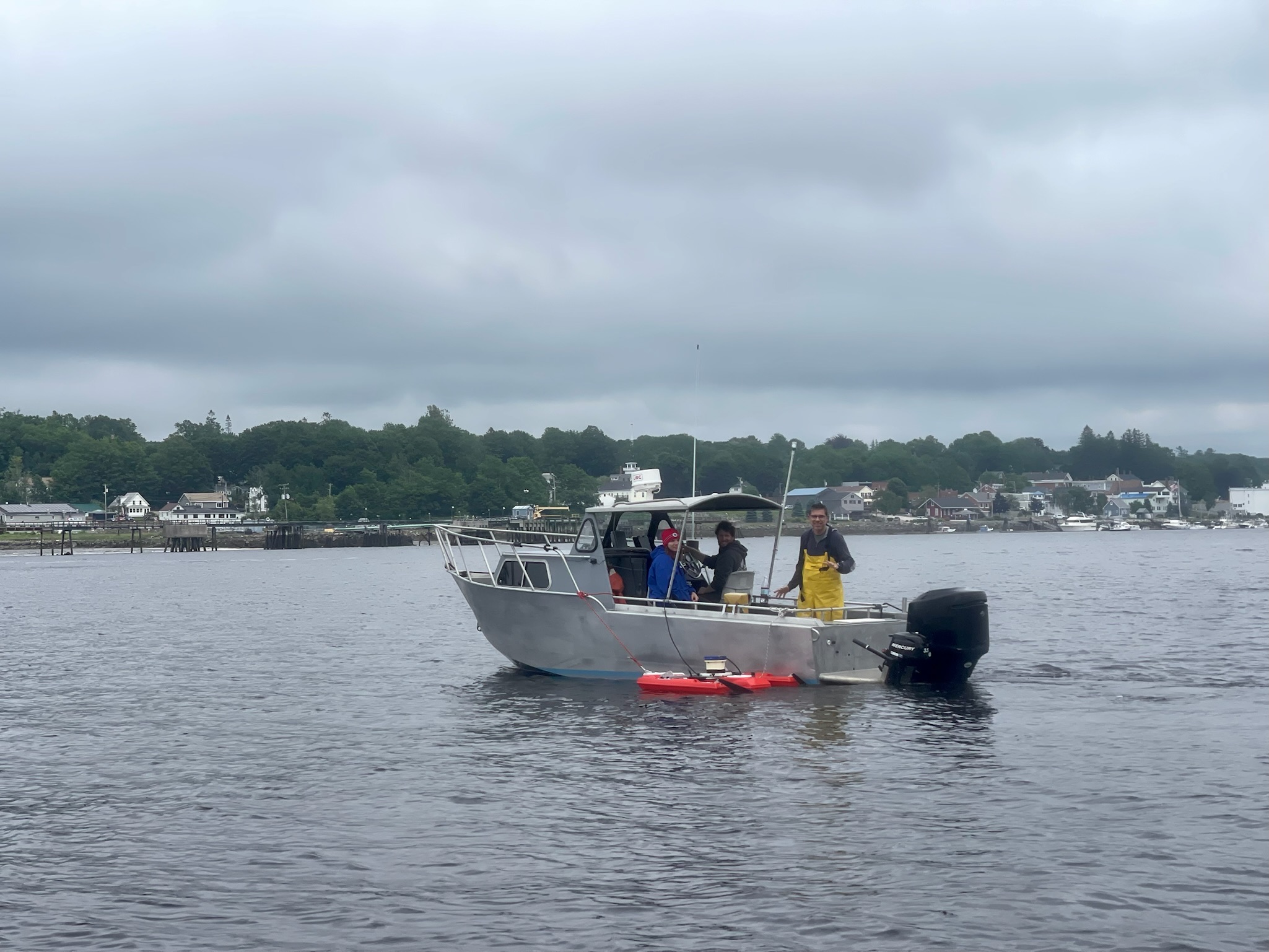
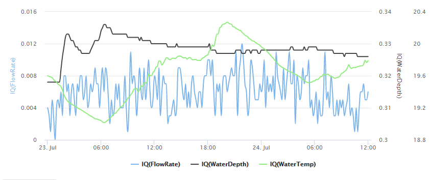
WPES researchers are tracking freshwater stream flow into coastal estuaries using multiple instrumented river input monitoring stations, some of which produce data reported in real time to the WPES webpage. Recorded flow time series are used to calibrate and validate watershed hydrologic models to predict rainfall runoff, and to provide boundary conditions for estuary hydrodynamic models.
Visit our Freshwater Flows page to learn more and for a link to our stream monitoring site!
The WPES team are improving the understanding of land-sea connections and how they relate to coastal conditions, using multiple hydrodynamic modeling tools to quantify and understand how tidal cycles and freshwater inputs affect estuary flow dynamics linked to pollution transport and residence time.
Visit our Estuary Hydrodynamic Modeling page to learn more about this project and see model output animations, and visit the Frenchman Bay Particle Transport Forecast page to see a modeled transport forecast for the next 72 hours!
In order to manage pollution causes and develop solutions to related problems, it is important to develop an understanding of how and why some coastal areas show more vulnerability to pollution than others.
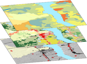
WPES researchers have undertaken several coast-wide bacteria pollution vulnerability analyses and coastal setting clustering efforts. An outcome of this work includes an automatic watershed-estuary delineation tool designed to help support coastal management decisions in Maine. Visit our Vulnerability Analysis page to learn more!
River Forms, Flows, and Dynamics
River systems are the arteries of the ecosystem, transporting fresh water, sediment, and other constituents from headwater streams to coastal estuaries.
The river systems that drain our landscapes transport fresh water from precipitation runoff, snowmelt, and shallow groundwater baseflows from high to low elevations on a journey that in most locations ultimately ends in the ocean. As the water moves it performs work, shaping the river channel and transporting sediment and other constituents downstream.
Rivers’ forms and locations in the landscape can depend on factors ranging from regional tectonic and glacial histories affecting bedrock and soils to modern precipitation regimes. Throughout human history, river systems have been used for transportation, energy, and resources, so many rivers have additionally been altered by human interventions for these purposes or for flood control, with effects on natural ecosystems.
Systematic monitoring of river flows reaches back at least as far as the nilometers of ancient Egypt, and in modern times includes the use of automated gages, remote sensing, and computer models that combine data with first-principles physics equations and statistical relations.
WPES researchers study the forms and dynamics of river systems at spatial scales from whole landscapes to individual river features. To learn more, explore our river projects using the tabs at left.
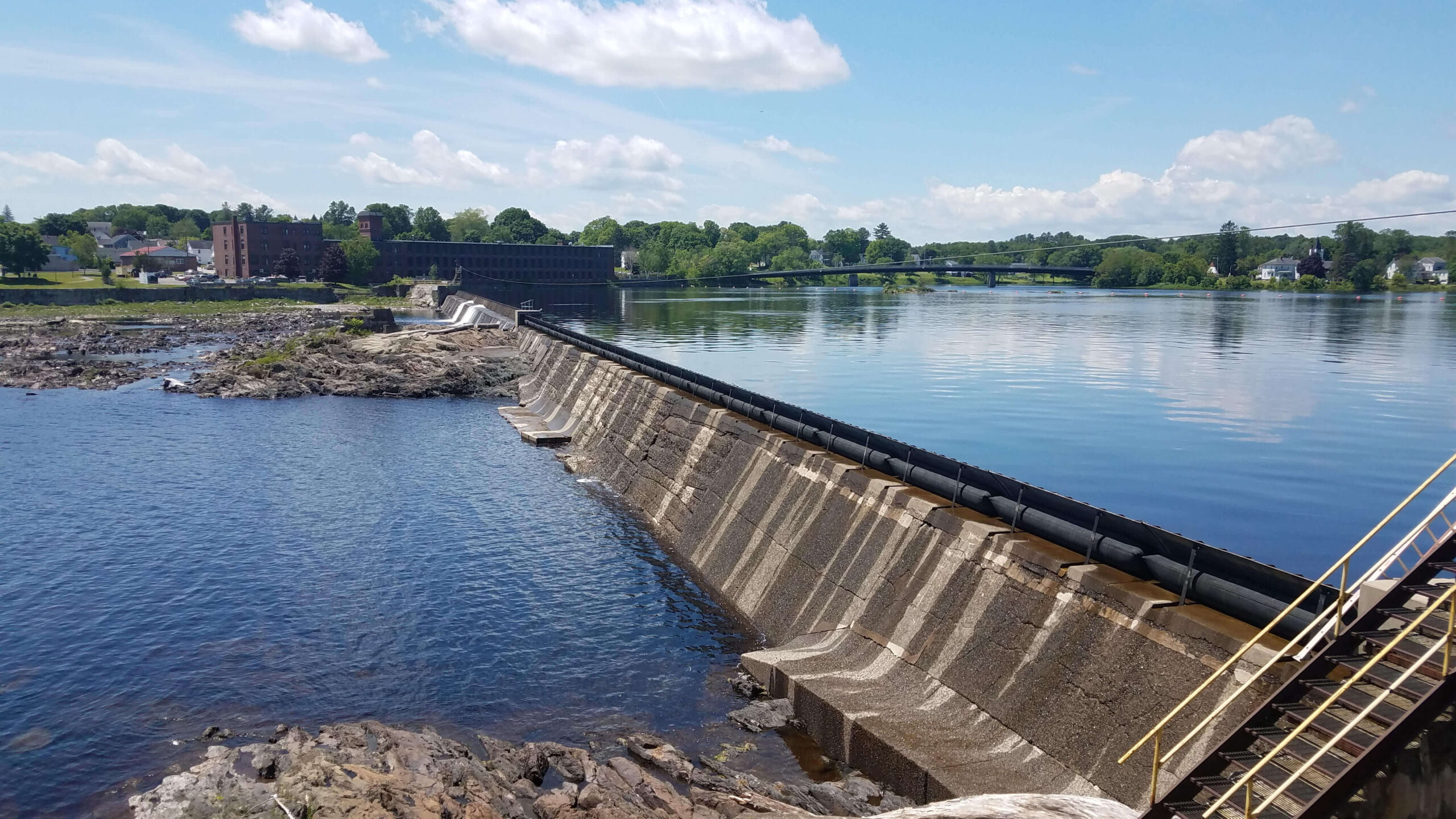
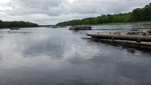
The Penobscot is a river in flux, responding to dam renovations and removals, shifting land uses in its watershed, and a changing climate. WPES researchers are looking at one portion of the upper Penobscot watershed, the East Branch Penobscot River, to better quantify how landscape and infrastructure interact to produce current flow regimes in the river and its major tributaries and perform scenario testing to explore potential effects of future changes.
Visit our East Branch Penobscot Habitat Rehabilitation page to learn more about this work!

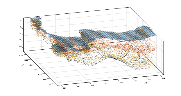
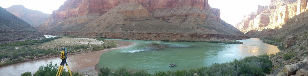
The WPES research group has initiated a new collaborative project focused on mapping channel bottom textures in the Colorado River below Glen Canyon Dam and relating them to other river reach attributes like water surface slope and geomorphic features.
Check back for a dedicated page as the project progresses!
Each reach of a river network is characterized by a collection of features related to structures, channel form, bottom substrates, and hydraulic conditions. The features influence flow dynamics, ecological conditions, and aquatic habitat important to many fish species.
Notable in the Penobscot and other Maine rivers with log driving histories are man-made features called “boom islands.” Nick Richmond (M.S. ’18) used numeric modeling to explore the influence of these structures on channel flow velocity fields. To learn more about how remnant boom islands can influence modern flow dynamics, click here to visit the download page for Nick’s thesis.
Headwater Processes and Practices
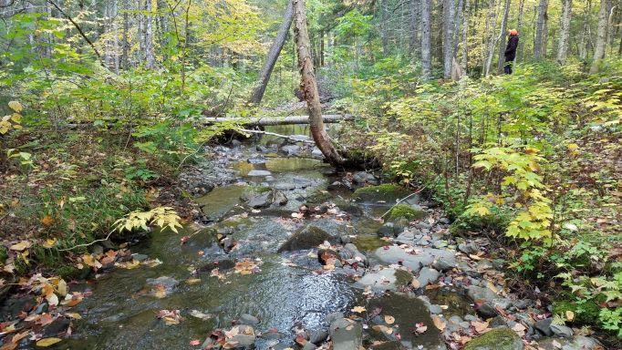
Everything begins in the headwaters, where the patterns of precipitation runoff from the landscape into small channels shape the water and sediment budgets of the larger rivers downstream.
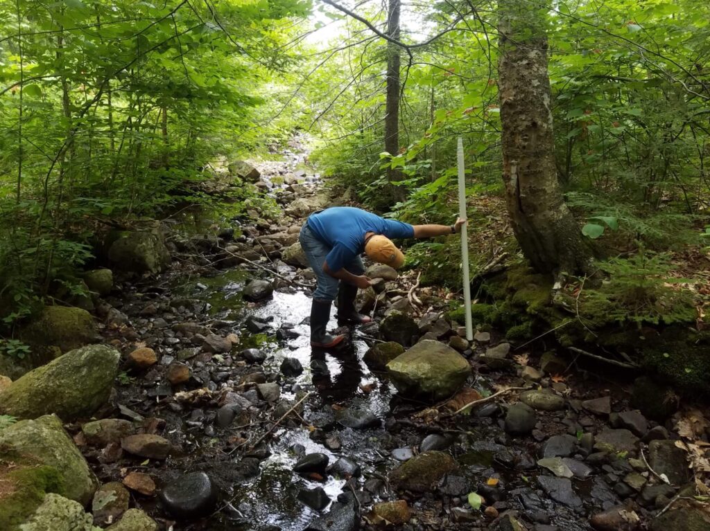
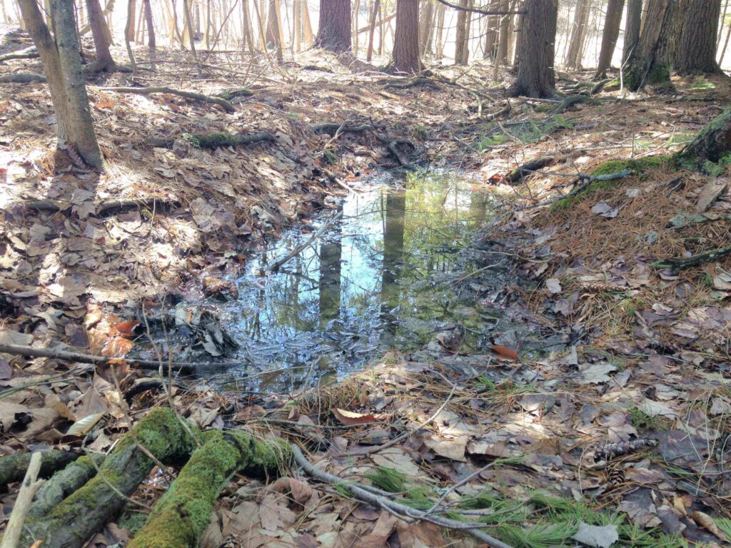
All rivers and streams start somewhere, and that somewhere is the headwaters. Near the upper fringes of watersheds, tiny tributary brooks and creeks arise from seeps and swamps, and channel heads form on hillslopes where concentrated precipitation runoff is able to begin eroding the soil. Where these important transitions occur depends on a number of factors, including local topography, soils, land use, groundwater, and precipitation regime, and their distribution affects the transport of water, sediment, nutrients, and pollution from the landscape into river systems.
Explore WPES headwater process and practice research projects using the tabs at left.
Anyone who has stepped into the Maine woods is familiar with the ubiquitous patchwork of pit and mound features, primarily from tree throw. Despite their small size, these features can affect local hydrology by diverting or capturing surface runoff during precipitation events.
Visit our Upland Microtopography page to read about the results of a project to use high-resolution elevation data to quantify the total volume of these features in different areas of the Maine landscape and investigate how they are affected by land use and surface slope.
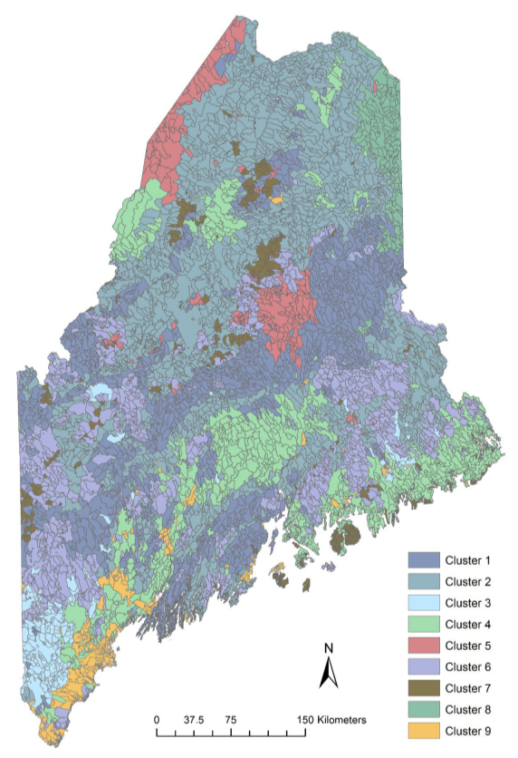
WPES alum Brett Gerard (Ph.D. ’18) investigated and quantified geomorphology, climate conditions, surface flow regimes, and stream channel dynamics in headwater streams and developed an approach to categorize Maine’s deglaciated landscape into “Geomorphic Response Units” (GRUs) consisting of areas with particular sets of geomorphic characteristic relevant to stream dynamics.
To read more about this research, click here to visit the download page for Dr. Gerard’s dissertation.
Maine’s woodland areas provide economic benefits and ecosystem services to residents and visitors alike. Sustainable management of these areas involves consideration of watershed hydrologic processes and dynamics in their headwater stream systems.
Visit our Headwater Stream Diagnostics page to learn more about this research!