UMaine and Colby College partner to improve forest health and monitoring
In a state where the majority of land is covered by forests, monitoring them is critical to understanding and maintaining their health. Forests are constantly changing based on the environment, now more than ever with increased drought conditions in Maine. To understand these changes, there needs to be comprehensive data available to stakeholders in the forest industry.
University of Maine researchers are working with Colby College to improve Maine’s ability to monitor local forests. Professor Dan Hayes in UMaine’s School of Forest Resources has partnered with Professor Justin Becknell at Colby College to research how remote sensing tools can be utilized to create high-quality measurements of forests. Remote sensing technology obtains information about objects through drones, planes and satellites in addition to traditional on-the-ground measurements. Hayes explained, “We can use technology and remote sensing data to fill in the gaps where we haven’t measured things on the ground, and then project the data into the future so we can understand what to expect under different scenarios.” The remote sensing data expands upon data previously collected through fieldwork on the ground, adding an extra layer of analysis. Through the partnership, both schools benefit from sharing complementary expertise and resources that creates a fun, collaborative project. The UMaine team measures forests from above while Colby’s team measures at ground-level. When their data is combined, it creates a complete three-dimensional view of a forest.

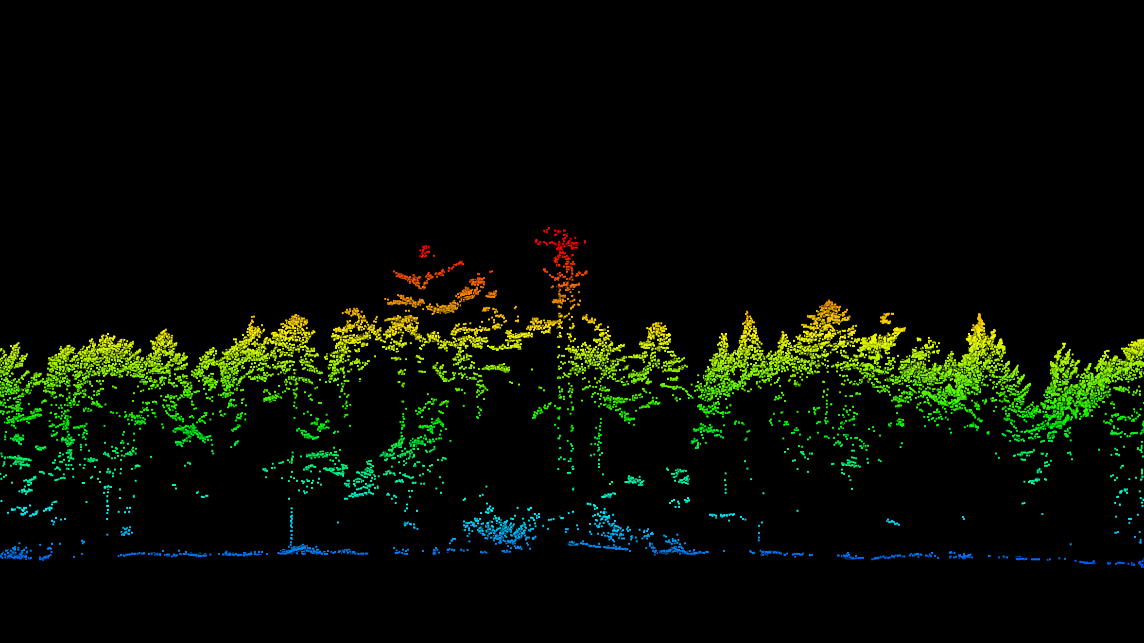
Both teams’ remote sensing work utilizes LiDAR, a technology that uses laser pulses to determine the height of trees and other features of a landscape. The process involves flying an airplane or drone over a forest, shooting out laser pulses, seeing how long it takes for each pulse to leave the plane, bounce off a tree, and return to the plane. Based on altitude of the plane and the speed of light, those laser pulses create a three- dimensional scan of the forest. Terrestrially, the same process is repeated but the pulses are measured from a tri-pod on the ground to capture the terrain. Just like in the air, laser pulses leave a tri-pod fixed on the ground, hit an object and then return to the tri-pod, measuring the time it takes to return.
While the project is still in the preliminary stages, Hayes is excited by the results so far.

“We now have the ability to get high-quality data that allows us to discover and learn all sorts of things,” Hayes remarked. By having access to the University of Maine’s Cessna airplane and LiDAR scanning equipment, Hayes and his team are able to complete scans whenever they desire new data.
For example, the presence of leaves in the summer creates different measurements compared to the lack of leaves in the winter, requiring more data. “Using our own airplane makes things a lot easier, as we can directly create our own data,” said Hayes. With UMaine and Colby’s ability to collect LiDAR independently, it removes the error present in utilizing secondary sources and other institutions’ data. This information can then be used by stakeholders in the forest industry to help answer questions on the health and composition of forests.
Hayes and Becknell’s data collection is essential for answering questions forest managers have about the future of their work. “We keep track of the forest resources for timber, fuel, carbon sequestration, wildlife habitats and more,” Hayes explained. Knowing the forest composition provides answers about the current availability of resources important to their work, such as estimating the amount of timber available in a given area. When forest managers have more questions in the future, Hayes and Becknell will be able to address them with their newfound ease in collecting high-quality data.
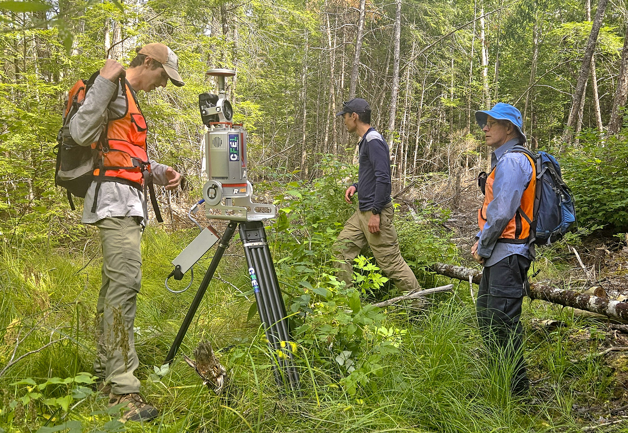
Both schools rely on diverse teams of experts to make this work possible. At UMaine, this project would not be possible without the work of Dave Sandilands who flies the airplane that collects data, and Assistant Research Professor in Forest Ecosystem Modeling Xinyuan Wei who analyzes and models the data. UMaine graduate student Max Wegner works with Becknell in operating the LiDAR technology along with undergraduate students from Colby College. Hayes also recognizes UMaine’s Wheatland Geospatial Lab for supporting this project, as well as Professor of Forest Biometrics and Modeling Aaron Weiskittel’s role as a PI for Maine-FOREST.
This collaboration was made possible through funding from the NSF EPSCoR RII E-CORE Maine-FOREST award.
Story by Heather Johnson, Graduate Assistant
Contact: Daniel Timmermann, daniel.timmerman@maine.edu
Categories: Maine FOREST