MAPI Field School Updates
MAPI Summer 2014 Field School
 The University of Maine’s Summer Archaeological Field School in the Machias Bay Area was created through a Maine Academic Prominence Initiative (MAPI) grant. The field school is conducted in cooperation with the Passamaquoddy Petroglyph Project, which contributes an understanding of occupation sites associated with some of the most significant concentrations of petroglyphs in the Northeast and Atlantic Canada.
This is a four-week field school which provides hands-on archaeological opportunities for students, contributes to an understanding of Maine’s past, and strengthens the relationship between the University of Maine and the Wabanaki Tribes. The field school participants spend the month of June excavating shell middens for bits of animal bones, clam shells, stone flakes and plant remains.
For updates on what is happening at the field school, please see below.
Field School Log
May 28, 2014
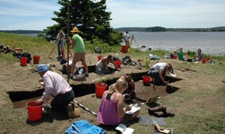
Set-up Day in Machias. We have been working on this site in Machias Bay for several years and every year we have to re-establish our grid and data points so that we know where we are. This may not sound very profound but it is a good place to start our daily log. We will be excavating in square units and recovering bits and pieces of past people’s activities, but it really cannot be overemphasized that out responsibility is to preserve the context of the finds at the same time that we are excavating them. We need to be able evaluate how all the bits and pieces are interrelated, years after they are excavated, so that we can ask different questions. We may want to better understand how animal bones are related to what people ate, the role of different animals in the oral traditions of the Wabanaki, and how people and animals have adapted to climate change in the past. In this photo we are re-establishing the grid on the edge of a vast mudflat where clams are collected at present and were collected in the past. The transit is set precisely over a grid point and we look for old stakes and set new ones. If we are an inch off (2.5 cm) we are not particularly happy and occasionally we put in a new stake that splits an older one (which does make us happy) broken off by a lawn mower years ago. We are setting up the spatial context so that future finds will already have a place. The students will arrive on Sunday.
June 2, 2014
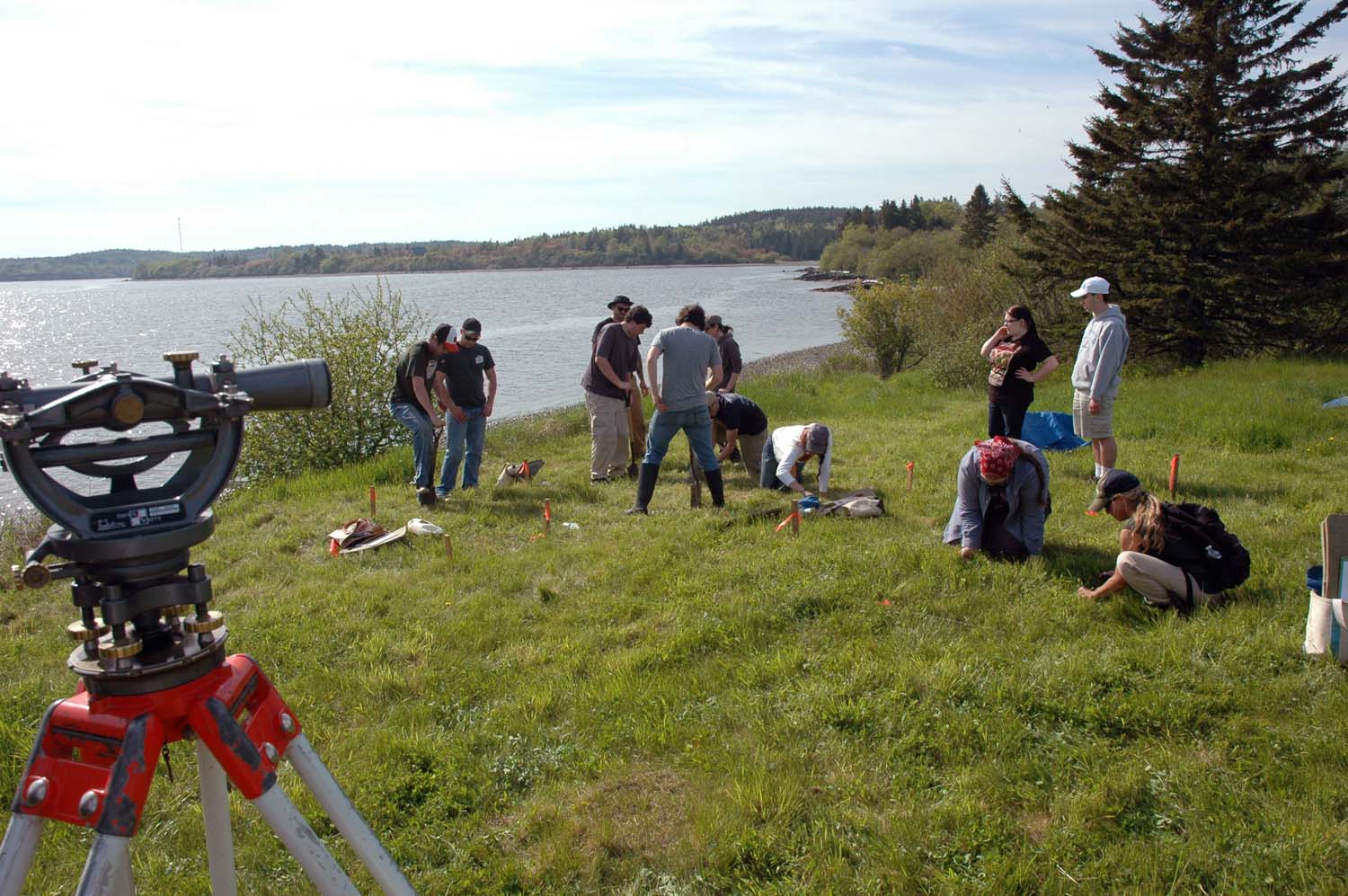 Everyone made it to the field school yesterday, always a good start. This morning, after a 2 ½ hour Powerpoint lecture, review of archaeological materials and field forms, and a flint knapping exercise we made it out to the field by 2:00 PM, time for everyone to finish setting grid corners, and for part of the crew to set up the outhouse that Steve Bicknell built for the first season here in 2006. Before digging anything elevations are taken at nine points around each unit. Everyone read the rod with reasonable accuracy, another good start. We are working on specific problems and are mostly clustered together this year. Spades are used to cut the sod and roll it off to a depth of about 5 cm. before removing 5 cm levels for screening. Note in today’s photo the David White 8300 level transit. This site was first excavated by the University of Maine in 1973 and this very transit was used 40 years ago. It is a beautiful instrument that when leveled with the long level bubble remains rock solid throughout the day. We level it on the center of the same nail head every day, so all our elevations for the past five years are from the exact same point.
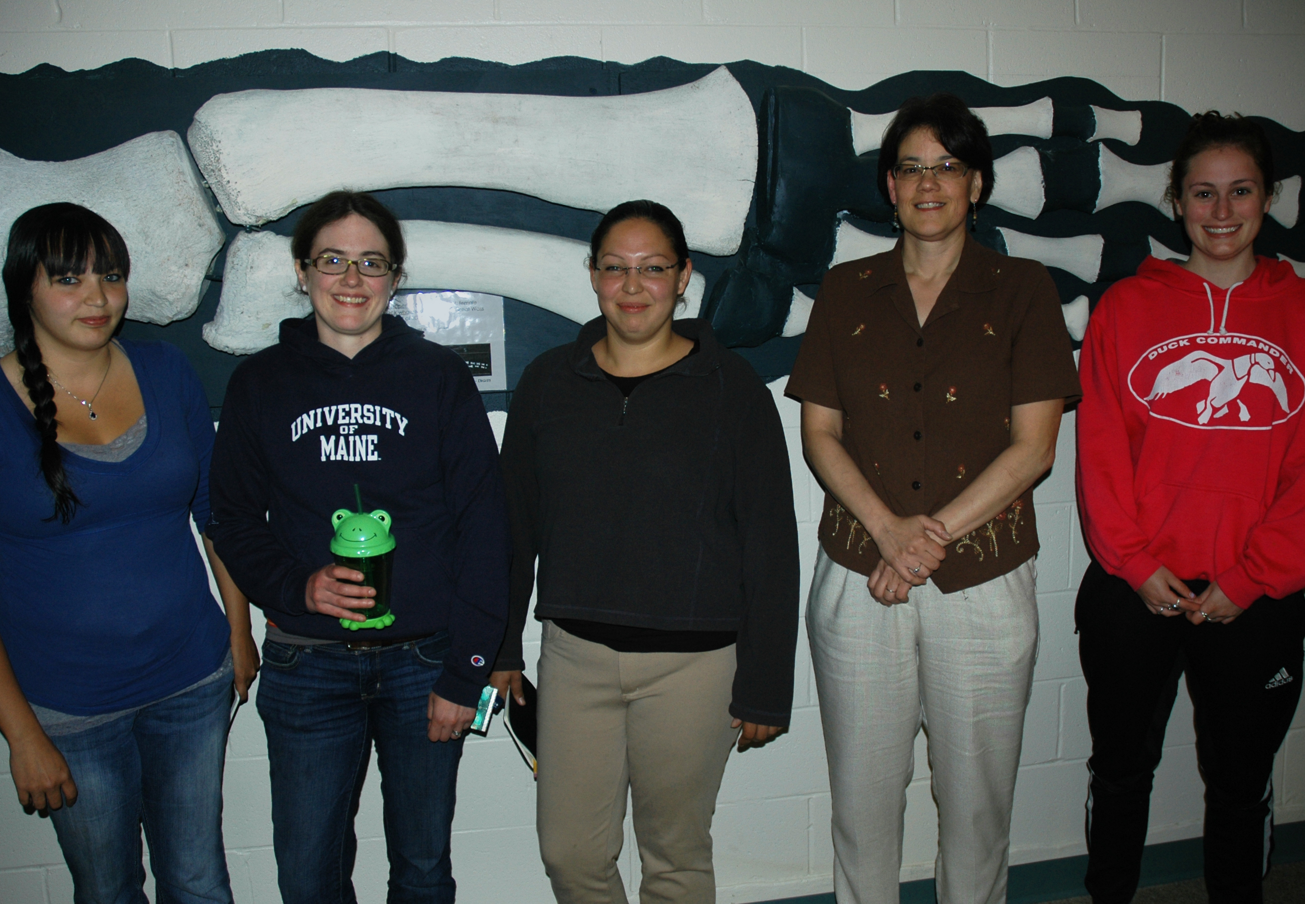
First days are always a little stressful. We have twelve students and three supervisors working and living in close quarters, although we are hardly roughing it here at the University of Maine at Machias with great suppers in the dining hall. Nonetheless each year is very different from the others, with different characters. As one student claims to have recorded in his journal: “Captain’s Log: it seems like a good group. No evidence of psychosis. The day went smoothly. Morale is high. The future is looking bright.”
June 4, 2014
Today was an important day in the field school. Today we had the first Tribal Historic Preservation Officers of both the Penobscot and Passamaquoddy at our field school. An important part of our field school is working with the Native communities that represent the descendants of the cultural material we are excavating, the Wabanaki people of Maine. Relationships between archaeology and Native communities have changed greatly over the last couple of decades, especially since passage of the Native American Graves Repatriation Act in which control of human burial remains, once the domain of archaeologists and museums, was significantly transferred to Native American groups. If I may speak kindly of my own past as a student of archaeology 40 years ago, some of us simply assumed that what we were doing should be important to modern descendants because we were rescuing knowledge about the past, from thousands of years before written history and from times disrupted by European colonization. Native students participated in excavations at the University of Maine in decades past, including students that have moved on to become tribal historians. But it is part of current trends, good ones, that archaeology needs to include participation and research by broader range of communities and groups, with the belief that greater participation will contribute to greater respect and appreciation for the past and present of different people.
Those of us who were becoming archaeologists 30 or 40 years ago remember when the discipline in the United States (although not particularly in Maine) was strongly dominated by a rather narrow view of science, that considered the important questions to be those that shaped all humans in the competition for survival, while relegating the values and beliefs of different cultures as a kind of background noise. This was by no means a universally held approach and many archaeologists struggled to broaden the reach of archaeology, but it is fair to say that some of the loudest voices were arguing for a pretty darn narrow view of what was important, however great the contributions to that view. Some of us see it as a time of youthful arrogance in a young discipline, appreciating that we all have to grow up. At the same time it was a genuine effort to increase confidence in our observations and interpretations,
Maine and our present research provide a great example of changes in the field. Machias Bay has one of the highest concentrations of rock art or petroglyphs on the east coast of North America. Cultural artistry and symbolism were among the topics that were not easily subjected to scientific proofs, at least by old standards, because they are expressions of belief systems of particular cultures. Thus, even though the petroglyphs or rock art were among the strongest and most visible cultural expressions of Native culture (in a number of different areas in North America), they were relatively less studied than by those who desired to be more scientific. Fortunately, it takes all kinds, and in Maine we had an archaeologist who was a bit of a renegade, and spent his career documenting petroglpyhs, first on the Northwest Coast, documenting rock art that was about to be inundated by a new hydroelectric Dam on the Columbia River in 1956, and then in Maine. Mark Hedden has documented Maine’s petroglyphs for the past 35 years, compiling records of hundreds of images, some of which have since been erased by erosion, modern development and the carelessness of adding one’s seemingly innocent initials, chiseled into a cultural document of stone, hundreds or thousands of years old.
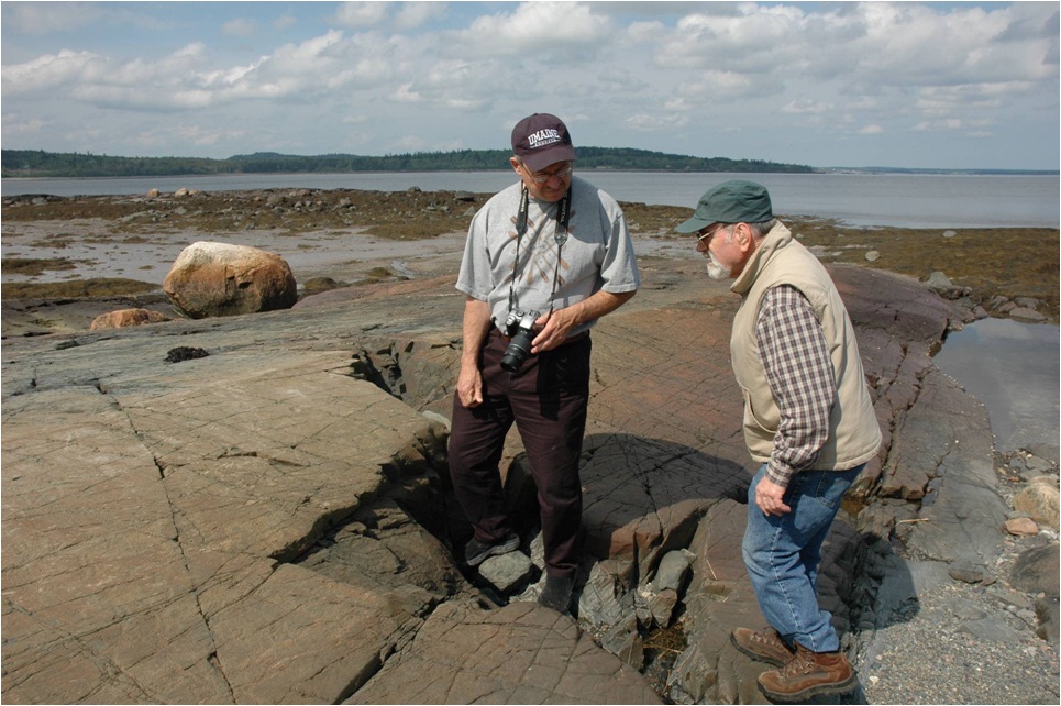
The first photograph with this day’s report is from a few years ago, when Passamaquoddy tribal historian Donald Soctomah and archaeologist Mark Hedden were both one of the major petroglyph sites. Since the petroglyphs are a record of cultural beliefs, Mark necessarily had to study the oral traditions of the Wabanaki and more distant Algonquian speaking tribes such as the Ojibwe from the Great Lakes. At the same time the Wabanaki never forgot that the petroglyphs were theirs, a written document of their spiritual and cultural heritage. So when a major petroglyph site came up for sale in recent years, the Passamaquoddy with the assistance of Mark Hedden in alliance with the Maine Coastal Heritage trust and many individuals were able to acquire the property. Over two centuries after losing the land near the time of the American Revolution, the major petroglyph site was returned to the Passamaquoddy in October of 2006. It was a moving and exciting ceremony with many Passamaquoddy elders and community members, gift giving and sweat lodge participation. This in turn initiated the tribe’s quest for how to manage their newly returned heritage. Do they maintain it for private ceremonies, much like it may have been used for thousand or years, or do they make it available, rebuilding traditions and using it to convey cultural knowledge and appreciation. It is a tricky business to advocate for public education and appreciation when increased publicity is a double edged sword. Publicity risks damage to the fragile petroglyphs when word spreads and people want to return on their own and cannot possibly know when they are walking on and damaging eroding artwork. Making rubbings, a practice once common on historic grave stones, is now recognized to damage fragile petroglyphs, often found on thin veneers of weathered stone that can crumble when pressure is applied. This is a topic that needs to be pursued in perpetuity, but for now let me just say that as director of the University of Maine field school, I do not bring people to the petroglyph sites without special permission, and hearing the story from someone like Donald Soctomah will always be more meaningful than hearing it from someone outside of the tradition, or seeing the petroglyphs out of context. Things of value take patience and respect.
All this background does lead to our field school. When Lisa Neuman (Anthropology Department and Native American Studies) and I put forth our proposal to run an archaeological field school on eroding shell middens, a necessary part of the program was to pursue the question of how archaeology benefited the Native communities. The question itself may seem a bit arrogant or patronizing, suggesting perhaps that this was something new or that Native Americans were not already doing archaeology. But our proposal was simply acknowledging what was a good path to take and to always keep in mind. The Passamaquoddy petroglyph project, in a way, anticipated our purpose, since the first year of our field school was the same year that the Passamaquoddy acquired the petroglyph site, and in 2008 the University of Maine was invited to participate in an ongoing Passamaquoddy program, to better understand the broader context and the particular lives of the makers of the petroglyphs.
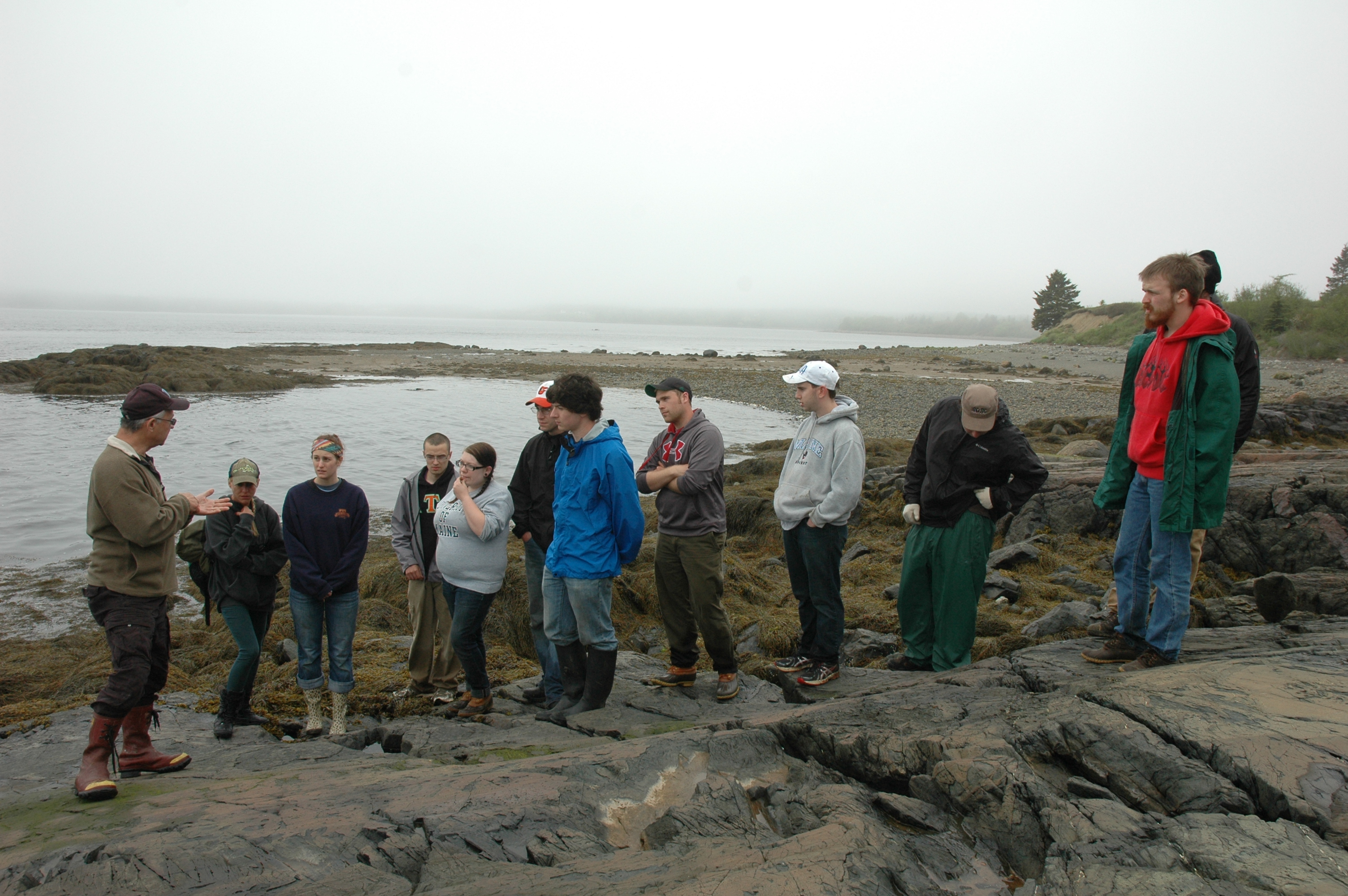
So why was June 4 an important day for the field school? It is the day that Donald Soctomah showed us the petroglyphs, tracing the history of the site, the meaning of the petroglyphs to the Passamaquoddy, and the contribution that our students make to those pursuits. It is exciting to find artifacts that are hundreds or thousands of years old, but it requires personal experiences to link the objects to a broader context, to active heritages and the different layers of value. Donald is always gracious when he emphasizes how the students are contributing to their understanding of the petroglyphs. As an older archaeologist I must say it is something we hope to do but often fall short. It is also something that Donald says to everyone who visits the petroglyphs, that the visitors’ appreciation and respect for the past contributes to present goals. He says it to everyone yet it is always meaningful and sincere, because increasing public awareness, appreciation and interest is the necessary ingredient to making the petroglyphs more public and to protect them at the same time. Donald has talked to our field school groups for the past six years, but I think this was the longest and most far reaching presentation I have seen, perhaps because he has spoken to many groups, including scientists, historians and religious groups with a goal of including the diversity of the audience, rather than to preach. This is easy to say and perhaps even trendy, but a challenge to do well, finding value in science and traditional belief systems.
Donald was the first Tribal Historic Preservation Officer (THPO) of the Passamaquoddy, a position created in 2002 as an official government to government pathway to address preservation issues. Bonnie Newsom, our guest speaker for the evening, was the first THPO for the Penobscot Nation. Both experienced the trials and rewards of establishing new relationships, within the tribes and between governments. There is a great deal of review and compliance work, reading proposals for development projects, seeking to avoid or reduce impacts on historic locations, working with the State Historic Preservation Office (SHPO) in Augusta and with Federal Agencies.
Bonnie’s presentation focused on a number of themes, including Indigenous Archaeology, part of her ongoing dissertation research at the University of Massachusetts, after receiving her Master of Science degree through the Climate Change Institute at the University of Maine. She defined “Indigenous Archaeology” as archaeology that is done by and for the interests of the community, whether Native or non-Native, and she spoke on the first cultural resource management (CRM) project that was designed, executed and reported on entirely by the Wabanaki. Interestingly the topic was “Archaeological Investigations at a WWII German POW Camp, Indian Township.” Although badly disturbed by subsequent land modification, the little known POW camp is now on Passamaquoddy land and Donald Soctomah made the case that this aspect of cultural heritage needed to be investigated and recorded, during operations by the US military to look for unexploded ordinance on old military installations. Donald asked Bonnie to direct the archaeological work, which was also her first experience with historical archaeology, done on a site that people still remembered. Bonnie thought it strangely appropriate that the first fully Indigenous Archaeology CRM project in Maine should focus on a German prisoner of war camp, representing the universality of Indigenous interests. The project was designed to build tribal capacity to conduct archaeological research, contributing to the community’s ability to manage archaeological resources and to an important and little know aspect of the World Wars.
It is a long path to understand changing perspectives on power and knowledge, whether for those of us who grew up with belief that our own values were somehow adequate to preserve the heritage of others, or for current students who may take for granted the obviousness of modern ethics. These topics may be trendy, but they need to be experienced, and for our goals here, this was an important and unusual day. We even got in three hours of excavation after the rain, with the report on significant discoveries saved for a later day (BSR).
June 5 and 6
Yes, I got behind in my entries, but the following are based on journal entries and photographs of the day. Every year we develop new research problems and sometimes re-excavate old units to look take a new look at old excavation walls. This year we re-opened two units in the first few days. Cassy and Natalie opened one unit, previously excavated in 2010, to further explore Feature 11, a pit lined with black soil and then backfilled with yellow subsoil.
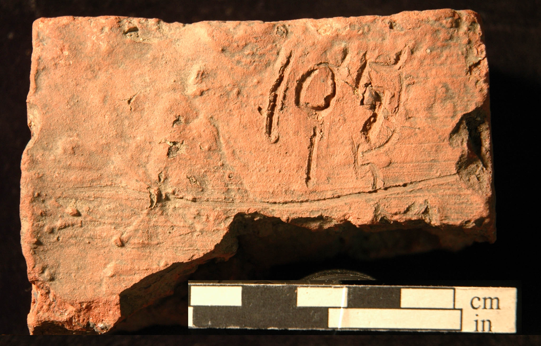
While excavating our old backfill from this unit, Cassy found a red brick with numbers scratched into the soft clay before it was fired. We call it the math brick. It has 105 over 15 with a line, under which it is broken through the top of a five suggesting it was probably a multiplication problem with the missing product likely being 1,575, perhaps the number of bricks made or needed. Since it came from our own backfill from 2010 and since we save all excavated bricks, there was only one probable source. One unit excavated by the University of Maine in 1973 yielded a concentration of bricks, partly overlying an important pit feature that contained animal bone and Native pottery. We re-opened part of that pit in 2010 and found a large number of the bricks, of which we saved only a sample. Apparently we were not looking for bricks with numbers on them, as we missed the math brick twice in the first 41 years of excavations, but found it on the third try. What does it all mean? We don’t know yet. But solving little problems and finding connections is one of the major tools of archaeology, and it makes our happy chemicals flow, so be patient.
Sam and Nick re-opened units we had excavated in 2010, 2012 and 2013 to expose a portion of Feature 28, which had produced three skulls of the extinct sea mink (Neovison macrodon). 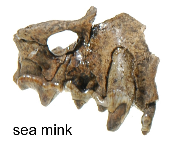 This feature is a lesson on learning what to look for, including discoveries made by students over several years, for which I am forever grateful. The sea mink is rather well known because it is cited as one of only a few carnivores on earth to become extinct during modern times, among others such as the Falkland wolf. The sea mink is thought to have become extinct in the late 1800s, and was only recognized as a different species in 1903 based on specimens recovered from Native American shell middens in Maine. No one ever photographed or painted a living sea mink, but we do have a remarkable paper written by Manly Hardy in 1903 (father of Fannie Hardy Eckstorm who recorded Wabanaki oral traditions). Hardy had handled many thousands of mink from all over Maine and talked to people who hunted the sea mink, although he considered it more likely that the sea mink was a local variety rather than a separate species. Donald Soctomah thought of the mink as a powerful animal, that along with the other members of the mustelid family (otters and weasels) frequent Algonquian oral traditions. Feature 28 is an opportunity to glean something of how sea mink were treated.
In 2010, Walter and Owen found two fragments of sea mink skull in the NE corner of their unit, but the excavation levels I had assigned were too coarse and the feature was not recognized. In the early years of our excavation, we thought that the site was more disturbed than it apparently was, and as a result we excavated the site in 10 cm (four inch) levels. We had heard about the activities of artifact collectors at the site and despite the often well-meaning efforts, digging for artifacts is destructive and attitudes have changed toward uncontrolled excavation. I am pleased to say that in the five years we have excavated at our current location on private property, no one has disturbed the site in our absence. The shell midden is quite thin and we found brick fragments spread thinly throughout. I interpreted this to mean that much of it had been mixed up by digging, but I was at least partly mistaken. There are many disturbing agents, trees, ants, June beetle grubs and other critters that churn the soil, but with different effects.
The following field season, in 2012, the unit adjacent to where Walter and Owen found the sea mink fragments was excavated by Josh and Mandi. We were on the lookout for sea mink and graduate student Rob Ingraham was then specializing in analysis of animal bone from the site. On one of the rare occasions when I was not at the site, Josh uncovered a half dozen small teeth and skull fragments of sea mink, leaving them exactly in place. Rob identified and photographed them. It takes great care to excavate bone fragments and to leave them exactly in place when they range in size from a thumbnail to a grain of rice. By the time I returned the fragments had been removed but the critical records had been taken and proved adequate to establish that sixteen loose teeth and skull fragments came from three mink skulls, within an area about six inches in diameter. They also attached to the two fragments found by Walter and Owen two years before. This association initiated a variety of research efforts to place Feature 28 in context.
In 2013, one half of the feature was still left. It was entirely a stroke of luck that our grid ended up dividing the feature into four almost equal quarters. The feature was small enough that it could have fit within one of our excavation units and might have come out in one 10 cm level. As it was, I interpreted the feature to be simply a concentration of bone just below the shell level. In 2013, Sam and Emily excavated the third quarter fully aware as they approached the critical levels of the sea mink. They were careful to locate everything they could in place, and all the soil was saved from the critical five centimeter (two inch) levels. In fact they found no mink bone at all, but a layer of flakes, a complete stone ax and, importantly, evidence of a shallow pit feature. I did not think there was a pit feature at first, but the new evidence caused me to go back through the photographs and records from the previous three years, and to my great satisfaction, the records were sufficient to demonstrate that the mink skulls were in a shallow pit feature with scattered crushed shell. It is always satisfying to find that critical photographs were taken in previous years, even though we were not aware of what the problem was. This is when archaeology works. A thin layer of shell marked the bottom of a shallow pit feature, clearly encompassing the area of the mink skulls. With this information, Emily and Sam spent much of the following year working with Andrea Nurse of the Climate Change Institute, to identify pollen and plant spores that might have been associated with whatever the mink skulls represented, perhaps sewn on clothing or part of a medicine bundle. They received an award for their research from the Center for Undergraduate Research at UMaine.
Sam and Emily were back at the site this year. Sam and Nick re-opened the three units from years before, exposing the last corner of Feature 28. There were thin bands of shell, clearly preserved on both walls, defining the feature better than we had hoped. In the past year, Andy Heller put in considerable research on the nature of burned shell features at our site. Highly burned clam shell turns gray, while more lightly burned shell turns brownish and soft. Not only was the thin layer of shell underlying Feature 28 visible, but it consisted almost entirely of burned brown shell. In archaeology it is often a great challenge to glean what happened in a brief moment of time, from a thousand years of accumulated debris. The uniform layer of burned shell marked an event that corresponded to the distribution of sea mink and other artifacts. Does it provide a key to sorting out a series of activities relating the now extinct sea mink to Passamquoddy beliefs before the arrival of Europeans? It takes unusually good context to address such questions, opportunities that may or may not come again in a lifetime. Even if only a small piece of a puzzle, it is how we connect the past and present.
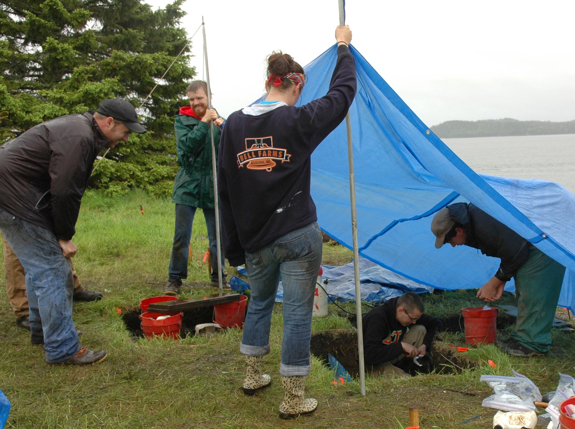
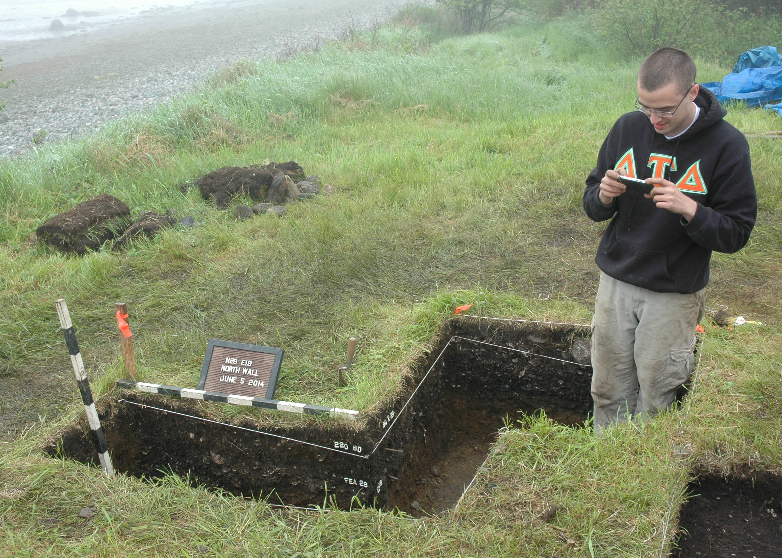
Once exposed in the corner of the excavation, only a fragile remnant of Feature 28 was left. Thursday and Friday promised rain and we did not want to leave the fragile corner over the weekend. On Thursday heavy rain set in about 1:00 PM and we finished the detailed graph of the wall under a tarp before calling it a day at 2:00 PM. We cover the pits at night to control runoff, but we cannot control the water table, and Cassy and Natalie’s pit had a foot of water in the morning. Friday promised heavier rain. Although conditions were not ideal we decided to take a soil column from Feature 28, for fear of losing the corner to collapse. In this case we took soil samples at 2.5 cm intervals (one inch) starting at the surface and carefully excavating to subsoil. These are the samples we screen back in the laboratory with window mesh, providing density of shell and gravel and tiny animal bones. We were lucky and got in most of the day, with heavy rain and wind coming in mid-afternoon. We decided to finish the critical area of the column sample and put up a tent. Our inexpensive tarp was not up to the wind, and the rivets immediately popped out, requiring student-tent-poles as Sam and Nick finished the column sample. Half the students had the option of going back early in the first van but all waited it out, mostly in the pouring rain till we were finished. Two days of rain set the pace for what we could expect in the future and the crew got through it with some enthusiasm . It was a very good first week.