Mapping the Empire
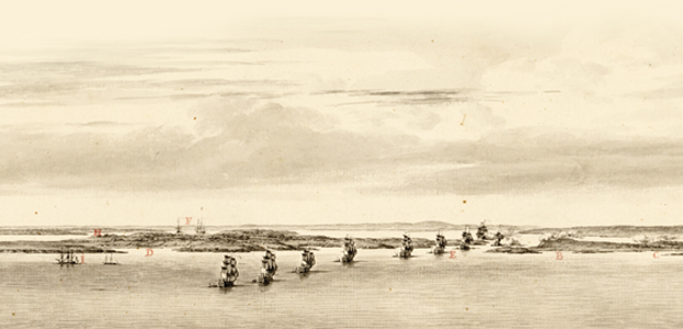
Rolled up and tucked away in a corner of the British Library in London sits a hand-drawn map of the Maine coast, created in the years just before the American Revolution. At a scale of two miles to the inch, it is an extremely detailed rendering of the intricate coastline from Cape Elizabeth to the St. John River. It’s big — 10 feet long or more when fully unfurled on a map table.
“It’s breathtaking to see,’’ says Stephen Hornsby, a professor of geography and Canadian studies at the University of Maine and the director of UMaine’s Canadian-American Center. “Absolutely magnificent. It’s part of the heritage of the state, but it’s in London. It’s unknown in Maine.’’
The Maine map is one in a series drawn from the first major survey of England’s holdings in North America. The General Survey of the Northern District and the Survey of Nova Scotia, conducted between 1764–75 by two Army officers, Samuel Holland and Joseph Frederick Wallet Des Barres, have been largely overlooked, despite their influence on the British government’s approach to surveying and on subsequent surveys done throughout the expanding empire.
Hornsby first became aware of the survey as a graduate student conducting research on Cape Breton Island and continued to find references to a major survey of British America as time went on. He noticed the distinct grid lines on Prince Edward Island, and how the roads and lot boundaries followed them. He also noticed what seemed to be a peculiar pattern of place names.
“I had questions that accumulated over the years and lay in the back of my mind,’’ he says.
To answer those questions, Hornsby began to research the survey — a five-year project that culminated last year in the publication of Surveyors of Empire: Samuel Holland, J.W.F. Des Barres and the Making of the Atlantic Neptune. The book has received favorable critical reviews and has earned Hornsby two awards: Publication of the Year by The Prince Edward Island Museum and Heritage Foundation, and the John Lyman Book Award for Science and Technology by the North American Society for Oceanic History.
Through his research, Hornsby discovered the most ambitious survey of that century. It was the first scientifically based survey of British America from Labrador to the Gulf of Mexico, which led to the publication of The Atlantic Neptune, a four-volume atlas containing maps and charts of that enormous area. The survey set the standard for mapping Britain’s expanding empire and established a practice of using the science of those surveys, backed by its formidable military force, to govern.
“The British surveys of North America were not simply interesting examples of the entwining of Enlightenment science and military power in the late 18th century, but directly influenced British understanding of specific parts of the globe and helped shape government policy at a critically important juncture,’’ Hornsby notes in his book.
Victory over France in the Seven Years War established Britain as the global military and scientific superpower. Scientific developments made it possible to fix latitude and longitude at sea, and established the Greenwich Meridian as the Prime Meridian, further aiding more precise and coordinated mapping.
And Britain needed maps.
According to Hornsby, Britain was ill-prepared to govern the vast territory it now controlled. In addition to Canada, which it had captured from France in the war, Britain also gained Florida and territories along the Gulf of Mexico from Spain. England now controlled all land in North America from the Arctic to the Gulf of Mexico and from the Eastern Seaboard to the Mississippi River.
Fishermen, explorers and settlers had been sailing in the North Atlantic for centuries, but according to Hornsby, their maps and charts were vague and lacked the detail that Britain needed to help govern the American colonies, as well as those newly acquired lands.
The government had a plan to settle the lands both in the north and south of the existing colonies in America. Parliament in 1763 issued a proclamation prohibiting further settlements beyond the Appalachian Mountains, and planned to funnel prospective settlers north into Maine and the Canadian provinces, and south toward Florida and Georgia.
To settle those areas, the British government proposed a General Survey of two districts: southern, from the Potomac River to Florida and into the gulf; and northern, from the Potomac to Labrador.
Enter Holland and Des Barres. The two Army officers, both engineers with surveying experience, were assigned to handle the survey in the northern district. Holland had worked on surveys along the St. Lawrence River at the end of the Seven Years War. He had been named surveyor general for Quebec and when the General Survey was planned, was also named by the British Board of Trade as surveyor general for the General Survey of the Northern District. Des Barres got his marching orders from the Admiralty and was named surveyor general for the Survey of Nova Scotia.
The two men faced problems with logistics, weather, geography and communication as they worked on the surveys. Although the French had settled areas along the St. Lawrence River and there were some settlements in Nova Scotia, much of the newly acquired Canadian territory was unsettled wilderness. Des Barres established his headquarters in Halifax. Holland, however, was forced to move his base of operation annually as the survey moved from Canada to the American colonies.
Both men were assigned ships and a captain to aid them in their surveys. Des Barres was assigned to work with Lt. John Knight, while Holland was paired with Lt. Henry Mowat. Knight, a good naval officer, and Des Barres produced a very good hydrographic survey, particularly of Nova Scotia, says Hornsby.
Holland fared differently. Mowat was often “off chasing smugglers,’’ a more financially profitable endeavor. Holland repeatedly bemoaned the lack of accurate soundings on the maps he produced.
The survey itself took much longer than anticipated. With Des Barres working in Nova Scotia, Holland focused his teams initially on the Gulf of St. Lawrence, St. John’s Island (now Prince Edward Island), Cape Breton Island and Newfoundland. It was in Newfoundland where Capt. James Cook cut his surveying teeth and gained the experience that earned him renown in the South Pacific. Though Cook’s exploits in the South Pacific overshadowed Holland’s accomplishments with the General Survey, Hornsby says, Cook considered him a mentor and once remarked that everything he knew about surveying he’d learned from Holland.
That first phase of surveying in Canada took five years — the time Holland had estimated for the entire survey. Holland was still at work on the surveys in the colonies when the outbreak of the American Revolution in 1775 forced him to leave New York, the southernmost point he had reached. Although the survey failed to stretch to the Potomac, the surveying parties led by Holland and Des Barres mapped about 15,000 miles of British North America from Labrador to New York.
The teams used what might seem like very basic survey tools and methods today. Flagmen set points and compasses were used to take bearings using triangulation to determine distances. Graduated chains were used to measure distances, one chain length at a time. Chronometers and quadrants established latitude and longitude.
Although the maps and charts contained some omissions and errors, they are surprisingly accurate — precise enough that UMaine geologists have used them to locate a 1760s Gulf of Maine shoreline and figure out the rise in sea levels since then, Hornsby says.
At the end of the American Revolution, Holland returned to Quebec to serve as surveyor general. In that role, he conducted and oversaw the survey of British lands to the west of Quebec toward Lake Ontario and Niagara, in preparation for the British loyalists, displaced from their homes in the colonies and seeking to relocate in that region.
Des Barres had remained in London during the early years of the war, promoting the publication of The Atlantic Neptune. Hornsby says Des Barres knew the value of the manuscript maps he possessed and was determined to publish them himself to gain both credit and what he hoped would be considerable profit. In early summer 1775, he was busy engraving and printing maps and charts based on the Neptune to get them in the hands of the Admiralty and on British war ships sailing to America that fall.
“They were very helpful for the navy during the early years of the war,’’ Hornsby says. “But the great irony of the project is that while the British had maps and charts based on the coastal surveys, the war, to a great extent, was fought on land. And the British did not have good maps of their 13 colonies.’’
Interior maps of the colonies might have made a difference in the conduct and the outcome of the war, according to Hornsby. However, Britain learned from the experience of the General Survey and put that knowledge to good use after the war.
“By the early 1800s, Britain realized that they needed a naval mapping office,’’ Hornsby says. “The General Survey was accomplished in a rather ad hoc manner; it was all done by different parts of the government. That’s not a very efficient way of operating. The experience and the problems and difficulties led to the Admiralty creating the Admiralty Hydrographic Office.’’
It was the hydrographic office that would create the British Admiralty charts that covered most of the globe’s waters and remained the gold standard for mariners throughout the 19th and into the 20th century, Hornsby says.
But it was Holland and Des Barres who set the standards for those imperial surveys on land and on water — scientific, coordinated surveys of an empire on which the sun never set — from London to India, Australia, Africa and Atlantic Canada. The two surveyors provided Britain with the tools and methods to delineate its empire and define much of the world we know today.