2025 Maine Sustainability & Water Conference
Thursday, March 27, 2025
Augusta Civic Center
Augusta, Maine
Conference Menu
Poster Session
Poster Competition Winners
High School
Winner
1. Improving the Effectivity of Nitrate Removal in Biosand Filters Using N. oculata
Sofie Rueter (student), Bangor High School
Honorable Mention
2. Continuous High Salinity Killing Marsh Grass
Phoebe Shank (student), Machias Memorial High School
Undergraduate
Winner
13. Pigment Analysis Reveals that Picoeukaryotes Dominate Picoplankton Community in Harpswell Sound, Maine, in Late Fall
Emma Mazlish (student), Bowdoin College
Honorable Mention
7. Adaption and Application of an Existing USGS Unvegetated-to-Vegetated Ratio Workflow for Salt Marsh Vegetation Monitoring
Caroline Fales (student), University of New England
Graduate
Winner
31. Aligning Community Preferences with Policy Action: Examining Climate Resilience Priorities in Maine’s Community Resilience Partnership
Faizan Saif (student), University of Maine
Honorable Mention
22. Hydrophobic Modification of Paper Using Emulsified Soybean Wax
Mahbuba Daizy (student), Department of Chemical and Biomedical Engineering, University of Maine
High School Posters
- 1. Improving the Effectivity of Nitrate Removal in Biosand Filters Using N. oculata: Sofie Rueter (student), Bangor High School
- 2. Continuous High Salinity Killing Marsh Grass: Phoebe Shank (student), Machias Memorial High School
- 3. The Effect of Offshore Wind Array Frequency on Quorum Sensing of Pyrocystis fusiformis: Kendra Weaver (student), Tess Welch (student), Brunswick School District
Undergraduate Posters
- 4. Karenia mikimotoi Occurrence in Harpswell Sound, Casco Bay, from 2022-2024: Emma Barker (student), Bowdoin College
- 4A. Ecology and Distribution of Juvenile River Herring in the Kennebec River: Dana Bookman (student), University of Southern Maine
- 5. Channel Sediment Characteristics Following Dam Removal and Subsequent Historic High-Flow Events, Temple Stream, Farmington, ME: Will Christman (student), Alex Debo (student), University of Maine Farmington
- 6. Pipes, Pollution, and Prisms: Adapting a mapping tool to assess wastewater outflows along Maine’s coast: Madeline Gavin (student), Lara Luczak (student), University of Maine, madeline.gavin@maine.edu; lara.luczak@maine.edu
- 7. Adaption and Application of an Existing USGS Unvegetated-to-Vegetated Ratio Workflow for Salt Marsh Vegetation Monitoring: Caroline Fales (student), University of New England
- 8. PFAS in Maine Wildlife: How an Emerging Contaminant Impacts Hunting and Angling Behaviors: Carissa Furtado (student), University of Maine
- 9. The Relationship Between High Elevation Lake Acidity and Watershed Factors: Christopher Houdeshell (student), University of Maine Farmington
- 10. Laboratory-Scale Pilot Study: Evaluating Components and Conditions for Carbon Sequestration using glacial rock flour: Landen Jorgensen (student), University of Southern Maine
- 11. Impacts of Climate Language on Rural Maine Community Resilience Initiatives: Sonia Leone (student), University of Maine
- 12. Selecting Surface Water and Well Water Sample Sites to Detect and Predict PFAS Movement in the Environment: Brendan Lewis (student), College of the Atlantic
- 13. Pigment Analysis Reveals that Picoeukaryotes Dominate Picoplankton Community in Harpswell Sound, Maine, in Late Fall: Emma Mazlish (student), Bowdoin College
- 14. Climate-Driven Range Expansion of Ixodes scapularis: Insights from Predictive Modeling: Ian R. Mowatt (student), University of Southern Maine
- 15. What’s Next? A Policy Analysis of PFAS Regulations in Maine and Throughout the United States: Eddie Nachamie (student), University of Maine
- 16. Sediment Dynamics Downstream of a Recent Dam Removal: Analysis of Deposits from the May and December 2023 Flood Events: Kevin Sweeney (student), University of Maine Farmington
- 17. Supporting Sustainability in Maine’s Brewing Industry: Dean Syed (student), University of Southern Maine
- 18. Observing Ground-Dwelling Arthropod Biodiversity in Comparison to the Density of Multiple Life Stages of Ixodes scapularis (Blacklegged Tick) at Two Forested Sites in Southern Maine: Sage Tocci (student), University of Southern Maine
Graduate Posters
- 19. Sustainable PFAS Treatment in Maine’s Public Water Systems: Balancing Water Quality, Policy, and Environmental Impact: Josephine Adu-Gyamfi (student), Lukas Norment (student), Civil and Environmental Engineering, University of Maine
- 20. Can Freshwater Fisheries Provide Sustenance in an Age of Scarcity, Simplification, and Strife? A Biophysical Economic Analysis of Ice-Angling for Panfish in Central Maine: Deborah Alademehin (student), Dept. of Wildlife, Fisheries and Conservation Biology, University of Maine
- 21. The Role of Local Energy Action Networks (LEANs) in Promoting Renewable Energy and Energy Efficiency in Underserved Communities across the USA: Janine Siqueira Borges (student), University of Maine. Ecology & Environmental Science
- 22. Hydrophobic Modification of Paper Using Emulsified Soybean Wax: Mahbuba Daizy (student), Department of Chemical and Biomedical Engineering, University of Maine
- 23. Geospatial Integration of PFAS Survey Data: Melissa Godin (student), University of Maine
- 24. Co-Designing Microgrids for Energy Justice: A Literature Review Analysis of Best Practices, Barriers, and Pathways for Underserved Communities: Muhammad Hamza (student), University of Maine School of Economics
- 25. Aftermath of a Major Firefighting Foam Spill in Brunswick, Maine: Spatiotemporal Dynamics of Per- and Polyfluoroalkyl Substances in the Downstream Aquatic Environment: Macy Hannan (student), Department of Civil and Environmental Engineering, University of Maine
- 26. Foamed Lobster Shell Composites for Thermal Insulation and Packaging Applications: Olivia Lee (student), Department of Chemical and Biomedical Engineering, University of Maine
- 27. Quantifying the Extent of Coastal Stabilization Along the Casco Bay Using Archived NRPA Permits and Satellite Imagery: Marisa N. Monroe (student), University of Maine
- 28. Development and Characterization of Seaweed-Derived Flexible Thin Films and Coated Paper for Food Packaging Applications: Sanjana Mutyapu (student), Dept. of Chemical and Biomedical Engineering, University of Maine
- 29. COPRI at UMaine: Coastal Research for a Sustainable Future: Vanessa Quintana (student), University of Maine, Department of Civil and Environmental Engineering
- 30. Comparing Microbial Communities in Restricted and Unrestricted Marsh Habitats: Heather Richard (student), University of Maine
- 31. Aligning Community Preferences with Policy Action: Examining Climate Resilience Priorities in Maine’s Community Resilience Partnership: Faizan Saif (student), University of Maine
- 32. Impacts of High-Frequency, Short-Duration Rainfall Events on Bacterial Pollution in Frenchman Bay, Maine: Taylor Bailey Spencer (student), University of Maine, Dept. of Civil and Environmental Engineering
- 33. Investigating Salt Marsh History, Morphology, and Colonial Impacts Through Sedimentary Reconstructions : Phoenix Susak (student), University of Massachusetts-Amherst
Professional Posters
- 34. PFAS in Maine: A New Website to Share PFAS Research Efforts, News, Publications, and Resources: Jane Disney, MDI Biological Laboratory
- 35. The Loring Air Force Base RI — Maine’s Largest PFAS Puzzle: Maria Guerra, Lindsey Papa, WSP
- 36. Climate Ready Casco Bay: Kelly Rehberg, Sara Mills-Knapp, Gretchen Anderson, Greater Portland Council of Governments,
- 37. Catalytic Approaches to Sustainable Petrochemical Alternatives: Brandon Tate, Bowdoin College
- 38. Drinking Water Testing on Maine’s Outer Islands Reveals Need for More Testing: Morgan Karns, Island Fellow, Mount Desert Island Biological Lab
- 39. Building Collaborative Action through the Maine Community-Led Energy and Climate Action Network (MAINECAN): Cressica Brazier, Louise Chaplin, University of Maine
Poster Abstracts
High School Posters
1. Improving the Effectivity of Nitrate Removal in Biosand Filters Using N. oculata
Sofie Rueter (student)
Bangor High School
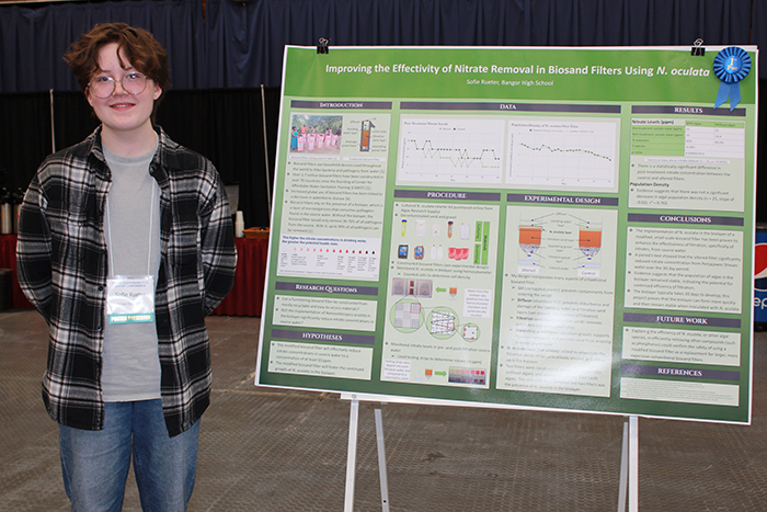
Biosand filters are an effective way for rural or less-developed communities to purify water from local water sources. However, not much research has been done on how the addition of microorganisms, specifically the microalgae Nannochloropsis oculata, into the biolayer could improve filtration efficiency. In this project, N. oculata was introduced into the biolayer of a biosand filter constructed out of mostly recycled and easily accessible materials. Water collected from the Penjajawoc Stream was treated with an altered filter (with N. oculata) and a control filter (without N. oculata). Nitrate concentrations pre- and post-treatment were measured; N. oculata cell density was measured over time. It was found that the altered filter consistently reduced nitrate levels more effectively than the control, with an overall 60% reduction in nitrate concentration. The difference between the data sets was found to be statistically significant (n = 25, p < 0.01). Over time, the N. oculata population in the biolayer remained relatively stable; this indicates that the population likely adapted to the conditions in the biolayer. Overall, these results suggest that N. oculata augments nitrate removal in biosand filters, offering a more sustainable and affordable solution for improved water quality. This research is especially relevant as human populations grow and access to safe drinking water becomes increasingly critical in rural or developing areas.
2. Continuous High Salinity Killing Marsh Grass
Phoebe Shank (student), Jim Lenke
Machias Memorial High School
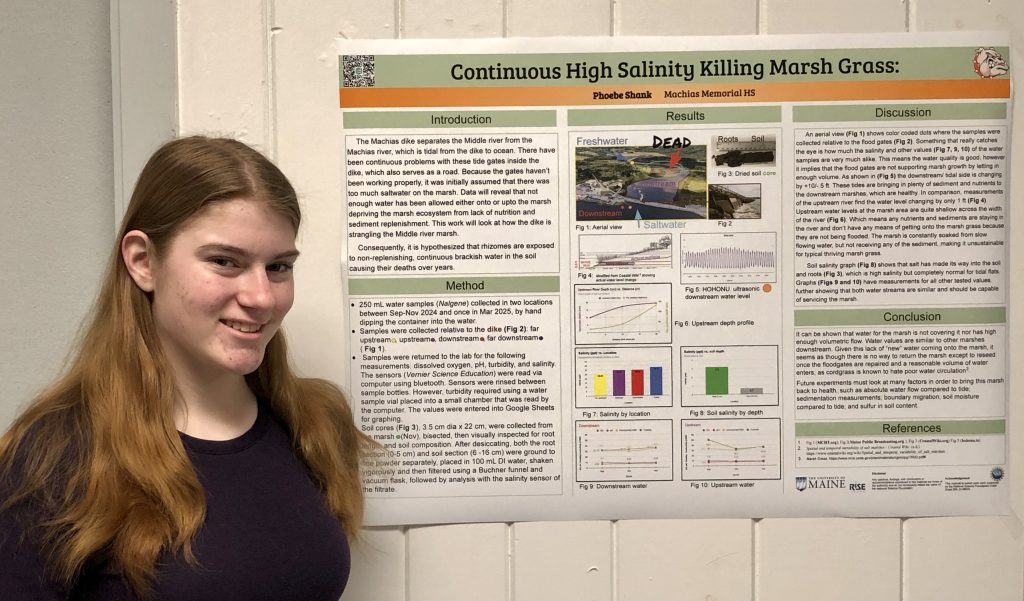
The Machias dike, as vital roadway, has long been active that used a floodgate to allow upstream areas to be grown for hay. However, because the floodgate is under a major roadway, upgrading and repairing is not readily feasible. As a consequence, a large marsh area now on conserved land upstream of the dike, is almost completely wiped out because of continuous high salt content without draining completely nor replaced by freshwater. Data presented will reveal water analysis both upstream and downstream of the dike to be identical which shows how the floodgates have failed a vital carbon sequestration ecosystem that is now in need of replanting with a more salt tolerant grass.
3. The Effect of Offshore Wind Array Frequency on Quorum Sensing of Pyrocystis fusiformis
Kendra Weaver (student), Tess Welch (student)
Brunswick School District
The Gulf of Maine’s geography lends itself to generating energy via off-shore wind arrays; however, its waters also house many interdependent vital organisms. As the State continues to seek funding and permitting for offshore wind energy projects within the Gulf, sustainability of marine ecosystems must also be considered. The goal of this experiment was to determine whether the frequency levels generated by off-shore wind arrays inhibit the communication ability (quorum sensing) of the bioluminescent dinoflagellate, Pyrocystis fusiformis. The hypothesis was that quorum sensing ability of Pyrocystis fusiformis would be inhibited by exposure to sound at a frequency modeling that of off-shore wind arrays. In order to conduct this experiment, a population of Pyrocystis fusiformis was equally separated into two Erlenmeyer flasks, immersed in 12-hour light cycles, and fed once per week. The control group was kept in silence and the experimental group was exposed to a 220 Hz tone generator for 10 minute intervals daily. A Vernier Light and Color Sensor measured daily responses to controlled disturbances for both groups via maximum and average lux measurements. Preliminary results indicate that quorum sensing ability of Pyrocystis fusiformis degraded over time for the experimental group as compared to the control group. Maine Audubon and other agencies have done preliminary research on the effects of offshore wind on bird and fish environments, however, there is a paucity of research related to the study of primary producers such as dinoflagellates. This experiment implies that there is value in its continuation on a larger scale.
Undergraduate Posters
4. Karenia mikimotoi Occurrence in Harpswell Sound, Casco Bay, from 2022-2024
Emma Barker (student), Collin Roesler
Bowdoin College, ebarker@bowdoin.edu, croesler@bowdoin.edu
Harmful algal blooms (HABs) cause seasonal disruptions to shellfish and crustacean harvesting and aquaculture in the Gulf of Maine (GOM) each year, and occurrences may be increasing with warming waters. New HAB species, including the dinoflagellate Karenia mikimotoi, have begun regularly occurring in the GOM in recent years. K. mikimotoi forms high-biomass blooms that cause localized hypoxia and marine animal mortalities throughout the GOM, including in Casco Bay in 2017 and 2019. However, dynamics of the species are still poorly understood in the region. This study assessed the occurrence and origin of K. mikimotoi in Harpswell Sound from 2022 to 2024 using automated imaging in-flow cytometry at the Bowdoin College Schiller Coastal Studies Center (SCSC). Temporal analysis was performed on a twice-hourly 3-year timeseries of phytoplankton community composition. Additional spatial analysis was performed using data collected during 7 cruises in the summer of 2024. Cruises sampled two stations in Harpswell Sound and two stations in the adjoining embayment known as Lombos Hole. All imaging in-flow cytometry records were AI auto-classified and K. mikimotoi cells were manually counted. The species bloomed regularly in low concentrations from June through August of all years studied, with variation in annual maximum concentration. K. mikimotoi concentrations were substantially higher in low tide samples than high tide samples from SCSC, and summer 2024 sampling indicated that blooms initiated inshore, supporting previous evidence that Lombos Hole is a source for dinoflagellate blooms. Future K. mikimotoi monitoring, study, and management efforts may be facilitated by targeting Lombos Hole.
4A. Ecology and Distribution of Juvenile River Herring in the Kennebec River
Dana Bookman1 (student), Caragh Beasley1 (student), Patricia Bishop1 (student), Garrett Conlogue1 (student), Sam Desaulniers1 (student), Brian Determan2 (student), Tabitha Frenning1 (student), Michaela LaCrosse1 (student), Alexandria Morningstar1 (student), Sara Mower1 (student), Izzy Probert1 (student), Karen Wilson1
- 1. Environmental Science and Policy, University of Southern Maine, dana.bookman@maine.edu, karen.wilson@maine.edu
- 2. Biology, University of Southern Maine
The Kennebec River system supports some of Maine’s largest populations of alosines (Alosa sapidissima, A. aestivalis, and A. pseudoharengus). As ecologically significant anadromous species, alosines play a critical role in both freshwater and marine ecosystems. This study, conducted by the Aquatics Systems Lab at the University of Southern Maine (USM) in collaboration with Maine Department of Marine Resources (DMR) and Maine Sea Grant, seeks to deepen our understanding of juvenile alosine ecology in the lower Kennebec River system. Fish samples were collected from four habitats (riverine, tidal river, Merrymeeting Bay, and the Kennebec Estuary) by the Maine DMR Juvenile Alosine Beach Seine Monitoring program from July to September in 2024. Fish were dissected for stomach content analysis, stable isotope analysis of food web position and habitat residency, and otoliths for aging and growth estimates. We also collected aquatic invertebrates from the same river reaches to develop a stable isotope “map” of the river to compare to fish tissue isotope values. Initial results suggest that the three species of alosines are foraging in all four river habitats, and that their diets shift significantly depending upon the river section and the alosine species. We anticipate that these results will demonstrate the importance of these riverine habitats for juvenile alosines, with implications for how these river habitats are managed for water quality and flow.
5. Channel sediment characteristics following dam removal and subsequent historic high-flow events, Temple Stream, Farmington, ME
Iris Bertolami, Will Christman (student), Alex Debo (student), Christopher Houdeshell, Hazel McEnaney, Jenna Payne, Amanda Power, Kevin Sweeney, Sophia Winters
Division of Natural Sciences, University of Maine Farmington, william.christman@maine.edu, alexander.debo@maine.edu
Temple Stream, a tributary of the Sandy River in Franklin county, was opened following removal of a historic dam in the summer of 2022. Subsequently, two flood events in 2023 redistributed coarse sediment throughout the previously impounded area and contributed to the development of point bars within the channel. Grab samples collected in the fall of 2024 were collected from upstream to downstream around a large meander in the former impoundment, following high-water events. Samples were dried and sieved to determine grain size distribution. Additionally, several of the largest clasts found in the field were chunks of Presumpscot Formation exposed along the margins of the former impoundment and were described individually. Samples at the upstream end of the meander were poorly sorted with a median size of coarse sand, while downstream samples were slightly smaller in diameter. Samples of the clay “cobbles” were angular close to their source, but those collected downstream were closer to gravel in size and significantly more rounded. This change in size and shape was observed over just a few hundred meters, suggesting that these clasts break down quickly once introduced into the channel bed. While sampled sediments are larger than the mud and silt present in the channel while the dam was in place, comparing them to sediments sampled a year earlier is confounded by the rapid evolution of the channel shape and point bars in this reach of the stream.
6. Pipes, Pollution, and Prisms: Adapting a Mapping Tool to Assess Wastewater Outflows Along Maine’s Coast
Madeline Gavin (student)1,2, Lara Luczak (student)1, Bea E. Van Dam1,4, and Sean M.C. Smith1,3,4
- 1. School of Earth and Climate Sciences, University of Maine, madeline.gavin@maine.edu; lara.luczak@maine.edu
- 2. Ecology and Environmental Sciences, University of Maine
- 3. Darling Marine Center, University of Maine
- 4. Mitchell Center for Sustainability Solutions, University of Maine
The Maine coast has been shaped by a history of tectonics, glacial activity, and sea level changes leading to spatial variations in watershed runoff, estuary morphometry, and tidal ranges. The coastal complexity makes it difficult to assess pollution vulnerability across varied locations and conditions. Previous research has focused on closures in Maine’s shellfish harvesting areas due to bacteria-pollution events. An interactive mapping tool called “Estuary Builder” was developed to help the Maine Department of Marine Resources classify coastal settings based on proxy metrics related to bacteria sources, delivery, and estuarine residence time pollution culprit categories, and to identify areas that may experience greater vulnerability to bacteria pollution problems. This tool is now being adapted for the Maine Department of Environmental Protection (MEDEP) to evaluate the relative contribution of wastewater treatment facility discharges to fresh water flows and tidal exchange in varied settings. This poster summarizes research focused on quantification of point source wastewater discharges and tidal prism volumes exchanged during regular tide cycles that can evacuate and replace water in coastal estuaries. Facility permits and geospatial data are used to assess outfall locations and discharge volumes. Tidal ranges along the coast are interpolated from datum information at NOAA tidal monitoring and prediction stations. These data expand the catalog of proxy metrics related to pollution sources and residence time in the “Estuary Builder” platform. Updated data will be integrated into the coastal pollution vulnerability assessment tool, enhancing the capacity of MEDEP to identify and respond to pollution problems along Maine’s coast.
7. Adaption and Application of an Existing USGS Unvegetated-to-Vegetated Ratio Workflow for Salt Marsh Vegetation Monitoring
Caroline Fales1 (student), Jacob Aman2
- 1. University of New England, cfales@une.edu
- 2. Wells National Estuarine Research Reserve
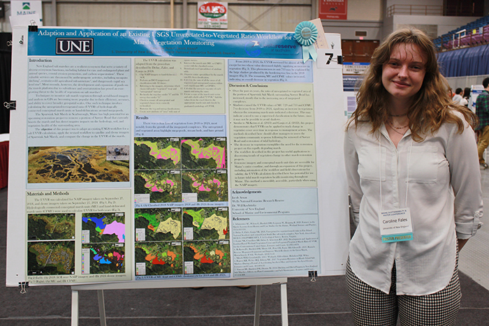
The threats posed by ancient farming infrastructure to salt marshes across New England has resulted in a rapid degradation of high marsh vegetation. Techniques to monitor vegetation through aerial-based imagery and analysis in GIS are becoming more popular due to their efficiency, accuracy, and ability to cover broader geospatial scales. One such technique involves calculating an unvegetated-to-vegetated ratio (UVVR) of hydrologically connected conceptual marsh units or hand-delineations around mega-pools. The Spurwink Marsh in Scarborough, Maine is set to undergo a restoration project, which aims to restore 0.75 acres where a road bisects the marsh and to enhance the surrounding area. To monitor vegetation before and after the restoration, a UVVR workflow was adapted for this project based on existing USGS data. This workflow was used to calculate the UVVR for NAIP imagery from 2018 and drone imagery from 2024 of the marsh. In almost all cases, the UVVR value of each marsh unit increased from 2018 to 2024, signifying a decrease in vegetated area. The overall decrease in vegetation exemplifies the need for the restoration project on this rapidly degrading marsh. The workflow described in this project has useful applications to discovering trends of vegetation change in other marsh restoration projects. Extensive imagery and conceptual marsh unit data are accessible for Maine’s entire coastline, and through an expansion of this project, including automation of the workflow and field observations for validity, the UVVR calculation described here has potential for use in future tidal marsh vegetation health monitoring throughout Maine.
8. PFAS in Maine Wildlife: How an Emerging Contaminant Impacts Hunting and Angling Behaviors
Melissa Godin, Caroline Noblet, Carissa Furtado (student)
University of Maine, Carissa.furtado@maine.edu
Per- and poly-fluoroalkyl substances (PFAS) are a diverse class of synthetic fluorinated chemicals known for their potential to cause human health issues and their ability to bioaccumulate in various species, including fish that are caught and game that is harvested in Maine. PFAS contamination in ecosystems presents a potential public health risk for those who consume wild caught fish and game, and undermines the perception of Maine as a pristine and safe place to recreate outdoors. To assess the impact of PFAS on the behavior of anglers and hunters, the University of Maine School of Economics partnered with the Maine Department of Inland Fisheries and Wildlife (MDIFW) to conduct two surveys of Maine hunting and fishing license holders. Ongoing evaluation of the angler survey deployed in September of 2024 (n=3,719, 9% response rate) shows that 74% of anglers are moderately to extremely concerned about environmental contaminants in the fish that they catch in Maine. But despite this high level of concern, 27% of anglers indicated that they are not confident about where to find information regarding fish consumption advisories, and only 19% had heard of PFAS advisories. Preliminary analysis from the survey of hunters being deployed in January of 2025 will explore potential behavior changes associated with the “do not eat” advisories issued by MDIFW/ME CDC that have been modified over time as the testing of wildlife for PFAS has expanded. Our results contribute to the understanding of the complex relationship between human behavior and ecosystem health.
9. The Relationship Between High Elevation Lake Acidity and Watershed Factors
Christopher Houdeshell (student), Rachel Hovel
University of Maine Farmington, christopher.houdeshell@maine.edu, rachel.hovel@maine.edu
Past atmospheric deposition of sulfuric and nitric acids (“acid rain”) has acidified high elevation lakes across Maine and New England, affecting the ecology of the lakes and their surroundings. Since the passage of the Clean Air Act Amendments in 1990, acid deposition has declined and many of the affected lakes have begun to recover. However, this recovery trajectory does not look the same at all lakes. Across western Maine, nine high-elevation lakes have been part of long-term water chemistry monitoring since 1986 and show variation in their pH trends over time, with five of the lakes increasing in pH, three declining in pH, and one showing no trend. To investigate why acidification recovery trends vary by lake, we explored relationships between water chemistry pH and ANC trends as response variables, and lake and watershed morphology and current watershed soil pH and dominant ions as predictors. We found no significant relationship between lake recovery and morphology, watershed morphology, or watershed soil pH. However, there was a relationship between soil pH and the lake sulfate trends. Further studies focusing on underlying surficial geology and longitudinal data collection on watershed soil chemistry will be useful to further reveal influences on lake recovery from acid deposition.
10. Laboratory-Scale Pilot Study: Evaluating Components and Conditions for Carbon Sequestration Using Glacial Rock Flour
Landen Jorgensen (student), Joseph Staples
University of Southern Maine, landen.jorgensen@maine.edu, joseph.staples@maine.edu
The increasing concentration of CO2 in the atmosphere continues to be a primary driver of global climate change. Carbon sequestration via geochemical processes represents a promising method for mitigating CO2 levels. This study explores the use of glacial rock flour in the sequestration of atmospheric CO2. Laboratory trials utilizing glacial rock flour in water showed a reduction greater than 250 ppm atmospheric CO2 compared to 70 ppm in aqueous controls. While the high sediment loads in early trials preclude direct observation of flocculation, measurable CO2 depletion suggests an active sequestration process. Factors influencing carbon binding efficiency and retention, sediment composition, aeration rates, pH, salinity, and temperature are under evaluation. The early stages of this research provide additional insight into the viability of mineral-based carbon capture and inform future research in potential field-based applications. The current study also aims to explore optimal conditions for geochemical CO2 capture, long-term carbon sequestration, and storage methods. These findings contribute to the growing field of engineered carbon sequestration, offering potential augmentation of traditional biological carbon capture methods.
11. Impacts of Climate Language on Rural Maine Community Resilience Initiatives
Sonia Leone (student), Sharon Klein
University of Maine, sonia.leone@maine.edu, sharon.klein@maine.edu
Language about climate change can create barriers for communities seeking to engage in resilience initiatives. Underserved Maine populations experience the effects of climate change, from severe winter storms and power outages to high energy costs. However, Maine’s culture of political polarization, rugged individualism, and distrust of institutions can contribute to a negative perception of climate action within rural communities. Language like ‘climate change and ‘government funding’ can bring local resilience projects to a halt, especially when outsiders do not engage with communities through respectful processes. This poster will present the results of an undergraduate Honors Thesis that analyzes the barriers and opportunities of climate language in underserved Maine communities. It will also examine how iterative co-production of research and equitable relationships can empower successful resilience initiatives. This study uses three methods: (1) A review of academic literature about place-centered climate knowledge and equitable research methodology, which will be compared to (2) interview data from Maine community leaders who engage with resilience projects and issues at the local level, and (3) survey data from a co-developed study about citizen understandings of climate adaptation and resilience projects. The results will be shared with community partners who co-developed the survey, and their feedback will be integrated into thesis revisions. This study ultimately aims to provide researchers and community leaders with an understanding of how current academic discourse aligns or contrasts with rural Maine perceptions of resilience initiatives.
12. Selecting Surface Water and Well Water Sample Sites to Detect and Predict PFAS Movement in the Environment
Brendan Lewis1 (student), Jane E. Disney2, Richard F. Hilliard2
- 1. College of the Atlantic, 2003brendan@gmail.com
- 2. Community Environmental Health Laboratory, MDI Biological Laboratory
To evaluate PFAS contamination in drinking and surface water originating from upstream point sources, we have developed an approach to select sample sites that capture the downstream movement of PFAS through runoff which can be used to predict the presence of PFAS in nearby sites. Focusing on contamination from public schools in coastal communities, we have been able to link PFAS in downstream wells and surface water to point sources upstream, tracing the pollutants’ path through the watershed. This approach utilizes USGS LiDAR for hydrological analysis in conjunction with USGS wetland layers and satellite imagery in ArcGIS Pro. Understanding how contaminants move through the watershed allows us to infer which other wells are likely to be contaminated from the same source based on the catchment area of sites at which we have confirmed contamination. Our team successfully predicted the movement of PFAS from the contamination associated with Mt. Desert Island High School, and we are working on a similar investigation in the communities surrounding Deer Isle-Stonington High School. At MDI High School, we detected PFAS profiles in well water and culvert outflows highly correlated with the catchment area of the school; this was not the case for wells that were geographically closer but hydrologically unassociated with the point source. We expect comparable results at Deer Isle-Stonington High School, where we are applying similar techniques. To our knowledge, this is the first use of topographic wetness index analysis in PFAS contamination investigations.
13. Pigment Analysis Reveals that Picoeukaryotes Dominate Picoplankton Community in Harpswell Sound, Maine, in Late Fall
Emma Mazlish (student), Collin Roesler
Bowdoin College Department of Earth and Oceanographic Science, emazlish@bowdoin.edu
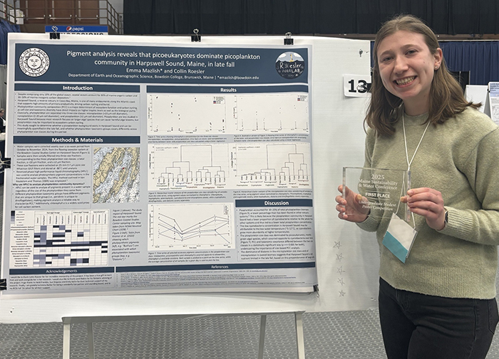
Despite comprising only 10% of the global ocean, coastal oceans account for 80% of marine organic carbon and 30–50% of marine inorganic carbon deposition. Harpswell Sound, a reverse estuary in Casco Bay, Maine, is one of many embayments along the Atlantic coast that supports high amounts of primary productivity, driving carbon cycling and burial. Phytoplankton community composition is a major determinant of ecosystem function and carbon cycling, as cell size and taxonomic diversity have direct impacts on higher trophic levels and the biological pump. Classically, phytoplankton are separated into three size classes: microplankton, nanoplankton, and picoplankton. Picoplankton are less studied in Harpswell Sound because most research focuses on larger algal species that can cause harmful algal blooms. However, the proportion and taxonomic composition of picoplankton biomass to overall phytoplankton biomass affects how carbon cycles in the ecosystem. This study sought to determine whether a picoplankton background exists in Harpswell Sound and can be meaningfully quantified in the late fall, and whether phytoplankton taxonomic groups covary differently across phytoplankton size classes during this period. High-performance liquid chromatography was used to quantify photosynthetic pigment concentrations in size-fractionated water samples. Picoplankton comprised 10–25% of total phytoplankton biomass and microplankton accounted for the remaining biomass. Nannoplankton biomass was negligible during the study period. The picoplankton community was dominated by chlorophytes, prasinophytes, chrysophytes and cryptophytes, with low levels of cyanobacteria observed. The microplankton community was dominated by haptophytes, diatoms and cryptophytes. These findings match expected picoplankton biomass proportions for coastal estuaries.
14. Climate-Driven Range Expansion of Ixodes scapularis: Insights from Predictive Modeling
Ian R. Mowatt (student), Joseph K. Staples
Environmental Science and Policy, University of Southern Maine, ian.mowatt@maine.edu, joseph.staples@maine.edu
The geographic expansion of Ixodes scapularis, the primary vector of Borrelia burgdorferi (Lyme disease), has been strongly influenced by climate change, reforestation, and shifts in host populations. This study integrates correlative and mechanistic modeling approaches to evaluate the species’ future distribution under projected climate scenarios. MaxEnt modeling, utilizing WorldClim CMIP6 data (2041-2060), predicts continued northward expansion into southern Canada, driven by increasing minimum winter temperatures. Meanwhile, DYMEX simulations, incorporating physiological stress thresholds, confirm that for up to a +3°C temperature increase, habitat suitability increases in northern latitudes while extreme summer heat may impose physiological limits on populations in the southeastern U.S. The results highlight potential declines in cold stress as a historical barrier to tick survival, supporting the likelihood of continued establishment in previously unsuitable areas such as northern New England, the Great Lakes region, and southern Canada. Alternatively, increasing summer heat stress may stabilize or slightly reduce tick populations in regions where temperatures exceed their thermal tolerance. These findings have significant public health implications, as the expanding range of I. scapularis may lead to increased Lyme disease risk in newly colonized areas. This study combines predictive modeling approaches to enhance assessments of future I. scapularis distributions, emphasizing the need for proactive vector surveillance and targeted disease prevention strategies in a changing climate.
15. What’s Next? A Policy Analysis of PFAS Regulations in Maine and Throughout the United States
Eddie Nachamie (student), Rachel Schattman
University of Maine, edward.nachamie@maine.edu, rachel.schattman@maine.edu
Per- and polyfluoroalkyl substances (PFAS) have become a contentious topic due to their widespread accumulation and concerns over their public health implications. The state of Maine is one state in the U.S. that is currently dealing with the consequences of PFAS contamination in a variety of areas ranging from drinking water and waste management to environmental pollution and resulting farm closures. The aim of this review is to examine how federal EPA policy as well as Maine’s policies (which are among the most stringent legislation developed thus far) in response to PFAS contamination have evolved since the early 2000s, a period when more stringent regulation of these substances began. Additionally, the review will provide a non-exhaustive description of other states’ legislative response to further understand the landscape of PFAS regulation within the United States. By establishing what rulemaking exists in the United States’ regulation of PFAS, further regulatory gaps can be identified. Describing Maine’s policy in this field provides a case-based understanding of current policy actions as well as providing more context for what regulation could still be implemented. Establishing Maine’s existing regulatory landscape allows for a comparison to other states as they consider passing similar legislation or for federal actors seeking to develop regulation. As a result of the ubiquitous nature of PFAS within the environment and human populations, this type of reference will be valuable for policymakers looking to implement existing frameworks to address increasing awareness of PFAS contamination and its public health, economic, and environmental implications.
16. Sediment Dynamics Downstream of a Recent Dam Removal: Analysis of Deposits from the May and December 2023 Flood Events
Kevin Sweeney (student), Julia Daly
Division of Natural Sciences, University of Maine Farmington, kevin.sweeney@maine.edu
This study examines sediment deposits downstream of Temple Stream following the removal of a long-standing dam. Two major flood events in 2023—one in May and another in December—created large, dune-like sediment deposits across the floodplain immediately downstream of the former dam location. Prior to dam removal, this area showed signs of scour and sediment starvation. Following these high-flow events, sediment >0.50 m thick was deposited across much of the area and secondary distributary channels formed across the surface of the new deposit. The objective was to analyze grain size distribution within these deposits and compare this to the surface of the distributary channels. Fieldwork involved mapping the dunes, vertically sampling the deposits from trenches, and surface sampling along the channel axis. Results showed coarser sediments upstream and finer grains downstream in the distributary channel, and the coarser sediments were larger than those found within the deposits. Each flood event showed a fining upward sequence, so the total sediment deposit exhibited coarser sediments in the middle, likely due to higher energy at the onset of the December 2023 event. The findings highlight how flood intensity and landscape features influence sediment composition and deposition, providing insights into post-dam removal sediment dynamics and flood event impacts on stream morphology.
17. Supporting Sustainability in Maine’s Brewing Industry
Dean Syed (student)
University of Southern Maine, dean.syed@maine.edu
Brewing is a resource intensive process. There are numerous independent breweries across Maine, with the state having one of the highest concentrations of breweries per capita in the country. Economic conditions and consumer demand have accelerated sustainability improvements in many industries including brewing. This poster highlights work performed by BetterBev team members in providing sustainability technical assistance to Maine breweries. The poster contextualizes and describes the impact of sustainability efforts. Assistance provided to breweries highlighted in the poster falls under three main categories; researching funding opportunities, supporting sustainability recognition processes, and operational improvements. Our work is analyzed in the poster through a community well being and ecosystem health lens, providing a unique insight into sustainability efforts and challenges in the brewing industry.
18. Observing Ground-Dwelling Arthropod Biodiversity in Comparison to the Density of Multiple Life Stages of Ixodes scapularis (Blacklegged Tick) at Two Forested Sites in Southern Maine
Sage Tocci (student), Brady Speed, Joseph Staples
University of Southern Maine, sage.tocci@maine.edu, brady.speed@maine.edu, joseph.staples@maine.edu
The increase in range and density of Ixodes scapularis (the Black-Legged, or Deer, tick) across New England has been observed since the 1990s, along with an increase in tick-vectored diseases. Traditional management strategies involving the use of acaricides, which can have potential negative impacts on non-target species, have failed to stem the steady northward expansion of this species. Integrated Pest Management strategies seek to lessen the use of pesticides in favor of more sustainable approaches that rely on ecological relationships in addition to traditional methods. Some studies have already explored the potential of predatory arthropods to manage tick levels, and this research aimed to further explore this topic by observing the populations of different arthropod species at high- and low-density tick sites in southern Maine. In this study, pitfall traps were installed at the Wells National Estuarine Research Reserve (WNERR) in York County, Maine, in the fall of 2023. Collections from Fall 2023 indicated a dominance of ground beetle species (Cyminidis spp.) in areas of lower tick density. This observation, along with concurrent monitoring of terrestrial arthropod biodiversity during the emergence of larval Ixodes scapularis, led to an extension of the study during the fall and summer of 2024. Ongoing statistical analyses are evaluating biodiversity and tick density based on the most recent collection period.
Graduate Posters
19. Sustainable PFAS Treatment in Maine’s Public Water Systems: Balancing Water Quality, Policy, and Environmental Impact
Josephine Adu-Gyamfi1 (student), Lukas Norment1 (student), Onur Apul1, Jean MacRae1, Caroline Noblet2, Reed Miller1
- 1. Civil and Environmental Engineering Department, University of Maine, josephine.adugyamfi@maine.edu, lukas.norment@maine.edu, onur.apul@maine.edu, jean.macrae@maine.edu, reed.miller@maine.edu
- 2. School of Economics, University of Maine, caroline.noblet@maine.edu
Per- and polyfluoroalkyl substances (PFAS), known as ‘Forever Chemicals’ pose significant risks to drinking water quality and public health. In response, Maine set maximum contaminant levels (MCLs) for PFAS in 2021, and the U.S. Environmental Protection Agency (EPA) is now advancing stricter federal regulations. Statewide testing suggests that at least 11% of Maine’s public water systems will require treatment to meet these new standards, raising challenges related to compliance, cost, and environmental impact.
Common PFAS treatment methods, such as granular activated carbon and ion exchange resins, are effective but often resource-intensive, contributing to high energy use, carbon emissions, and waste management concerns. These challenges create tension between regulatory compliance and Maine’s broader sustainability and climate goals.
This study integrates stakeholder engagement with technical analysis to identify key concerns, informational needs, and feasible treatment strategies for Maine’s water systems. Through life cycle assessments, we evaluate PFAS treatment technologies based on their effectiveness, energy consumption, carbon footprint, and financial viability. Our findings will be shared in accessible formats to support decision-making for water system operators, policymakers, and community stakeholders.
By aligning water quality management with environmental and economic sustainability, this research aims to inform policy development and promote sustainable solutions for PFAS mitigation in Maine’s public water systems.
20. Can Freshwater Fisheries Provide Sustenance in an Age of Scarcity, Simplification, and Strife? A Biophysical Economic Analysis of Ice-Angling for Panfish in Central Maine
Deborah Alademehin (student), Stephen Coghlan, Jessica Jansujwicz
Dept. of Wildlife, Fisheries and Conservation Biology, University of Maine, deborah.alademehin@maine.edu, stephen.coghlan.maine.edu, jessica.jansujwicz @maine.edu
Decades of fossil-fueled economic and population expansion have pushed humanity beyond Earth’s carrying capacity, triggering a global “Meta-Crisis” manifested in climate chaos, biodiversity loss, resource depletion, inflation and socio-political unrest. In response, rural communities—such as those in Maine—may increasingly rely on local ecosystems for sustenance through fishing, hunting, foraging, and other back-to-land activities. We study the capacity of ice-angling for Panfish to provide sustenance for Mainers during a likely future of scarcity, simplification, and strife. We will analyze otoliths from Panfish harvested over 10+ years to infer vital characteristics of individuals and population, integrate findings with trophic transfer models to assess their capacity to sustain Maine anglers. In addition, we investigate the behaviors, attitudes, and motivations of anglers themselves through surveys and interviews to understand how perceptions of climate and economic shocks affect angler behavior and harvest pressure might influence fishing practices. Although we have not yet finalized data on the human dimension’s components of the study, our questions focus on how changes in local conditions—economic or environmental—might alter the ways people fish and, in turn, shape overall harvest dynamics. Ultimately, we compare the demand for panfish among Maine anglers with the productive potential of local ponds using biophysical economic model that incorporates human behavior, we aim to illuminate feedback loops between fish populations, lake productivity, and angler behavior, thereby guiding recommendations for regulations/management prescriptions.
21. The Role of Local Energy Action Networks (LEANs) in Promoting Renewable Energy and Energy Efficiency in Underserved Communities across the USA
Janine Siqueira Borges1 (student), Sharon Klein2, Caroline Noblet2
- 1. University of Maine. Ecology & Environmental Science, janine.siqueira@maine.edu
- 2. University of Maine, School of Economics, sharon.klein@maine.edu, caroline.noblet@maine.edu
The transition to renewable energy and energy efficiency (REE) is critical for addressing multiple environmental and social issues, yet Indigenous, rural, and low-income communities often face significant barriers to participation. Local Energy Action Networks (LEANs) may play a pivotal role in supporting community-led sustainable energy initiatives, but their role in supporting underserved communities require further investigation. This study examines the internal frameworks of LEANs, analyzing how they structure their programs, navigate challenges, and achieve successes in promoting community-led energy transitions.
This research first conducted an augmented literature review to identify potential LEANs nationwide, analyzing their missions, actions, and engagement strategies. Second, we documented and compared the outreach methods, partnerships, and community interactions of these LEANs in a database. Finally, we conducted semi-structured interviews with LEAN leaders to provide insights into the challenges, successes, and impact of these networks in promoting REE adoption. Emphasizing networks that actively engage with underserved populations, this study highlights best practices and structural barriers influencing equitable energy transitions.
Preliminary findings suggest that LEANs leverage grassroots leadership, cross-sector collaboration, and adaptable program models to drive community-driven energy solutions. However, challenges such as funding limitations, regulatory obstacles, and trust-building persist.
By shedding light on the role of LEANs in fostering equitable access to REE, this study contributes to the broader discourse on environmental justice and community resilience, offering insights for policymakers, practitioners, and scholars committed to sustainable energy transitions.
22. Hydrophobic Modification of Paper Using Emulsified Soybean Wax
Mahbuba Daizy (student), Douglas W. Bousfield, David J. Neivandt
Department of Chemical and Biomedical Engineering, University of Maine, mahbuba.daizy@maine.edu, bousfld@maine.edu, david.neivandt@maine.edu
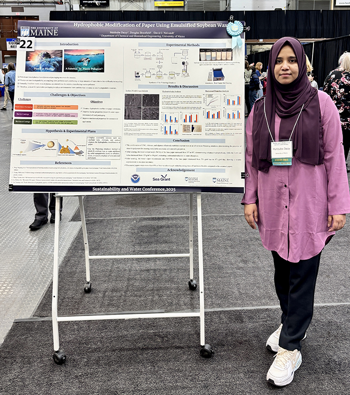
A hydrophobic coating layer on paper is needed to prevent liquid water transmission in some packaging applications where there is a demand to replace plastic with sustainable materials that degrade to benign components if littered. Currently, most paper-based packaging that needs a water barrier depends on petroleum-derived polymers. Nevertheless, the facile and effective construction of packaging paper materials with excellent water repellency, and biodegradability currently faces distinct challenges. To address this challenge, the author has developed a one-step coating method to prepare hydrophobic paper by templating stable oil-in-water (O/W) Pickering emulsion stabilized with cellulose nanocrystals (CNCs). The emulsion incorporates alginate in the aqueous phase and chitosan (CS) within the liquid soybean wax phase. The CNCs/soybean wax emulsion coating significantly improves the hydrophobic and water vapor barrier properties of the paper. Indeed, the water contact angle (WCA) of the paper increased from 37° to 92° after coating, demonstrating enhanced hydrophobicity. Additionally, the Cobb test value of the base paper decreased from 125 g/m² to 38 g/m², indicating a substantial reduction in water absorption. The water vapor transmission rate (WVTR) of the base paper decreased from 731 g/m²·day to 471 g/m²·day after applying the coating, demonstrating a notable enhancement in moisture resistance. This work may provide an alternative solution for safe, cost-effective and sustainable paper-based packaging materials to replace traditional disposable plastics.
23. Geospatial Integration of PFAS Survey Data
Melissa Godin1 (student), Caroline L. Noblet2
- 1. University of Maine, melissa.godin@maine.edu
- 2. University of Maine School of Economics
Per- and polyfluoroalkyl substances (PFAS) are a family of engineered chemicals that have been used in many household and industrial products since the 1940s, and are more colloquially referred to as ‚ ‘forever chemicals’ because they do not naturally biodegrade in the environment and bioaccumulate in animal and human bodies. As PFAS have emerged as an environmental contaminant of concern, Maine has been a leader in addressing PFAS contamination both in terms of testing and legislation. Initial testing and monitoring sites were selected based on proximity to known PFAS exposure sources, such as sludge and septage spread sites. This research integrates data from complementary studies on citizens’ knowledge and preferences regarding PFAS, with targeted sampling near Tier I and II septage sites, based on the hypothesis that those living near known contamination sites may have different awareness and perceptions of PFAS. We overlay these concurrent survey responses with PFAS water testing results to identify any spatial patterns. Preliminary analysis found statistically significant relationships exist between zip code and who respondents trust to provide accurate information about PFAS and other contaminants. Additionally, while responses varied within geographic groups, zip code was significantly associated with concern about PFAS in drinking water, perceptions of where PFAS is a problem in Maine, and the extent to which people felt they should know about PFAS. These findings suggest that proximity to contamination sites influences community perceptions of PFAS, with different communities exhibiting varying levels of awareness, concern, and trust in information sources.
24. Co-Designing Microgrids for Energy Justice: A Literature Review Analysis of Best Practices, Barriers, and Pathways for Underserved Communities
Muhammad Hamza (student), Katherine Simmons (student), Sharon J.W. Klein
University of Maine, School of Economics, Mitchell Center for Sustainability Solutions, muhammad.imran@maine.edu, sharon.klein@maine.edu
This literature review synthesizes global research on microgrid co-design with underserved communities—including Indigenous, rural, low-income, and geographically isolated populations—to identify best practices, systemic barriers, and pathways for equitable energy transitions. Analyzing 70 sources, including 35 peer-reviewed articles, numerous case studies, and policy documents, the review reveals that successful microgrid projects prioritize community-led engagement, integrating cultural values, trust-building, and participatory decision-making. Key findings highlight the centrality of energy sovereignty, particularly for Indigenous communities, where ownership models and alignment with socio-environmental priorities enhance resilience and self-determination. Technical solutions, such as hybrid renewable systems, are most effective when coupled with socio-technical frameworks like Brazil’s Convergence Framework or Chile’s participatory model for Mapuche communities, which blend engineering with traditional knowledge. Challenges persist in policy and funding structures: top-down regulations, utility monopolies, and grant mechanisms often exclude communities lacking technical or financial capacity. Conversely, upfront funding, decentralized governance, and partnerships with NGOs/universities emerge as enablers. The review also underscores microgrids’ role in climate resilience, mitigating disasters like wildfires (California) and hurricanes (Puerto Rico), though long-term sustainability requires addressing operational gaps in social research and maintenance. Three critical recommendations arise: (1) adopt co-design methodologies (e.g., Living Labs, Social Capital Theory) to ensure solutions reflect community needs; (2) reform policies to prioritize equitable funding and tribal sovereignty; and (3) expand interdisciplinary research bridging technical, economic, and social dimensions. By centering underserved communities as partners—not beneficiaries—this review charts a path toward energy justice, where microgrids empower resilience, equity, and decarbonization.
25. Aftermath of a Major Firefighting Foam Spill in Brunswick, Maine: Spatiotemporal Dynamics of Per- and Polyfluoroalkyl Substances in the Downstream Aquatic Environment
Macy Hannan1 (student), Fatih Evrendilek1, Daniel Leclair2, Manisha Choudhary1, Kenneth Mensah1, Christoph Aeppli3, Arjun K. Venkatesan4, Onur G. Apul1
- 1. Dept. of Civil and Environmental Engineering, University of Maine, macy.hannan@maine.edu
- 2. College of Professional Studies–Aviation, University of Maine Augusta
- 3. Bigelow Laboratory for Ocean Sciences
- 4. Dept. of Civil & Environmental Engineering, New Jersey Institute of Technology
The 6th largest AFFF spill occurred on August 19, 2024 in Brunswick, Maine at Brunswick Executive Airport leading to 5,500 L aqueous film-fighting foam (AFFF) into the watershed surrounding the airport. Per- and polyfluoroalkyl substances (PFAS) are human-made substances, often found in AFFF, which have threatening effects when released into the environment. Particularly, PFAS exposure may lead to decreased fertility, increased risk of cancer, developmental effects, among other detrimental issues. There has been limited sampling and documentation of the fate and transport of a spill into a defined watershed following past large PFAS spills. Following the spill, the Maine Department of Environmental Protection (DEP) sampled nine locations over 11 days. This study revealed a 93% reduction in PFAS concentrations within the first few days due to remediation efforts and natural dilution, but their downstream transport persisted. According to Kruskal-Wallis and Steel-Dwass tests, spatial and temporal patterns of PFAS revealed significant spatial variability. PFOS, PFHxS, and PFOA consistently remained higher at the spill source but declined with distance. In addition to DEP sampling, 5 private wells, 2 surface water, wastewater influent and effluent, and 4 soil samples at 3 different depths each have been sampled through the University of Maine weekly for the first two months, biweekly for the second two months, then monthly sampling continues through August 2025. PFAS analysis following EPA method 1633 is followed to accurately access the concentrations and variations to see how compositions change over time following the spill.
26. Foamed Lobster Shell Composites for Thermal Insulation and Packaging Applications
Olivia Lee (student), Ryan Bourque, David J. Neivandt
Department of Chemical and Biomedical Engineering, University of Maine, olivia.lee@maine.edu, ryan.bourque@maine.edu, david.neivandt@maine.edu
Expanded polystyrene (EPS), commonly known as Styrofoam, is a non-biodegradable, petroleum derived product widely used for thermal insulation and impact absorption in packaging applications. EPS is composed of 95-98 percent air and is only recyclable through specialist facilities although recycling is not considered profitable due to high transportation costs. EPS often ends up in landfills and/or the terrestrial and marine environments where it fragments into smaller pieces, making it easier for animals to ingest. In 2011, the Neivandt Group at the University of Maine developed a biodegradable golf ball comprised of lobster shell and a natural binder, US Patent 10,065,080. Preliminary tests revealed that the composite could be foamed making it a potential substitute for EPS if the thermal, mechanical and physical properties could be adjusted appropriately. The present work has developed a means of mechanically foaming the composite resulting in materials with densities ranging from 0.010-0.058 g/mL. The thermal conductivity values for varying compositions of the foamed product range from 0.034-0.039 W/m*K which are within the targeted range of 0.030-0.040 W/m*K for EPS, indicating insulation properties comparable to EPS. Impact testing for different compositions of the foamed composite gave values ranging from 0.49-5.70 J/m which some compositions are greater than measured Styrofoam products which had values of 1.67 J/m. Preliminary water dissolution tests revealed signs of significant degradation of the sample over a 10-day period. Taken together, the present work indicates that the foamed lobster shell composites represent a biodegradable and environmentally benign potential replacement for EPS.
27. Quantifying the Extent of Coastal Stabilization Along the Casco Bay Using Archived NRPA Permits and Satellite Imagery
Marisa N. Monroe1 (student), Nathan P. Robbins2
- 1. University of Maine, marisa.monroe@maine.edu
- 2. Maine Department of Environmental Protection, nathan.p.robbins@maine.gov
The Maine Department of Environmental Protection (DEP) handles permit requests for coastal shoreline stabilization projects, either through a Natural Resources Protection Act (NRPA) Permit or a Permit by Rule (PBR) submitted by the landowner. Approved permits are recorded as a point location within a Geographic Information System (GIS) data layer; however, no measurement of linear feet of stabilization is included in that record. We used archived permit information to a.) map linear feet of stabilization on a GIS layer; and b.) record length and height of stabilizations and square feet of coastal wetland alteration for permits in the Casco Bay. In total, archived permits accounted for 40,743 ft (7.7 miles) of coastal stabilization. Because other stabilizations were clear from satellite imagery not included in the aforementioned mapping, we created a second GIS layer of coastal stabilizations apparent only from satellite imagery. Our main conclusion is that known, permitted stabilization projects in the Casco Bay make up less than half of existing coastal stabilizations. This information will support efforts in Maine to better understand the extent of coastal stabilization and to consider the use of nature-based designs, or Living Shorelines, as an opportunity to provide protection while minimizing the cumulative impacts of armoring on protected natural resources.
28. Development and Characterization of Seaweed-Derived Flexible Thin Films and Coated Paper for Food Packaging Applications
Sanjana Mutyapu1 (student), Doug Bousfield1, Colleen Walker2
- 1. Dept. of Chemical and Biomedical Engineering University of Maine, sanjana.mutyapu@maine.edu, bousfld@maine.edu
- 2. Process Development Center, colleen.walker@maine.edu
Majority of the solid marine litter is Single-Use Packaging. Paper is an alternative packaging material that is biodegradable and recyclable, but it lacks crucial barrier properties required for food preservation. Per- and polyfluoroalkyl substances (PFAS) are extensively used as paper coatings due to their exceptional barrier properties. These are attributed to their strong chemical bonds which would also translate to poor biodegradability. Traditional plastic films, such as polyethylene (PE), used in paper packaging are difficult to recycle. These films often remain in landfills after the paper decomposes. Seaweeds have emerged as a promising substitute.
In this study, Seaweed (kappaphycus alvarezii) powder has been used as it known for its high polysaccharide content. Mixed with glycerol as a plasticizer, it forms a viscous gel when dissolved in water around 80‚ÑÉ. This is cast on a plastic tray and dried overnight. Tensile tests showed good tensile strength of 0.6 MPa and 50% Elongation at break. Seaweed gel applied to paperboard gave excellent oil and grease resistant properties as the kit test value increased to 12 at 12 g/m2 of coat weight and the water vapor transmission rate decreased from 425 g/m2day to 330 g/m2 day. Since seaweed is inherently hydrophilic in nature, hydrophobic agents were used to improve the moisture barrier properties. SEM images and Gurley Air permeability test showed that a continuous coating surface is formed with low air permeability. This work has the potential to sustainably produce food packaging materials using simple and green processes.
29. COPRI at UMaine: Coastal Research for a Sustainable Future
Vanessa Quintana1,2,3,4 (student), Taylor Bailey Spencer1, Cristian Rojas1, Nalika Lakmali1, Nicholas Cyr1
- 1. University of Maine, Department of Civil and Environmental Engineering, vanessa.mahan@maine.edu, taylor.l.bailey@maine.edu, cristian.rojas@maine.edu, nalika.lakmali@maine.edu, nicolas.cyr@maine.edu
- 2. University of Maine, Department of Marine Sciences,
- 3. Oak Ridge Institute for Science Education
- 4. US Army Corps of Engineers
The Coasts, Oceans, Ports, and Rivers Institute (COPRI) at the University of Maine is a cohort of graduate students conducting novel research on topics related to sustainable coastal engineering design solutions, estuarine water quality, and ecological habitat modeling nearshore. Our research collectively aims to have implications and applications for coastal communities in Maine and worldwide. General topics include nature-based design solutions for coastal hazards, investigations of water quality to aid in decision support surrounding aquaculture and fisheries management, estuarine water processes modeling, and harmful algae blooms. Current research utilizes a variety of methods from numerical simulations to experimental and field observations, which focus on: 1) understanding circulation patterns for better prediction of floating material transport; 2) understanding the impact of large tidal range over estuarine circulation; 3) understanding the impacts of tidal asymmetry and river discharge for contaminated-material transport; 4) investigating storm surge dynamics and propagation in macro-tidal environments; 5) and examining front-wave interactions at the mouth of an estuary. The findings of these research projects aim to support decision-makers, numerical modelers, water quality managers, and coastal development planners in their actions toward shaping sustainable and thriving coastal environments and communities.
30. Comparing Microbial Communities in Restricted and Unrestricted Marsh Habitats
Heather Richard1 (student), Jean MacRae1, Tomoko Komada2, Brian McGill1, Sue Ishaq1, Peter Avis1, Andrew Rominger1,3
- 1. University of Maine, heather.l.richard@maine.edu
- 2. San Francisco State University
- 3. University of Hawaii
Salt marshes are vegetated habitats which have the potential to store concentrated amounts of carbon. The management and preservation of these ecosystems should be informed by how carbon cycling within these ecosystems is affected by human activities. We sampled 7 marsh locations in Maine and compared microbial communities above and below tidal restrictions and along creeks with and without restrictions. We assessed the various ways microbial composition differed based on marsh elevation, soil depth and location relative to a restriction in present. We tested the hypothesis that the more restricted a tidal creek is, the more environmental and microbial community varies between upstream and downstream habitats. Preliminary results show that while clear differences between upstream and downstream habitats were less evident than expected, individual marsh locations showed unique communities which provided insight into dominant biogeochemical processes likely occurring. The soils samples from shallow low marsh habitats showed the greatest effect of marsh site. The results of this study will hopefully inform future work seeking useful genetic markers to better understand salt marsh functioning and conservation management.
31. Aligning Community Preferences with Policy Action: Examining Climate Resilience Priorities in Maine’s Community Resilience Partnership
Faizan Saif (student), Sharon J.W. Klein, Caroline Noblet, Kathleen Bell
University of Maine, faizan.saif@maine.edu, sharon.klein@maine.edu, caroline.noblet@maine.edu, kathleen.bell@maine.edu
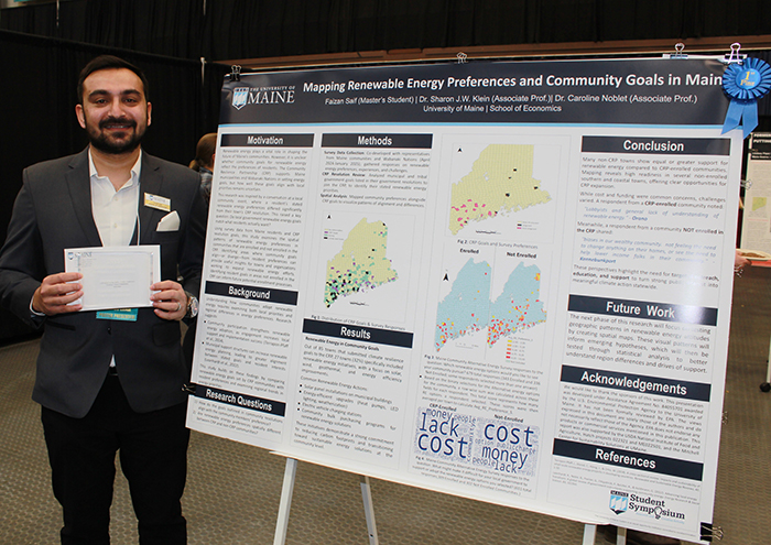
The Maine Community Resilience Partnership supports Maine municipalities and Wabanaki tribes in developing local climate resilience via community-driven initiatives. This poster examines how community preferences for climate resilience correlate with participation in the CRP and the goals communities specify in their government resolutions, required to join the CRP. This study uses survey responses and spatial data analysis to investigate the extent to which individual resident preferences align with the community goals specified in the CRP resolutions. It further examines socioeconomic factors, such as income and age, in shaping the community priorities expressed by individual survey respondents. Preliminary results indicate that CRP-participating communities are more likely to prioritize climate adaptation measures that align with their officially stated resolution goals, particularly in areas related to renewable energy adoption and infrastructure resilience. These findings suggest that formal participation in CRP helps communities translate policy commitments into action by aligning local planning with resident priorities. When community members are aware of their town’s CRP goals, they may be more motivated to support and adopt resilience initiatives, such as renewable energy projects and climate adaptation measures. This study maps these trends and thereby adds to the understanding of how policy mechanisms translate into community action across the wide geography of Maine. The findings furnish policymakers, municipal leaders, and climate advocates with valuable insights into improving climate resilience strategies at the municipal level.
32. Impacts of High-Frequency, Short-Duration Rainfall Events on Bacterial Pollution in Frenchman Bay, Maine
Taylor Bailey Spencer1 (student), Lauren Ross1, Sean Smith2,3,4, Bea Van Dam2, Sohaib Alahmed5
- 1. University of Maine, Dept. of Civil and Environmental Engineering, taylor.l.bailey@maine.edu, lauren.ross1@maine.edu
- 2. University of Maine, School of Earth and Climate Sciences, bea.vandam@maine.edu
- 3. Senator George J. Mitchell Center for Sustainability Solutions
- 4. Darling Marine Center, sean.m.smith@maine.edu
- 5. Halff Associates, sohaib.alahmed@maine.edu
Land-based runoff induced by precipitation events can be a significant source of bacterial contamination in coastal waters. Rising concerns regarding water quality in estuaries are warranted due to the expectation that climate change will exacerbate short-scale, episodic precipitation events, increasing both rainfall intensity and frequency, thereby enhancing pollutant runoff. Considering these factors, there is increasing need to understand how rainfall over a watershed translates to streamflow which ultimately enters estuaries during short-duration, high-intensity (2” of precipitation in 24h) storm events. Further, understanding the spatial extent of the polluted freshwater after the rainfall event is vital for effective management decisions surrounding aquaculture and shellfish harvesting in affected estuaries. This stakeholder-driven research aims to provide science-based evidence to inform emergency closures due to 2” rainfall events in Frenchman Bay, Maine, in active regions for shellfish harvesting and aquaculture. Using hydrologic modeling, this work quantifies the streamflow response to idealized, simulated 2” rainfall events for eight different streams entering three different estuaries in the Frenchman Bay area. From the hydrographs produced by this modeling, “worst-case scenario” storm bacterial loads are estimated for each of the estuaries. The hydrographs are then used to force the streamflow for idealized simulations with a three-dimensional, hydrodynamic model to assess the spatial extent of the polluted freshwater in the three estuaries in the days following the event. Preliminary results suggest that under a “worst-case scenario,” some estuarine regions remain affected compared to nominal conditions for longer than one week.
33. Investigating Salt Marsh History, Morphology, and Colonial Impacts Through Sedimentary Reconstructions
Phoenix Susak (student), Jon Woodruff, Dana MacDonald, Mark Leckie, Molly Autery
University of Massachusetts-Amherst, psusak@umass.edu, woodruff@umass.edu, dmacdonald@admin.umass.edu, leckie@umass.edu, mautery@umass.edu
This research explores the long-term impacts of colonial-era modifications on the Cousins River in Yarmouth, Maine. Due to intricate levying systems implemented by early agricultural practices, the marsh remains flooded for prolonged periods following high tide, leading to an increased loss of key habitat. I hypothesize that low-marsh environments were more extensive prior to colonial activities, while the widespread high-marsh platform (and pooling) seen today is a legacy artifact of early colonial agricultural engineering.
Paleo-analysis on sediment cores collected in the Cousins river salt marsh elucidate environmental change through loss on ignition, fossilized pollen and forams, stratigraphic, and isotopic analysis. Key changes in biodiversity delineate periods of Indigenous settlement, colonization, and agricultural evolution. Coprophilous spores are utilized as an indicator of livestock presence on the marsh and the coinciding development of marsh modification through levees and dikes. Marsh evolution from pre-colonization to present day is highlighted by transitions in pollen concentrations of Spartina alterniflora (a low elevation species) to Spartina patens (a higher elevation species). Sedimentation rates calculated through isotopic and stratigraphic analysis reveal 275 years of accumulation trends. Pollen concentrations of Amaranthaceae salicorniaceae provide insight as to when prolonged flooding in the high-marsh began.
The legacy of early colonial agricultural modifications on the Cousins River salt marsh result in loss of biomass production, sedimentation and habitat through sustained flooding. Signals of healthy marsh ecosystems have been generated to inform conservation and restoration efforts on the Cousins River.
Professional Posters
34. PFAS in Maine: A New Website to Share PFAS Research Efforts, News, Publications, and Resources.
Jane Disney1, Ashley Taylor1, Léo Charbonneau1,2, Brendan Lewis1,2, Cait Bailey1, Caitlin Oliver-Olsen1, and Richard Hilliard1
- 1. MDI Biological Laboratory, jdisney@mdibl.org
- 2. College of the Atlantic
Per- and polyfluoroalkyl substances (PFAS) or “forever chemicals” are soil, surface water, and groundwater contaminants found in many areas of the U.S. and around the world. They are used in various consumer products, such as non-stick cookware, stain-resistant carpeting, and floor waxes. In a nationwide study of private and public drinking water sources, at least one forever chemical was found in 45% of samples. These chemicals are known to adversely affect human health and cause harm to various types of ecosystems. In Maine, PFAS were discovered in agricultural areas where wastewater sludge was used as fertilizer in pastures and fields. Subsequently, PFAS were found in nearby wells, waterways, and wildlife. In 2022, all Maine schools and daycares were required to test drinking water for PFAS. Of 196 drinking water samples tested, 31% exceeded Maine and/or EPA standards for public water systems. Researchers across Maine have been working to understand the extent of contamination in agricultural areas, rural communities, and schools, and the potential impacts on public health. There has been a lack of coordination of research efforts and limited sharing of information, approaches, and findings. The PFAS issue is a pressing one that requires the timely sharing of research efforts. The new website at pfasmaine.org is intended to share emerging data, highlight local findings, showcase outcomes, and spark new collaborations.
35. The Loring Air Force Base RI — Maine’s Largest PFAS Puzzle
Maria Guerra, Lindsey Papa
WSP, maria.guerra@wsp.com, lindsey.papa@wsp.com
Occupying over 9,000 acres in the Town of Limestone, Maine, the former Loring Air Force Base is the site of the largest PFAS investigation in the state. In 2013, following the process set by Comprehensive Environmental Response, Compensation, and Liability Act (CERLCA), the US Air Force (USAF) began investigating PFAS contamination on the base, resulting from the historic use of aqueous film forming foam (AFFF). In 2022, the USAF initiated a CERCLA Remedial Investigation with the support of WSP USA Inc. (WSP) to define the nature and extent of contamination and evaluate whether the presence of PFAS causes an unacceptable risk to human and ecological receptors.
An effective investigation encompasses three major components: a site model that guides sample planning, field work that provides representation of the current state of the contamination, and data interpretation that informs future decisions.
To understand the extent of PFAS contamination, WSP designed an investigation that entailed three years of field work and included over three thousand samples. Activities were executed across the installation in coordination with key stakeholders. Media types sampled included soil, sediment, groundwater, surface water, stormwater, plant and animal tissue, to determine risk to human and ecological receptors. WSP will use this data in its final RI Report (expected late 2026) to answer the questions of what contaminants are present, where contamination is located, where and how the contamination may be moving, and what potential receptors might be impacted.
36. Climate Ready Casco Bay
Kelly Rehberg, Sara Mills-Knapp, Gretchen Anderson
Greater Portland Council of Governments, krehberg@gpcog.org, smills-knapp@gpcog.org, ganderson@gpcog.org
Climate Ready Casco Bay was developed as part of a National Fish and Wildlife Foundation funded project to develop nature-based coastal resilience solutions across eleven Casco Bay communities. This project sought to leverage current resources, weave together existing data and climate assessment efforts, identify and fill gaps, seek public input, and develop strategies for protecting the region’s coastline. It also serves as a resource for future efforts. The project provides a comprehensive, regional approach to climate resilience in preparation for climate risk and includes the work of multiple organizations and municipalities working on this issue in Casco Bay. This project — coordinated by Greater Portland Council of Governments and the Gulf of Maine Research Institute in collaboration with community volunteers, municipal staff, elected officials and community leaders — aimed to achieve the following outcomes: 1) Increased municipal knowledge, capacity and plans to protect coastal habitats and infrastructure from climate impacts; 2) Identification of high priority coastal resilience projects; 3) A regional resilience plan identifying community and ecosystem resilience needs, and actions and best practices to mitigate flood risks; 4) Present conceptual renderings of nature-based solutions in action at three different property types across the region; 5) An online portal supplementing the resilience plan and making information accessible to the region.
37. Catalytic Approaches to Sustainable Petrochemical Alternatives
Brandon Tate
Bowdoin College, b.tate@bowdoin.edu
Our research focuses on the development of catalysts for the hydrogenation of carbon dioxide, a reaction that produces renewable fuels and sustainable alternatives to petrochemicals. While traditional hydrogenation catalysts rely on precious metals to activate hydrogen through reduction-oxidation mechanisms, our approach leverages acid-base chemistry to split hydrogen into oppositely charged ions (H+ and H–), enabling its reaction with CO2 to form formic acid—an energy-dense fuel and a key feedstock for plastics, polymers, and pharmaceuticals. Ongoing experiments in our lab aim to elucidate the catalytic mechanism—the step-by-step process by which our acid-base catalysts make and break chemical bonds. Our mechanistic experiments, based on studies of chemical kinetics and isotope-labeling, are consistent with a reaction pathway in which hydrogen is cleaved into H+ and H– ions, followed by the delivery of the hydride ion to the electrophilic carbon atom of CO2, resulting in an intermediate formate ion. Proton transfer then completes the conversion to formic acid while regenerating the catalyst. Mechanistic insights guide our design of more efficient catalysts. We hypothesize that catalysts with more sterically shielded active sites will be more resistant to degradation, resulting in improved catalytic efficiency. Future work will explore how steric effects influence the performance of our acid-base pairs as catalysts for CO2 hydrogenation.
38. Drinking Water Testing on Maine’s Outer Islands Reveals Need for More Testing
Morgan Karns1,2, Douglas Cornman3, Ramsey Steiner4, Cait Bailey1, Amy Steckel1, Jane E. Disney1
- 1. MDI Biological Laboratory
- 2. Island Institute, MKarns@islandinstitute.org
- 3. Maine Seacoast Mission
- 4. Dartmouth College
New England’s bedrock has naturally occurring toxic metals that can leach into groundwater. In Maine, 56% of households are dependent on groundwater for drinking water and on Maine islands, this number increases to nearly 100%. Private water is not regulated; therefore, it is up to individuals to test and manage their drinking water. To address this issue, MDI Biological Laboratory (MDIBL) developed a citizen-science study of metal contaminants in drinking water and their impacts on health called Healthy Water, Healthy Aging (HWHA). The project has recently expanded to unbridged islands through a collaboration with Island Institute and Maine Seacoast Mission. To understand metal exposure over the lifetimes of participants, HWHA uses a combination of drinking water and health surveys and laboratory analysis of drinking water samples processed by Dartmouth Trace Element Analysis Core. We have reached ten new communities including the Cranberry Isles, Frenchboro, Swans Island, Isle au Haut, Matinicus, Monhegan, Peaks Island, and Vinalhaven. A total of 63 tests have been run with nearly 1/2 (~43%) showing at least one element above the safe consumption level. To date, the top two contaminants found are manganese which is linked to developmental delays in children and iron which can lead to infrastructure damage. Arsenic, lead, and copper contamination have also been found in elevated levels in some island homes. This expansion of HWHA to unbridged islands has enabled us to provide equitable access to metals testing and holistically understand the water security of these communities.
39. Building Collaborative Action through the Maine Community-Led Energy and Climate Action Network (MAINECAN)
Cressica Brazier, Louise Chaplin, Sharon Klein, Jasmine Lamb, Katherine Simmons
University of Maine, cressica.brazier@maine.edu, louise.chaplin@maine.edu
Maine is at a critical juncture for advancing energy and climate action, as federal support declines while climate impacts intensify. Ensuring that communities have access to affordable, clean energy and the resources needed to adapt to climate challenges requires strengthening local capacity and fostering in-state partnerships. The Maine Community-Led Energy and Climate Action Network (MAINECAN) was created to address these needs by bringing together a diverse coalition, including Wabanaki Nations, rural communities, the University of Maine, non-profit organizations, the private sector, philanthropy, and State partners. MAINECAN serves a dual purpose: as a statewide collaborative that facilitates knowledge-sharing and partnership-building among historically disconnected groups, and as a pilot study to identify barriers and opportunities in local energy and climate action. This poster will present key insights from the formation of MAINECAN, including the methods and early findings of a Social Network Analysis designed to map existing interactions and gaps within Maine’s energy and climate landscape. Scoping meetings and interviews with communities and non-profits also guided the network formation process, revealing patterns in Maine communities’ barriers and needs. Additionally, we will highlight the network’s initial impacts, such as strengthened cross-sector partnerships and improved resource accessibility for communities. This work demonstrates the importance of local and regional coordination in sustaining progress despite shifting federal priorities.