UM record of Oxaca quake
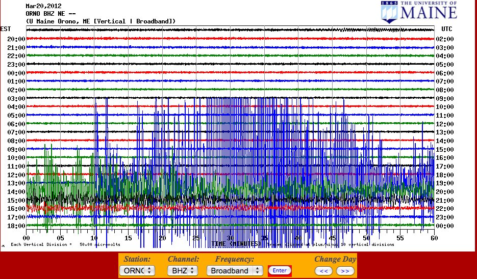 A Magnitude 7.4 Earthquake occurred on Tuesday, March 20, 2012 at 18:02:48 UTC time (2:02:48 Eastern Daylight time). The shaking was significant enough to be measured on the seismometer at the University of Maine. The quake occurred at a depth of 20 km (12.4 miles) at a depth of 20 km (12.4 miles). The epicenter was located 322 km (200 miles) south-southeast of Mexico City. The earthquake is a result of thrust faulting on or near the plate boundary between the Cocos and North American plates. The characteristics of the earthquake are thought to be consistent with subduction zone activity in the area. In the impacted area, the Cocos plate moves to the northeast at a rate of 60 mm/year (approx. 0.1 inch/year). Damage appears to be primarily structural, with no deaths and relatively few injuries reported.