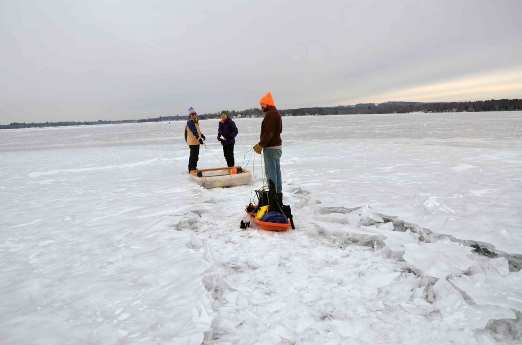
Participating Faculty: Mayewski, Campbell, Kreutz, Kurbatov, Maasch, Schild, Winski
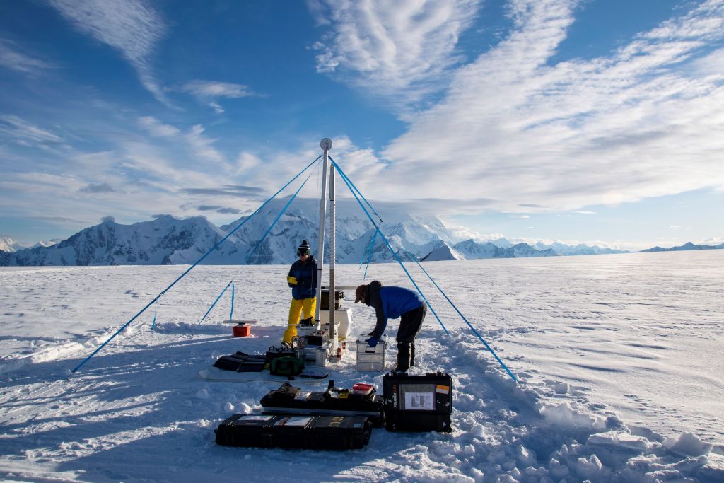
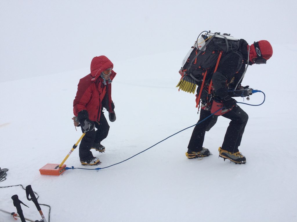
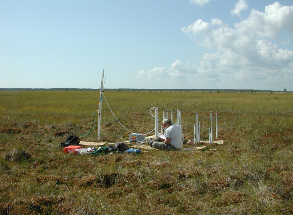
Description: The instrumental climate record extends back in time approximately 100 years in the Northern Hemisphere, and the record is shorter and sparser in the Southern Hemisphere. Understanding natural climate variability and assessing human impact on modern and past climate requires significantly longer records. Ice cores provide robust sub-annually resolved records of past temperature, precipitation, atmospheric circulation, sea ice extent, volcanism, biomass burning, dust, pollution, and trace/greenhouse gas concentrations. Our global array of ice cores includes records recovered from Antarctica, sub-Antarctic islands, Greenland, Alaska/Yukon, Iceland, Patagonia, New Zealand, and the Himalayas, Andes, and Tibetan Plateau, and we have plans to continue expanding our spatial, temporal, analytical, and modeling footprint. Overarching science questions that will continue to drive our research programs include: How have major climate forcings changed in space and time? What is the nature of climate-carbon cycle linkages? What are the dynamics, impacts, and implications of past abrupt climate changes? How do tropical-polar teleconnections affect the distribution of heat and moisture? How does Earth’s volcanism interact with the climate system?
Alignment with Cross-Cutting Themes and Growth Areas: Ice-ocean-atmosphere dynamics in a changing climate, chemical cycling across physical and temporal scales, Earth system modeling, Earth system data science, human-landscape-climate interactions, remote sensing
Participating Faculty: Cruz-Uribe, Allen, Gerbi, Hall, Kreutz, Kurbatov, Olsen, Putnam, Yates
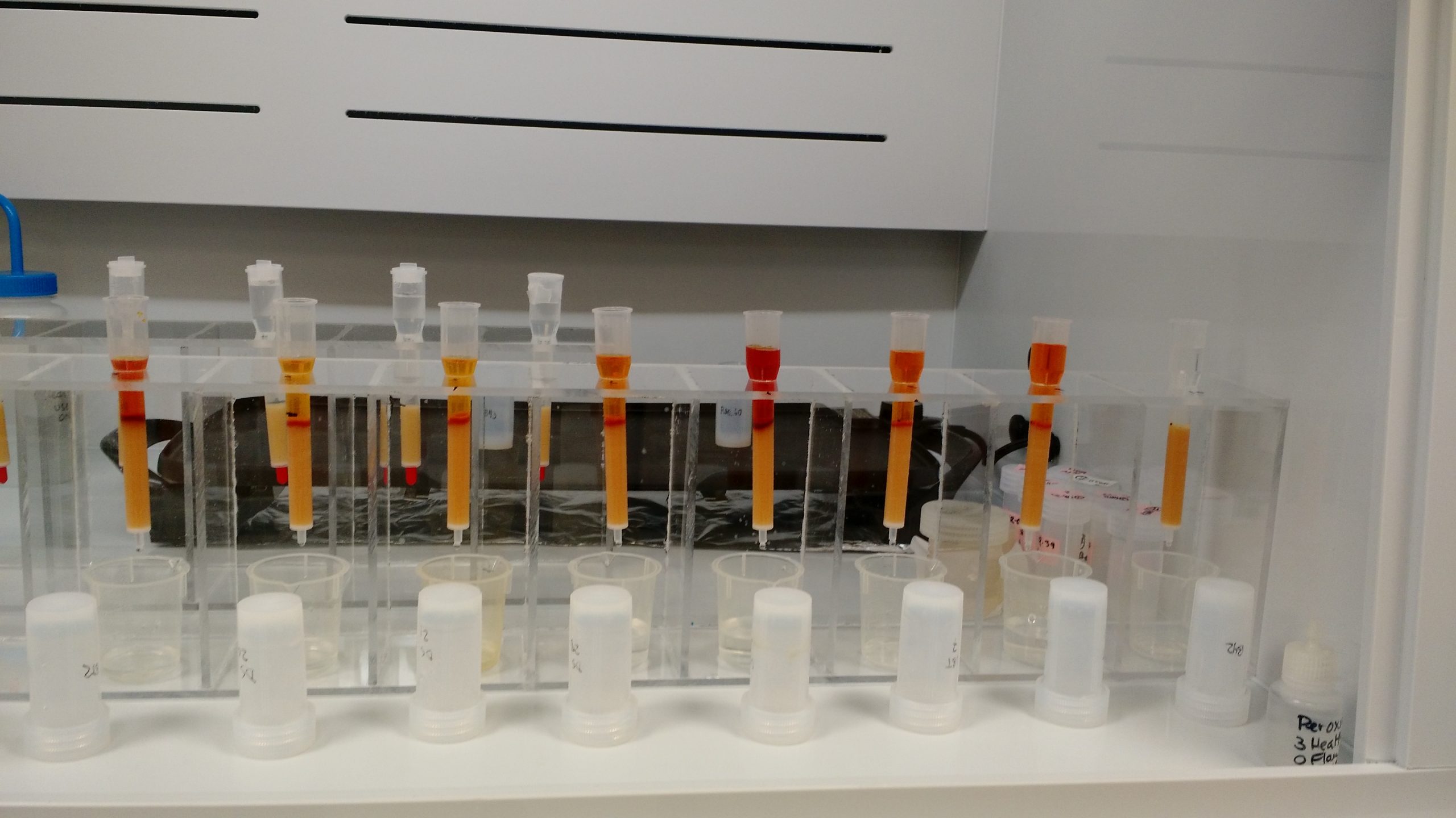
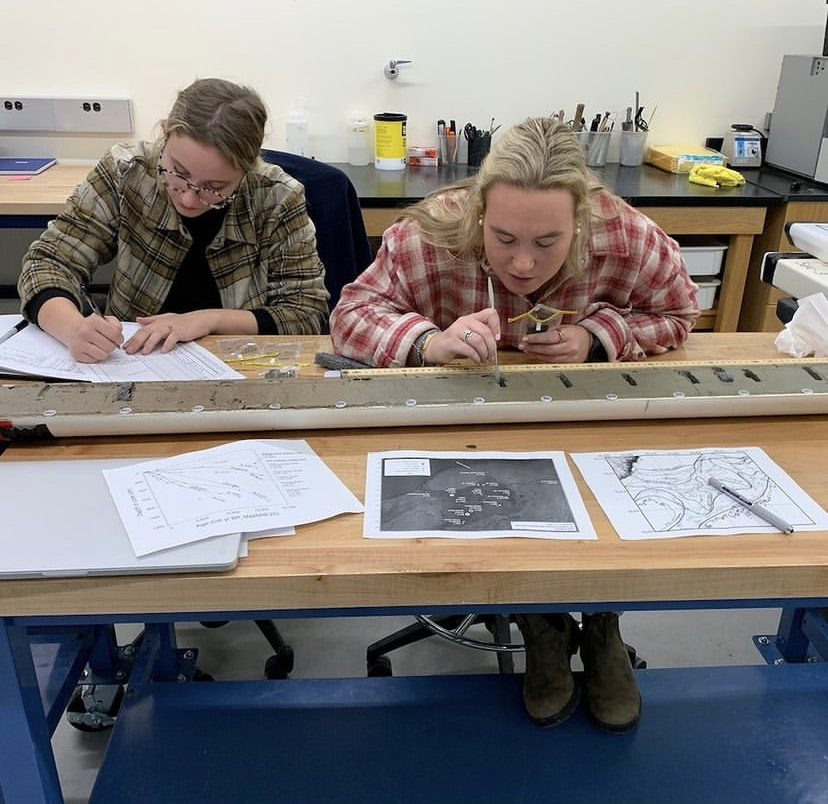
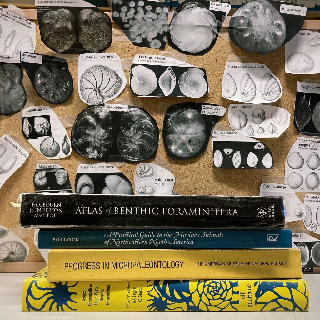
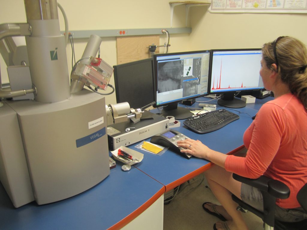
Description: The geochemical toolbox is a fundamental underpinning of many intersecting fields in Earth science. Our current analytical capabilities allow us to conduct research in the fields of solid Earth geochemistry (U/Pb geochronology, thermometry, trace element chemistry of rocks and minerals); environmental geochemistry (clay mineral chemistry, weathering profiles); marine geochemistry and paleoclimatology (fish otoliths, shark vertebrae, forams, ice); landscape evolution (cosmogenic dating); and stable isotope geochemistry (oxygen and hydrogen isotopes in water). Future developments in our analytical geochemistry facilities would expand our capabilities to undertake U/Th dating, high-precision isotope ratio analyses (i.e., Sr isotope ratios), and stable isotope measurements in a wider range of matrices (carbonate, bone, glass, mineral).Alignment with Cross-Cutting Themes and Growth Areas: Ice-ocean-atmosphere dynamics in a changing climate, chemical cycling across physical and temporal scales, water-Earth interactions: groundwater to landscapes, influence of (micro)structure on rock mechanics, Earth system data science, human-landscape-climate interactions
Participating Faculty: Hall, Denton, Doughty, Putnam
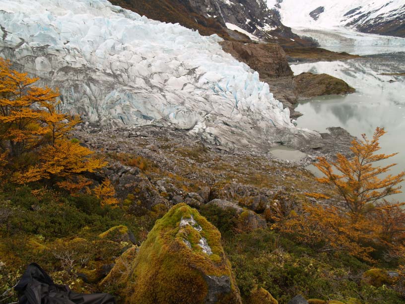
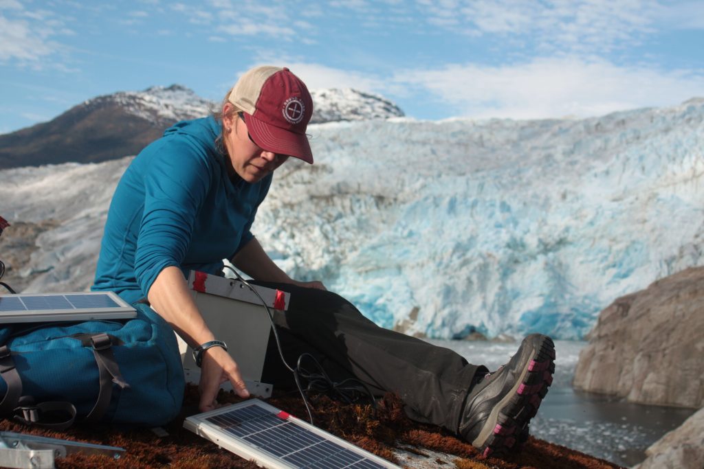
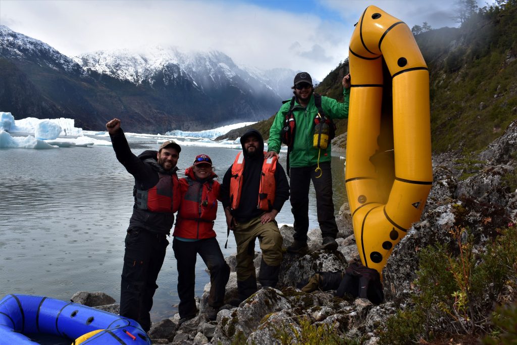
Description: Glaciers afford a robust proxy of summertime temperature variations, and records extracted from them can be used to assess climate change on a variety of timescales. We use glacial geomorphologic mapping in conjunction with detailed radiocarbon and exposure-age chronologies to assess the pattern, timing, and ultimately causes of climate variation. In addition, numerical modeling of glacier mass balance and ice flow is an excellent tool for reconstructing past glacier extents, thickness, and equilibrium-line altitude, all of which are sensitive to climate. Our work combines extensive field campaigns with detailed laboratory analyses and glaciological modeling. Research questions include: What caused ice ages? What is the pattern, timing, and origin of abrupt climate change? How stable is the Antarctic Ice Sheet? How much did the tropical lapse rate change during the last glacial maximum? How does topography influence glacier sensitivity to climate and subsequent moraine deposition? Which parts of a mountain range were ice-free and easily accessible by people 13,000 years ago?
Alignment with Cross-Cutting Themes and Growth Areas: Ice-ocean-atmosphere dynamics in a changing climate, Earth system modeling, human-landscape-climate interactions, remote sensing
Participating Faculty: Johnson, Gerbi, Koons, Cruz-Uribe, Yates, Coffin
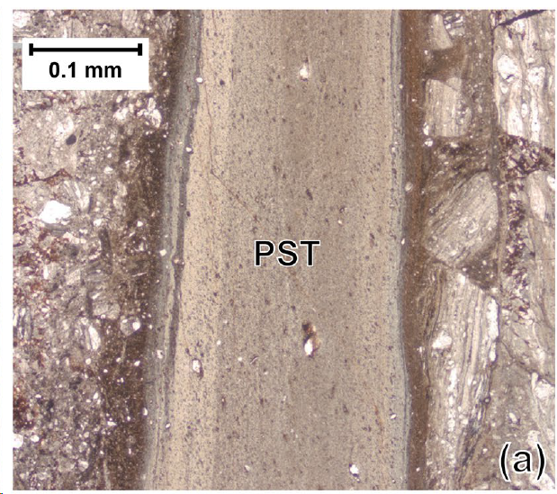
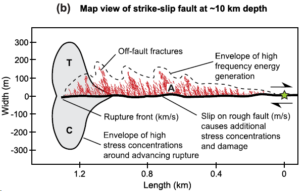
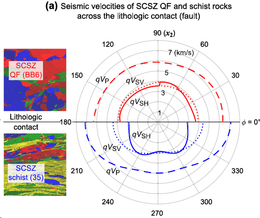
Description: Approximately 20,000 people are killed every year by earthquakes, making earthquakes one of the deadliest natural hazards on Earth and a central focus of geodynamical studies. Less than 20% of the total energy released during an earthquake radiates away from the fault as elastic waves that cause ground shaking. Thus, more than 80% of the total energy is converted in the fault and surrounding rocks to frictional heat and surface energy from fragmentation, among other energy sinks. Partitioning of the converted energy in the earthquake source volume is of first-order importance in earthquake mechanics, directly modulating patterns of slip and propagation, near-fault particle velocities, radiation efficiency, and earthquake intensity. The non-heat part of converted energy can be estimated from seismological observables, but heat energy is seismologically transparent. Thus, the open question of the relative roles of these different energy sinks is of fundamental importance for understanding rupture dynamics and the earthquake energy budget, with direct implications for seismic hazards. Geological studies play an essential role in evaluating the energy budget, providing direct estimates of both heat and surface energy, and we are at the forefront of this work. The combination of our modeling and field-based results has allowed improved characterization of seismically active faults, including conceptual and wave speed models that can be used to improve predictions of ground shaking directions and intensities. Currently we are investigating the lithospheric and seafloor structures that characterize the largest intra-oceanic earthquakes, with direct contributions to tsunami risk assessment. We work collaboratively with mechanical engineers at UMaine, and to date, our results have had many applications across the Earth and engineering communities, including the real-time simulation of microcrack growth, stress amplification arising from the elastic anisotropy of rock-forming minerals, interpretation of seismological data, and analyses of brittle damage and fragmentation of rocks, ceramics, and advanced composite materials.
Alignment with Cross-Cutting Themes and Growth Areas: Chemical cycling across physical and temporal scales, influence of (micro)structure on rock mechanics
Participating Faculty: Allen, A. Kelley, J. Kelley, Kreutz, Schild, Coffin
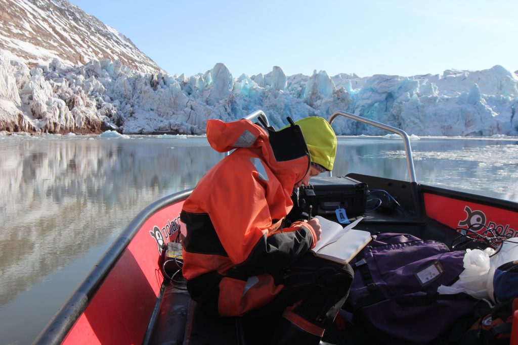
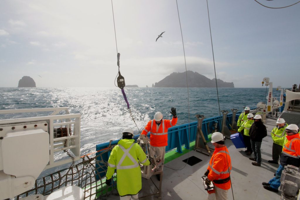
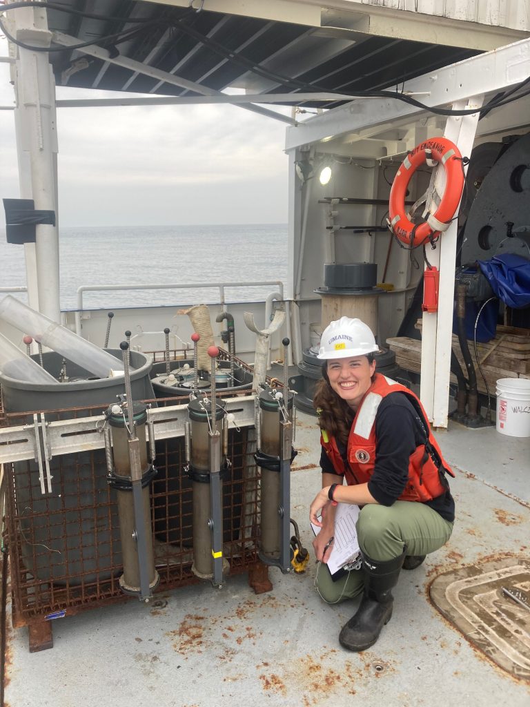
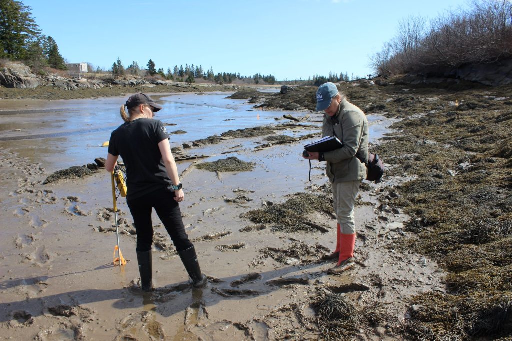
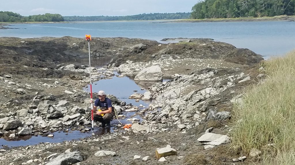
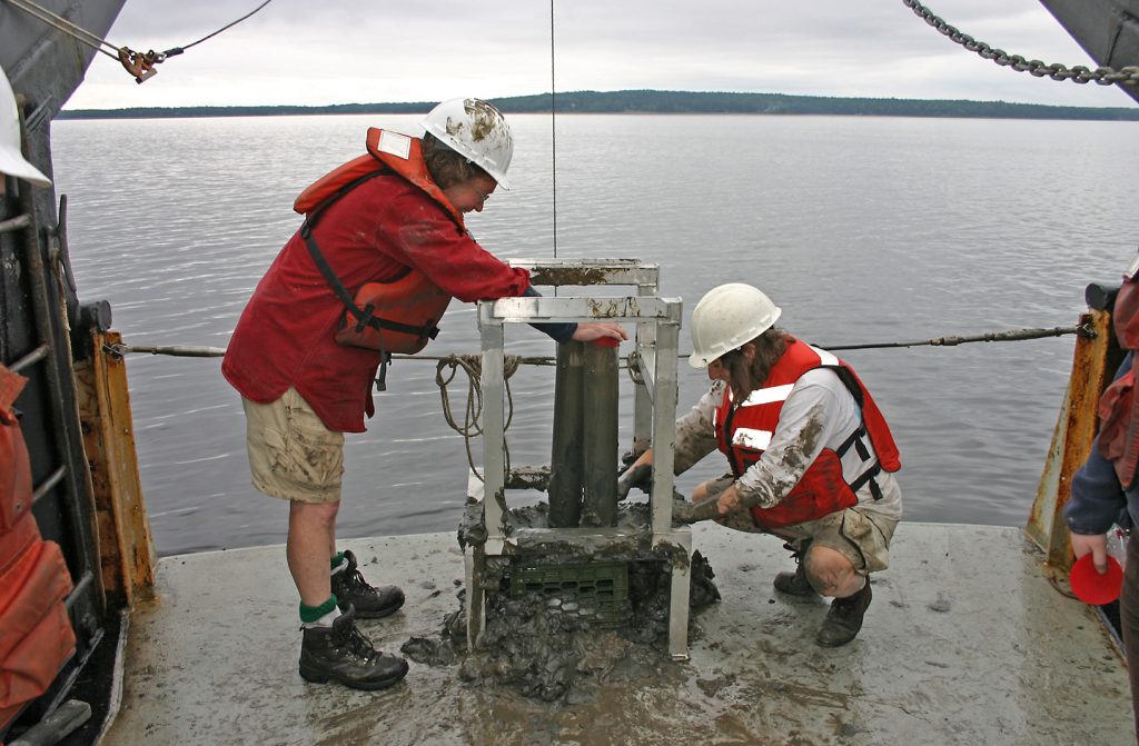
Description: The ocean covers more than 70% of Earth’s surface, and our group investigates the full extent of this marine environment, with study areas ranging from coastal zones to the abyss. During the last century, atmospheric CO2 has risen to the highest levels attained in 3 million years, driving changes in climate and sea level. With the recent explosion of human populations in coastal areas, there is an intensifying need to develop quantitative measurements and models for how coastal environments have changed in the past, are changing now, and will likely change in the future as the sea level rises and storms frequently alter the shore. Farther offshore, deep ocean basins preserve a detailed record of ocean and climate conditions that can span millions of years. Quantifying the magnitudes and rates of past changes provides key insight into how Earth’s climate system operates on long timescales that extend beyond human records. Current research regions include the coast of Maine, the Gulf of Maine, the Southwest Pacific, and the Southern Ocean. We apply an extensive toolkit of remote sensing geophysical equipment and geochemical techniques to probe these marine environments. Questions currently being addressed include: What is the relationship between large igneous province emplacement and oceanic anoxic events? Does hydrothermal activity associated with active hotspot volcanism nourish phytoplankton blooms in the Southern Ocean?
Alignment with Cross-Cutting Themes and Growth Areas: Ice-ocean-atmosphere dynamics in a changing climate, chemical cycling across physical and temporal scales, dynamic coastlines and estuaries, water-Earth interactions: groundwater to landscapes, Earth system modeling, human-landscape-climate interactions, remote sensing
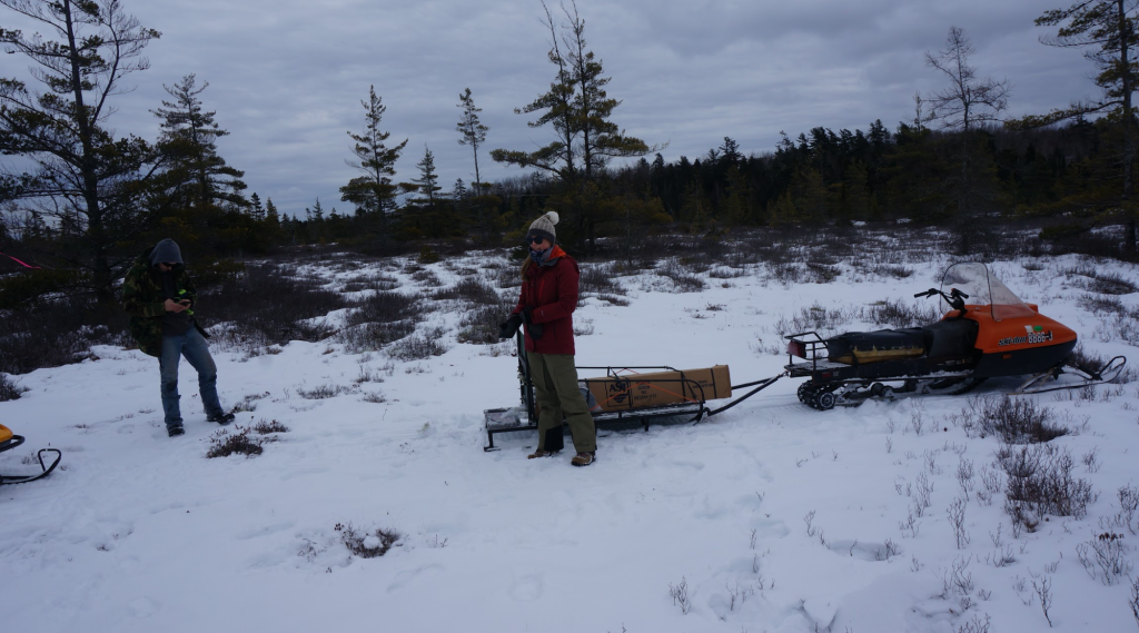
Participating Faculty: Campbell, Schild, Gerbi, Koons, Kreutz, Putnam
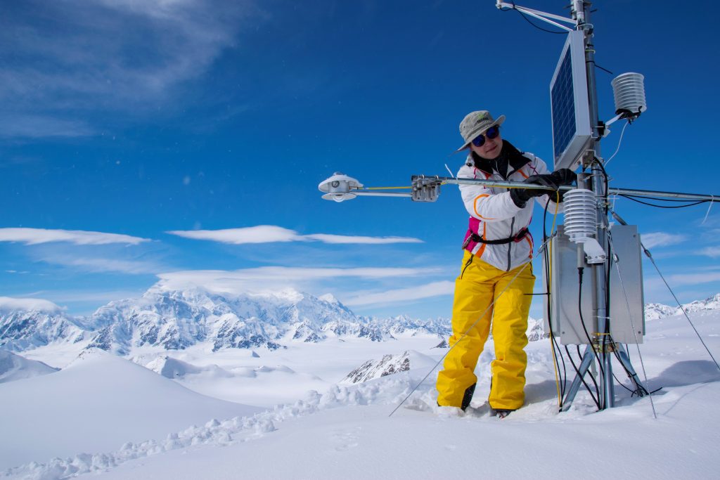
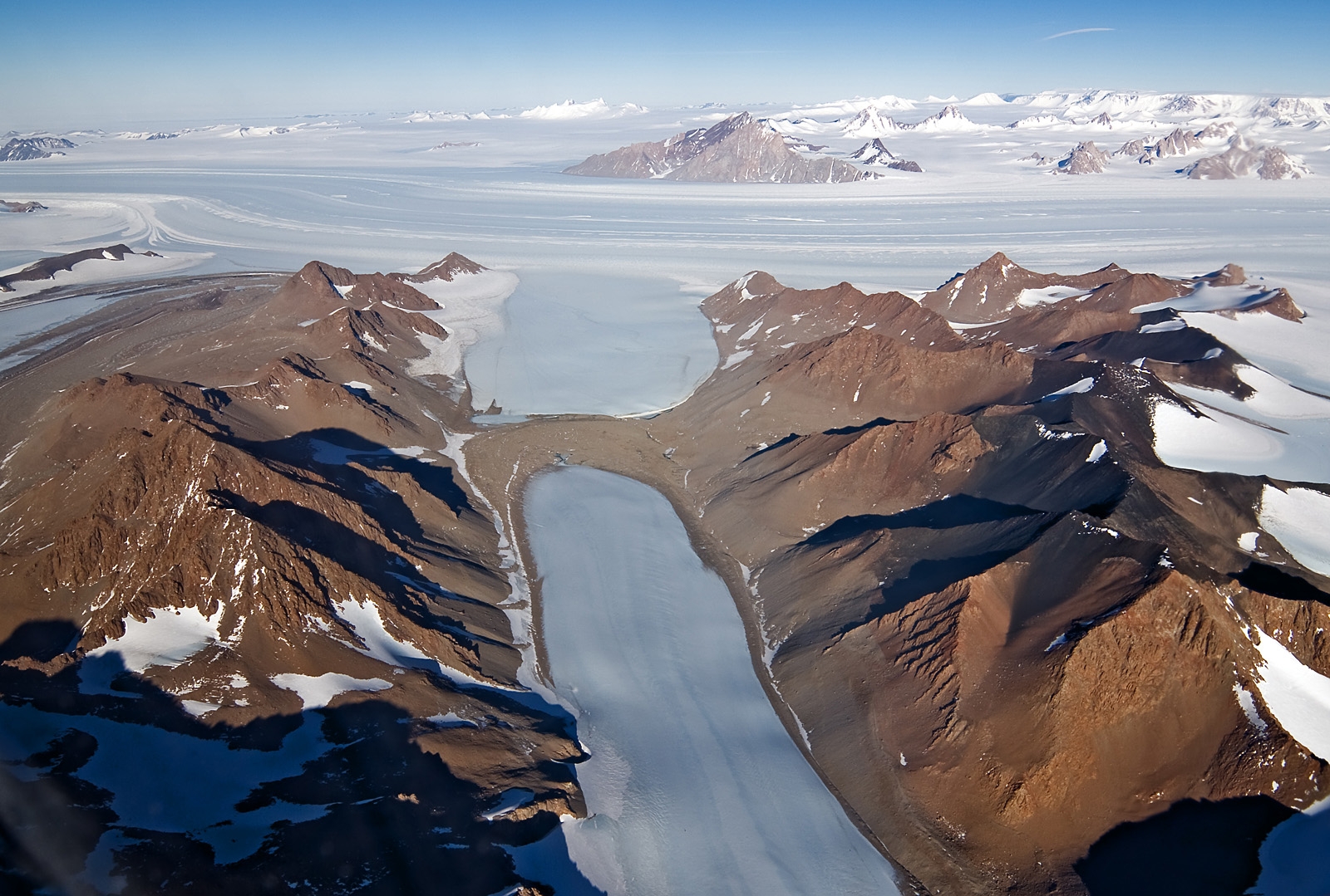
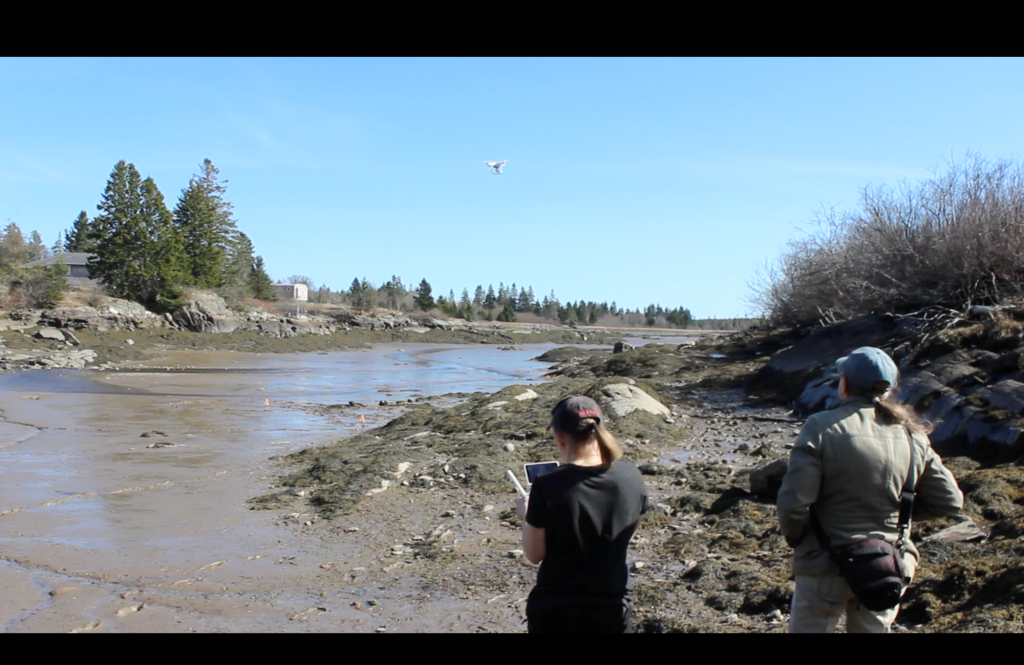
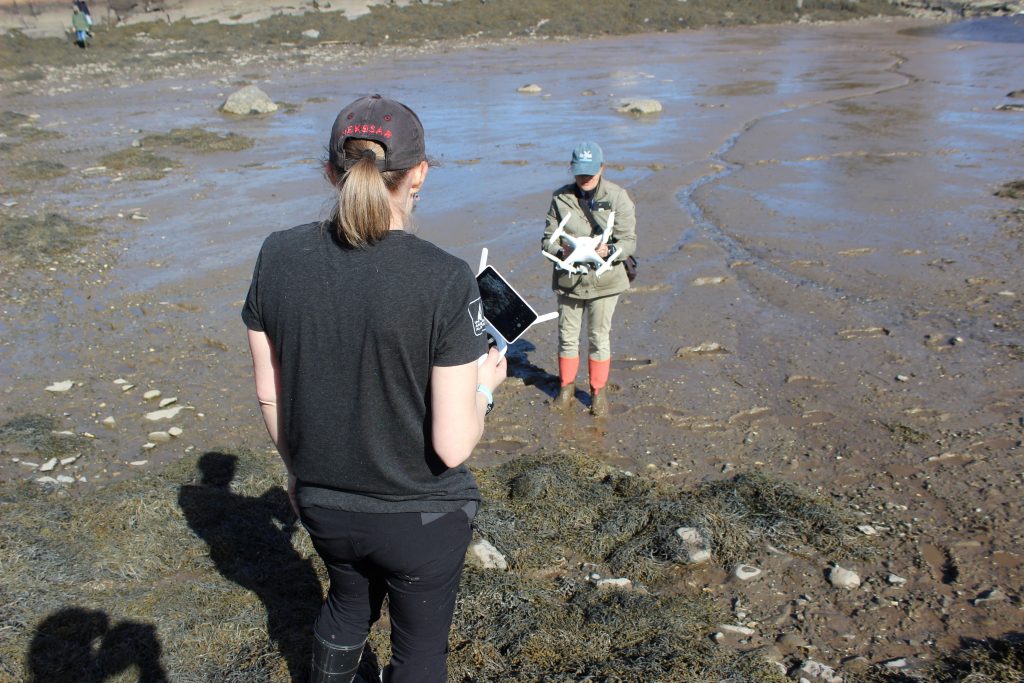
Description: Changes to polar and coastal environments across the planet have significant local impacts and global teleconnections. For example, coastal Maine waters are warming faster than nearly any place else on Earth. This is caused, in part, by increased meltwater from Greenland and other Arctic glaciers influencing ocean circulation patterns. Hence, understanding polar changes, including glacier mass balance, glacier dynamics, and/or permafrost and periglacial changes, and placing those changes into historical context through geomorphological and glacial geological evidence, is of local and global relevance. Remote sensing techniques (herein including ground-acquired geophysics and time-lapse camera imagery, as well as satellite and airborne remote sensing) represent critical tools and techniques required for scientists in the 21st century to quantify critical polar Earth systems changes and capture processes on relevant spatial and temporal scales. These tools and techniques also enable us to orient landscape change in the historical context using surficial or sub-surface clues. Lastly, this theme represents a “big data” component in Earth systems science: remote sensing data is likely to be incorporated into big-data analytics, artificial intelligence, machine or deep learning, and numerical modeling to address complex Earth systems questions. We currently focus on the following questions: How are glaciers and ice sheets changing now and how will they change in the future? How are permafrost and active layer thickness changing and how can we quantify permafrost extent and changes spatially across large and complex regions? How is the stability of coastal environments changing because of, among other variables, permafrost thaw, glacier retreat, increased fetch from sea ice retreat, and increased storminess?
Alignment with Cross-Cutting Themes and Growth Areas: Ice-ocean-atmosphere dynamics in a changing climate, human-landscape-climate interactions, water-Earth interactions: groundwater to landscapes, Earth system modeling, remote sensing
Participating Faculty: Olsen, Cruz-Uribe
Description: Water-rock interactions at planetary surfaces drive mineral transformations as secondary minerals form at pressure and temperature conditions that are different from the original conditions of rock formation. Because biological and climatic conditions drive the formation of these secondary minerals, new mineral assemblages provide a record of historic environmental conditions, allowing us to answer important questions about the geologic past. In addition, mineral dissolution rates can be incorporated into thermodynamic and kinetic models to predict the role of chemical weathering in climate, groundwater transport, and landscape evolution. Driving questions include: What are the dissolution rates of minerals that are important on Earth and other planetary surfaces? What conditions and processes govern reaction rates? What role does biology play in mineral weathering? Can we use existing data and models to predict ancient environmental conditions, particularly on Mars, that can be used in the search for extraterrestrial life?
Alignment with Cross-Cutting Themes and Growth Areas: Chemical cycling across physical and temporal scales, water-Earth interactions: groundwater to landscapes, human-landscape-climate interactions, remote sensing
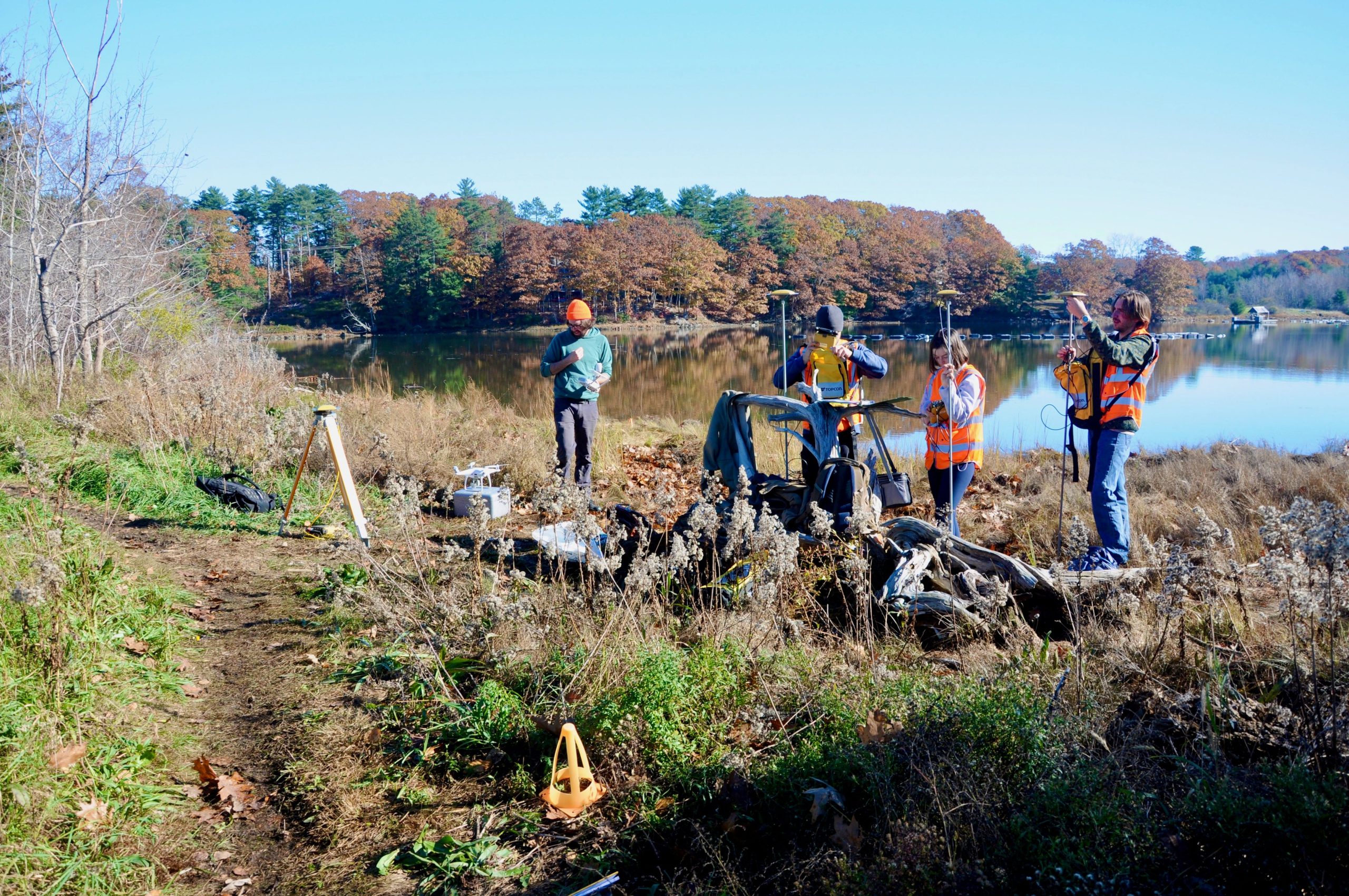
Participating Faculty: Smith, Allen, A. Kelley, J. Kelley, Kreutz, Reeve, Campbell
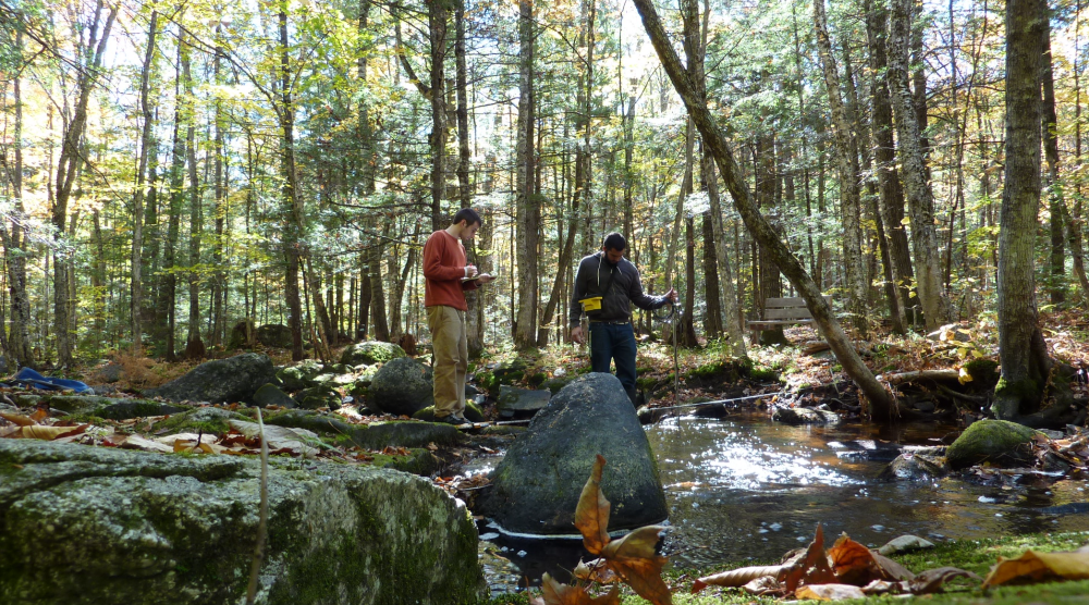
Description: Modern investigations of Earth surface processes and related applications in natural resource, public safety, water resource, and coastal area management involve extensive consideration of water and sediment movements in the landscape, groundwater, and surface water bodies, and in association with coastal bluffs, beaches, and estuaries. Measurements of sediment properties (e.g., grain size, density, structure, bulk density) generate information that has direct relevance to the quantification of landforms, past and present geomorphological processes, and the effects of human disturbances and climate change on the structure, dynamics, and condition of aquatic and terrestrial ecosystems in mountain, lacustrine, fluvial, coastal, and other intermediate settings in Maine and beyond. Example key questions include: What are the rates of movement of water, sediment, nutrients, and other constituents carried by water and sediment from land sources to sinks and coastal estuaries? What are the important components and relations to consider in modern watershed and coastal water and sediment budgets? How do those considerations relate to human driven landscape alterations, climate changes, ecological conditions, and society? Alignment with Cross-Cutting Themes and Growth Areas: Chemical cycling across physical and temporal scales, dynamics of coastlines and estuaries, water-Earth interactions: groundwater to landscapes, Earth system modeling, human-landscape-climate interactions
Participating Faculty: Schild, Campbell, A. Kelley
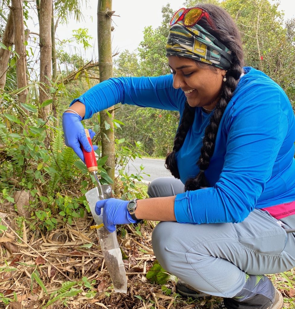
Description: Aerial-based imagery and ground penetrating radar techniques are increasingly part of archaeological surveys. Aerial imagery and data, largely acquired through structure-from-motion technology and LiDAR, can produce baseline images to monitor the condition of coastal archaeological sites and measure climate change-induced coastal erosion at several locations in Maine. Ground-penetrating radar can be applied to a broad range of geoarchaeological applications, including use as a prospecting tool, planning/focusing excavations, and characterizing archaeological site subsurface stratigraphy.
Alignment with Cross-Cutting Themes and Growth Areas: Ice-ocean-atmosphere dynamics in a changing climate, human-landscape-climate interactions, remote sensing

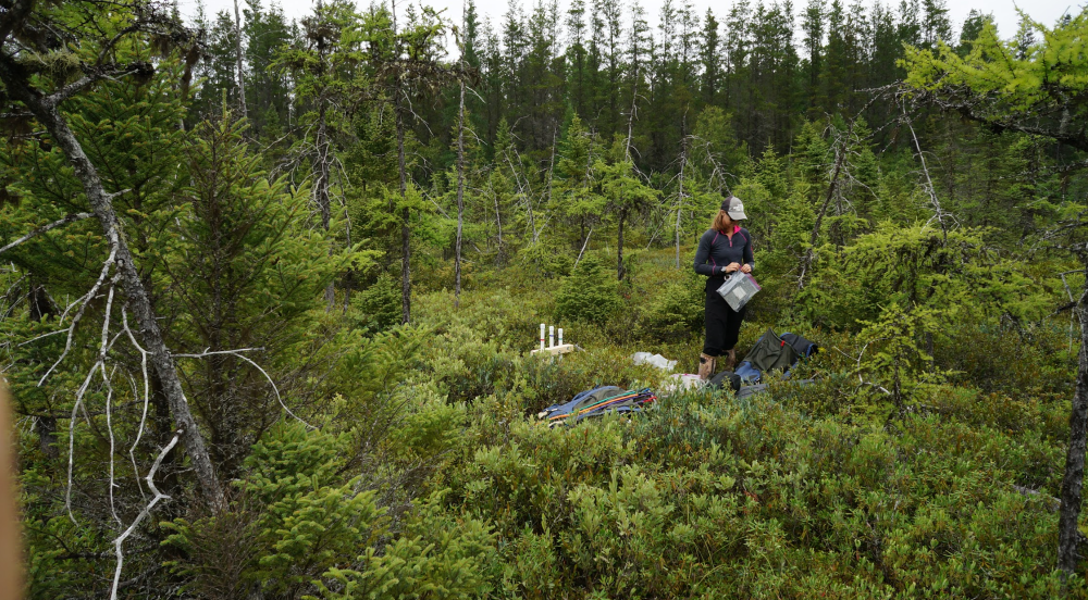
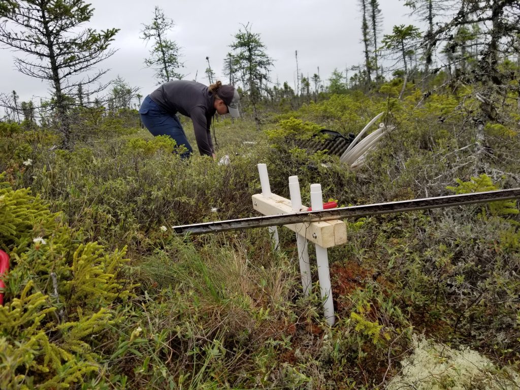
Participating Faculty: Reeve, Smith
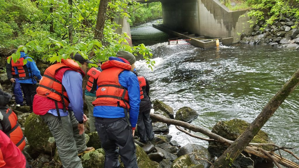
Description: Groundwater hydrology research focuses on the role of groundwater in sustaining ecosystems, the interaction between groundwater and surface water, the interplay between the hydrology of peatlands and carbon cycling, and characterizations of water resources to inform resource management decisions. A variety of computer modeling tools are used to test hypotheses, integrate sparse field data with GIS and remote sensing data, and create reasonable simulations of groundwater systems. Questions addressed through this research currently include: Where are groundwater-dependent ecosystems located and what locations are most valuable for protection of threatened species? How does groundwater flow influence methane production in deep peat? How can hydrology of peatland be manipulated to enhance CO2 sequestration? How will groundwater systems respond to changes in land-use and climate?
Alignment with Cross-Cutting Themes and Growth Areas: Water-Earth interactions: groundwater to landscapes, chemical cycling across physical and temporal scales, Earth system modeling; human-landscape-climate interactions
Participating Faculty: Olsen, Smith, Reeve
Description: The Critical Zone, defined as the area between the tree canopy and the base of groundwater, hosts Earth’s terrestrial life. Understanding interactions among water, rock, soil, plants, microbes, and animals is complicated and requires a multidisciplinary approach. However, this work is crucial to predicting how ecosystems will respond to future climate change and changes in land use, which affect soil fertility, water availability, nutrient cycling, and other ecosystem functions. Research questions focus on controls on processes occurring in the Critical Zone, how Earth materials interact with biota in ecosystems, and how the Critical Zone will respond to changes in climate and land use in the coming decades and centuries.
Alignment with Cross-Cutting Themes and Growth Areas: Chemical cycling across physical and temporal scales, water-Earth interactions: groundwater to landscapes, human-landscape-climate interactions, remote sensing
Participating Faculty: Johnson, Gerbi, Koons, Cruz-Uribe, Yates, Coffin
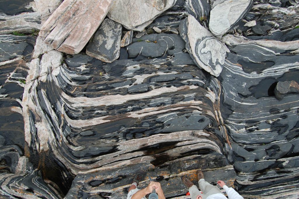
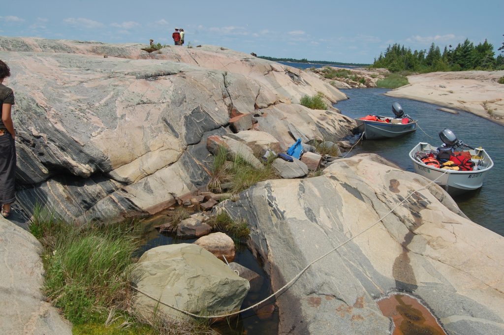
Description: Macroscale (geodynamic) events derive from microscale properties (rheology). Processes that operate at these small scales (microns to meters) influence larger km- to planet-scale kinetics, kinematics, dynamics, and transport. Thus, rheology fundamentally underpins our interpretations of tectonic/geodynamic history and Earth’s chemical-physical systems. Although we know the general factors that influence the coupled mechanical and chemical properties of rocks, we do not have adequate tools to predict how those properties interact and change over time. This knowledge gap severely hampers our ability to accurately describe the dynamic chemical and kinematic behavior of the lithosphere, including temporal and spatial patterns of fluid flow, reaction progress, and stress build-up on faults. Among the many unanswered first-order questions, our group is considering: What physical and chemical parameters drive rheologic change? Can a thermodynamics approach provide a more unified description of coupled reaction/deformation? How do we best parameterize microscale processes in macroscale geodynamic models? How do oceanic plateaus – an arguably simpler case than continents – rift, breakup, and separate? Field-based marine geoscientific observations are directly contributing to societal imperatives by providing evidence for Extended Continental Shelf submissions under the United Nations Convention on the Law of the Sea, and by contributing to the search for missing Malaysia Airlines flight MH370 in the Indian Ocean.
Alignment with Cross-Cutting Themes and Growth Areas: Chemical cycling across physical and temporal scales, influence of (micro)structure on rock mechanics