UMaine advances drone technology to aid forest management
Understanding a forest is difficult. This is especially true in Maine which is home to both ecologically and commercially unique forests. Decision makers rely on an array of resources, from foresters and scientists doing critical field work to drones and satellites flying overhead, to gather information. Innovations in unmanned aerial vehicles, or UAVs, may change what and how forest data is gathered. Guided by artificial intelligence, new drone technology is being developed to fly under the tree canopy to capture data.
Researchers at the University of Maine are advancing UAV technology as part of the NSF E-RISE Maine-FOREST project. UMaine Assistant Professor of Engineering Vikas Dhiman and Electrical Engineering Ph.D. student Arman Kiani are at the forefront of this effort.
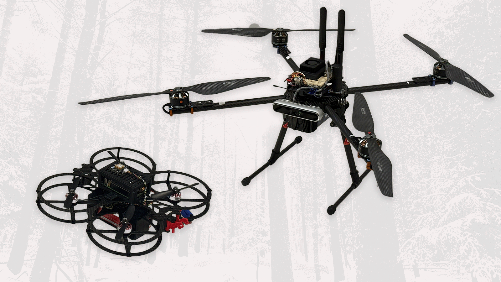
The team assembled custom-ordered drones that encompass a small computer that the AI runs on. Kiani works on the building and programming process, enabling the drones to observe and react to their environments. Guided by Dhiman, Kiani also debugs technical issues so the drones can successfully get off the ground. Once the drones are assembled, they have to learn how to navigate the unpredictable environment under the tree canopy.

“We have to detect obstacles as small as thin branches and involve them in the robot model so the drone learns to fly in paths without any obstacles,” said Dhiman. While UAVs are not new to forestry, Dhiman and Kiani are creating drones that address the technical and geographical challenges commonly experienced when measuring forests. Drones have traditionally been utilized for routine scans of a forest to observe forest composition by flying over the tree canopy. This method does not provide information like trunk width which is important for the timber industry.
“Instead, we aim to fly the drones below the tree canopy which is challenging because the drone needs to plan a path around shrubs and thin branches. To accomplish obstacle avoidance, we plan to use AI for detecting trees and placing them in a 3D model around which the drone plans its path,” said Dhiman.
Once these challenges are addressed, Dhiman and Kiani will be able to collect a wide variety of data that has traditionally been challenging and time-consuming to collect. By combining data from under the tree canopy with previously collected data from above the canopy, researchers can see a complete view of the forest.
“The aim is to get a unified picture of a forest, like measuring tree trunk width, the presence of different species and any diseases. We’re trying to get as much forest health data as we can,” said Dhiman.
While this research is still in the preliminary stages, Dhiman and Kiani are hopeful that these advances in UAV technology will allow for a more streamlined process in capturing forest data. Beyond the forest sector, Dhiman believes that AI-guided UAVs can be applied to many other scenarios.
“For example, emergency responders could utilize drones when it’s unsafe for them to go inside a building, like in the case of a fire or earthquake. With algorithms for obstacle avoidance and multi-drone collaboration, the research we are doing is fundamental in terms of drone navigation and exploration autonomously with as little human input as possible,” said Dhiman.
This research was made possible through funding from the NSF EPSCoR RII E-CORE Maine-FOREST award.
Story by Heather Johnson, Graduate Assistant