Project Information
Citizen Science Model Validation
The Collector for ArcGIS Application is a way for citizen scientists to assist professional scientists with validation of complex models.
Professional scientists regularly develop models to predict the geographic locations of a phenomenon of interest. A vital step in the modeling process is ground-truthing. This process involves surveying areas the model covers to determine how accurate the model predictions are at those locations. This step is cost and labor intensive, and often must be done far away from where the scientists who developed the model work.
With Collector for ArcGIS, scientists can make their not yet validated model output available alongside a survey of questions about the modelled subject. Citizen scientists who use the App can create geotagged responses to the survey, which provides the original scientist vital information about the predictive accuracy of their models.
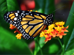
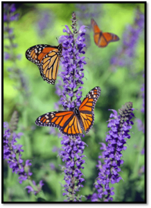
Monarch Butterfly Roost-Sites

The monarch butterfly conducts one of the most dramatic migrations in the world. Every fall, the great-great-grandchildren of butterflies who came north from Mexico in the spring will turn south and begin a 3,000 mile journey to their overwintering grounds.
Unfortunately, this migration is at risk. The numbers completing the migration have fallen by 90% in the past two decades. In an attempt to curb this decline, scientists across North America are working to learn more about the monarch and its behavior.
While migrating in the fall, monarchs rest at night, often congregating in groups several hundred or thousand strong. The criteria which determine where monarchs form these overnight roost sites are not well understood.
Researchers at the University of Maine have recently completed a model that seeks to determine where these roosts occur and the factors common among roost sites. Due to the large area this model covers, it is not feasible for the researchers to ground-truth it themselves. Instead, they have released their results in the Collector App and are seeking help from people like you.
Modeling Process

The model being validated in this process was developed using MaxENT (Short for Maximum Entropy), a statistical software package that seeks non-random correlations between environmental variables and known sightings of a species.
The known sightings for monarch roost sites were gathered from citizen scientist reports to Butterflies and Moths of North America, Mission Monarch, eButterfly, Biodiversity Index Serving our Nation, Global Biodiversity Information Facility, and iNaturalist. A total of 15 environmental variables were included in the initial model, broken into the four basic categories of topography, weather, vegetation, and humans.
With the information provided to it, MaxENT generated a map of the study area, with each pixel on the map representing a probability that a monarch roost-site would be found within the geographic bounds represented by that pixel. This map is what we are seeking to validate.
How You Can Help
- Download the Collector for ArcGis Application from your Smartphone’s App Store
- Read and Accept the Terms of Use
- Open the Monarch Roost Site Map
- Navigate to One of the Designated Points of Interest, or Create a New One Anywhere You Choose
- Fill Out and Submit the Short Survey About the Location You Have Chosen
Congratulations! You have helped to further scientific knowledge about the monarch butterfly, and contributed to the conservation of this beautiful species.
Submit as many surveys as you like; every piece of information is useful!