The Language of Maps: The biography of the species adaptation process under climate change and its effects on cultural evolution
By Stefania Irene Marthakis
![]()
“I have long, indeed for years, played with the idea of setting out the sphere of life — bios — graphically on a map,” philosopher Walter Benjamin once wrote. Maps have a long history of helping humans explain and navigate their world.
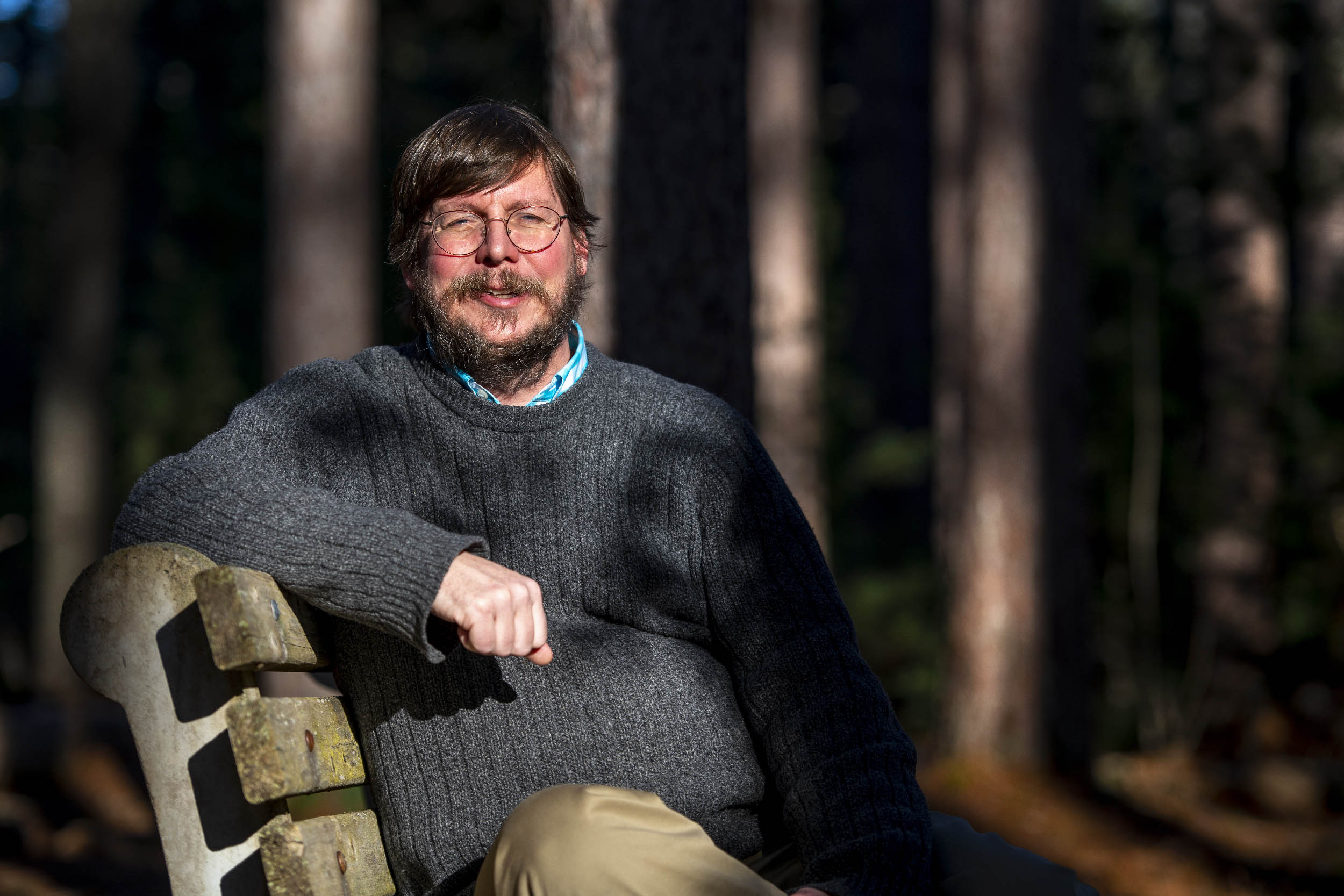
Brian McGill, Professor of Ecological Modeling, School of Biology and Ecology holds a joint appointment at the Sen. George J. Mitchell Center for Sustainability Solutions at the University of Maine. Building some of the first mechanistic models of shifts in species ranges in response to climate change, McGill leads the Barracuda project, which officially began in September of 2020.
Biodiversity and Rural Response to Climate Change Using Data Analysis (Barracuda) is made possible through a four-year, $4 million (RII Track-2 FEC) grant from the National Science Foundation (NSF). Brian McGill, whose career passion has been to combine environmental data and Big Data (large, complex, fast-growing data that cannot be efficiently stored or processed by traditional methods), is hoping to answer critical environmental conservation and global change questions.
How will several hundred species of animals, plants, crops, and zoonotic diseases get from where they are today to where they need to be in a new climate? And what are the implications for farmers and rural communities, whose livelihoods depend on these natural resources? For 14 glacial cycles (a time period marked by the growth of large, continental ice sheets), species have successfully tracked climate, but here is the rub: Today’s landscape is vastly more challenging, with an abundance of movement barriers due to human development and human land use (e.g., parking lots, suburban lawns). This is the single biggest issue for natural systems adapting to climate change.
As an ecologist, McGill knows that some degree of climate change is inevitable. Increasingly, a lot of academics are transitioning to studying how the world adapts rather than solely focusing on prevention. McGill is working with his longtime collaborator, Nicholas Gotelli (Co-PI) from the University of Vermont, to form an interdisciplinary team with the University of Maine, University of Vermont, University of Maine at Augusta, and Champlain College (Co-PIs: Timothy Waring (UM), Meredith Niles (UVM), and Matthew Dube (UMA), as well as Laurent Hébert-Dufresne (UVM), Kati Corlew (UMA), and Narine Hall (Champlain)).
Barracuda (which focuses on Maine and Vermont but may be applicable to the rest of the country) aims to understand the climate change adaptation process, while maximizing that adaptive capacity and unleashing it. Although preventing climate change has felt remote and is largely the responsibility of the federal government, adapting to climate change will require actions at the level of local policymakers and even individual farmers.
Barracuda will study, understand, and implement several novel approaches to advance environmental conservation, thus creating the first eastern-U.S.-wide analysis of several hundred species.
So far, most studies of ecological adaptation to climate change have used a correlation approach, which uses a species distribution model to predict 100 to 200 years into the future. In other words, when researchers find a species in this climate today, they identify these are aspects of the climate that are important and assume that these species will be in the same climate in the future. Scientists have gotten very good at doing this. “The harder problem is when we look at the transitions, which is what we’re trying to do on this project,” McGill stated.
“When you want to predict where something is going to live 10 years from now, you still need to know where it is going to grow well based on the climate at that time, but it’s got all these additional challenges of trying to get from here to there. It’s got to disperse to that new location, it’s got to establish a new population, and reach reproductive age. We’re trying to model all these things,” McGill explained. “I think we’re learning that it’s a lot harder to predict 10 or 20 years into the future than it is to predict 100 or 200 years into the future. To predict 10 or 20 years into the future, you must take all the details into account about on how it gets there, how it grows up, and when it grows up.”
Bailey McLaughlin, a UMaine Ph.D. student working on Barracuda, grew up on Long Island — where her dad is a part-time shell fisherman — exploring the different corners of the marine environment. Over the years, McLaughlin has seen that system change when she goes back home. “I got hooked on using science as a tool to understand the environment, which was interesting to me from the ecology side but also because the traditions of my family were tied to that landscape,” McLaughlin said.
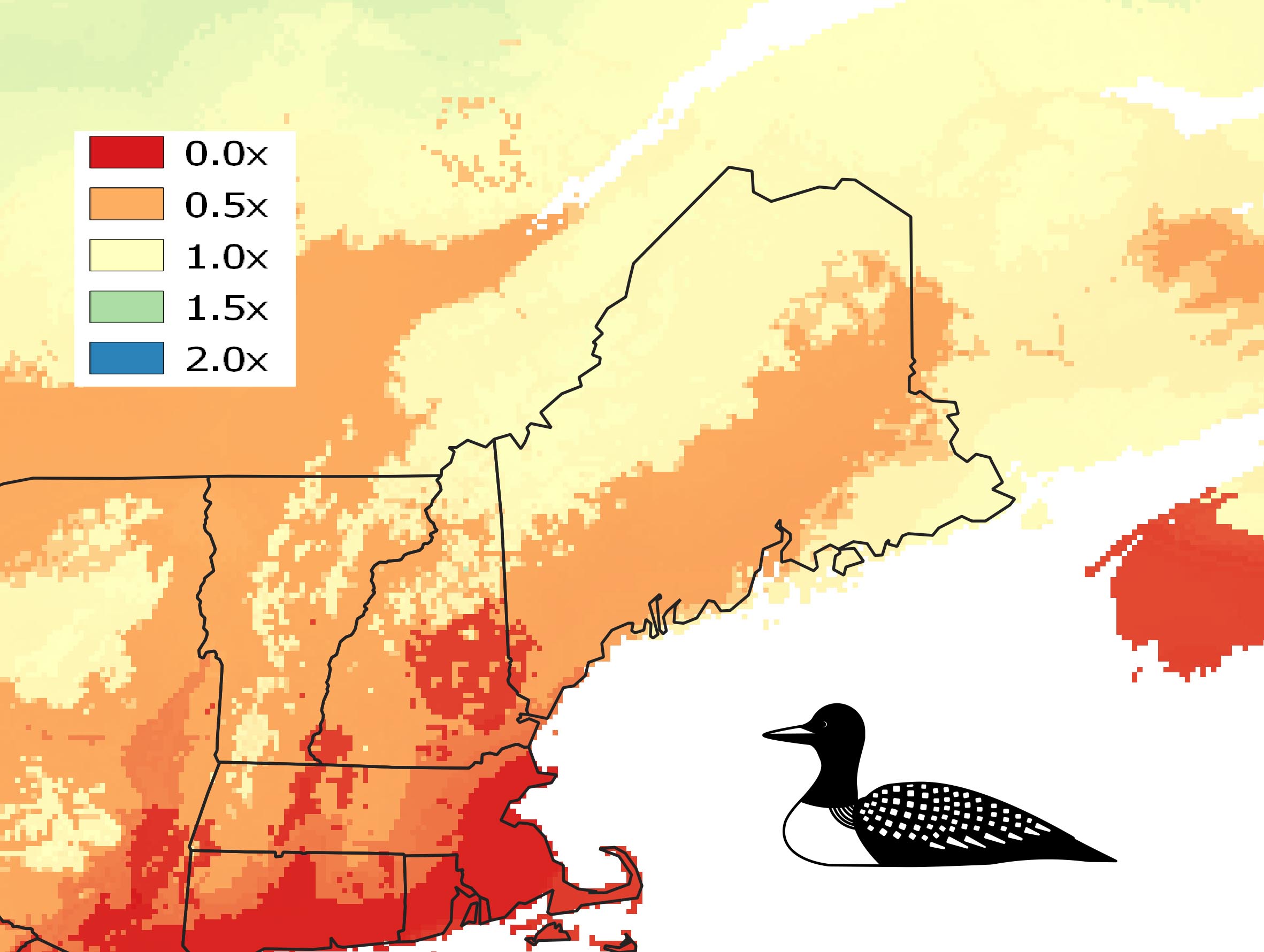
Now working within terrestrial ecosystems, McLaughlin is helping to aggregate data for target organisms (e.g., trees, birds, agricultural crops) as well as climate and data layers that will be used to help create these short-term forecasts. “We need occurrence data, but we also need additional information for the mechanistic model, so we’re also getting more species-specific data about life history, like population and age-to-maturity data, to understand more so how these specific species might respond,” McLaughlin explained. Upon completion, these models of species ranges will become a series of maps through time estimating where a species may be living 5, 10, 15, 20 years from now, or where species can and cannot become established.
Barracuda also aims to understand the cultural evolutionary process of adaptation — another new area of study — particularly for rural communities. For example, if one farmer does something a little different to respond to climate change, and it works, that behavior may spread throughout the community. Barracuda will develop national scale maps detailing which peoples and parts of the country are more likely and less likely to adapt to climate change. This mapping technique is novel, and will help policymakers locate areas that might have resilience to climate change.
Barracuda views socioeconomic and ecological climate adaptation through a spatiotemporal data science lens. This viewpoint is aided by a computer science team that is developing new spatiotemporal data tools and creating tools that are easier for ecologists and social scientists to use. McGill commented, “The conversation about climate change adaptation is really different than it was 10 years ago. The number of people noticing the concrete impact of climate change on their lives has grown in the past couple of years, especially those who work outdoors for their livelihood (e.g., farming, hunting, conservation, tourism).”
Barracuda also seeks to understand what is going to be the most useful way to communicate these projections within the real arena. Barracuda hypothesizes that this next-level-of-modeling — predicting the movement of organisms, mapping them, and making them available — will be useful to individual farms as well as county or state-level policymakers.
“In my experience,” McGill explained, “maps are just this great language. You have a meeting, you’re talking, and maybe you’re talking different languages or talking past each other, and then you put up a map and it just makes things concrete and tangible. I think the human brain is wired to think about maps, and that we all have this innate ability to navigate maps. I think maps are — the technical term is a boundary-spanning object — an object that goes across groups, and transmits information and makes connections across groups. I think maps are a key communication tool for complex data, which is part of why we have a strong spatial emphasis throughout the whole project.”
Barracuda’s Workforce Development component focuses on spatiotemporal data and data science. Data science is currently one of the most rapidly growing careers. A special emphasis is on the spatiotemporal aspects of data — it’s not just what happened but where and when it happened. Barracuda is making training in spatiotemporal data science a key focus, from high school-level to graduate students as well as training faculty who can train others.
“This goes back to how the grant started with a focus on training in data science. There’s a huge demand, but the supply of data science workers must come from universities doing training, but it’s a relatively new field, so we’re still developing capacity to do that training. EPSCoR grants are designed to improve the research capacity of the universities they fund as well as the teaching capacity. We’re excited to expand our ability to train more people in the workforce to use data science tools,” McGill said. “Increasingly interdisciplinary research and data science are really critical pieces to climate change adaptation, and also to solving all of society’s big problems.”