Streams
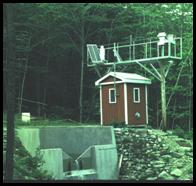
 The site lies on the upper 210 m of the southeast slope of Lead Mountain (475 m), a regional monadnock. Two first order streams, East and West Bear Brooks, drain two contiguous watersheds of 11.0 and 10.3 ha, respectively – forming the paired watershed complex. The average slope from the top of the watershed to the weirs is 31%. Both watersheds have concave profiles. West Bear has a shallow bowl developed at mid-elevation which serves as a discharge area; this bowl is commonly the site of first appearance of surface water. East Bear has a level area at about 2/3 of maximum elevation that is a discharge area. Drainage from this area passes over a bedrock lip before incising in thicker till over the mid-elevation reach.
Descriptive information and real-time data from various surface- and ground-water sites in Maine
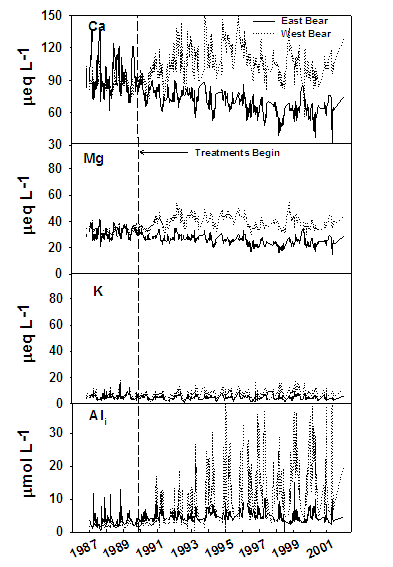
Anion and Cation Dynamics in East (control) and West (experimental) Bear Brooks
Before and After ongoing treatment of experimental watershed
 |
 |
