11. Geography Lesson 2
Description:

Have students…
A) Look at the map of Maine and identify the lines marking 42, 44, 45, and 46 degrees of latitude.
Decide which degree line you will use when answering the question “How many Canadians live in Canada south of Maine?”. To do this, you will need to pick a point in Maine. You might pick a place you have visited in Maine, or where Maine meets New Hampshire (which is about 43 degrees.)
B) Look at the Ontario map, locate the degree lines, and identify the towns in Ontario which are south of the degree line you chose to use.
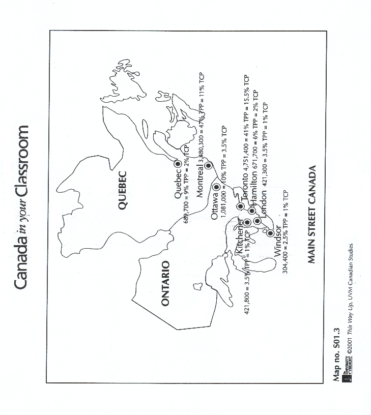
C) Use the population data from the Main Street Canada map and add up populations in the towns south of the degree line. Then make a ratio: population of towns south of Maine over the total population of Canada. Solve the ratio for per cent.
D) Look at the map Total Canadian Population by Province/Territory and identify the most densely populated areas.
Materials:
- Book: The Nystrom Desk Atlas: Canadian Edition
Maps:
- Main Street Canada
- Total Canadian Population by Province/Territory
- Map of Maine
- Ontario Road Map
Sources:
- Ontario Map – order from these web sites: Provincial Tourism Bureaus
- Main Street Canada
- Total Canadian Population by Province/Territory
- Interactive map of Canadian population
- Map of Maine
The Nystrom Desk Atlas: Canadian Edition. Chicago, IL: Nystrom, 2001. ISBN: 0782505872