| Chapter 1: Creating an English Atlantic, 1480-1630 |
|
|
| Figure 1.2 English Cloth Industry and Overseas Trade in the Early Sixteenth Century |
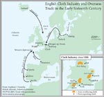
High Res Image – jpeg |
|
| Figure 1.3 English Overseas Trade in the Late Sixteenth Century
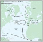
High Res Image – jpeg |
Figure 1.6
English Exploration and Settlement in North America and the Caribbean in the Early Seventeenth Century |
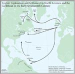
High Res Image – jpeg |
|
top of page |
| Chapter 2: Atlantic Staple Regions: Newfoundland, the West Indies and Hudson Bay |
|
|
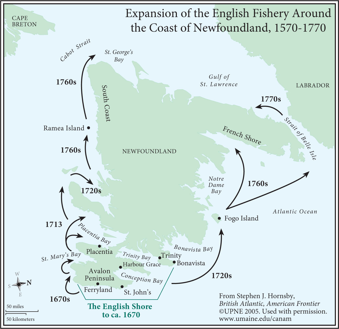
Figure 2.2
Expansion of the English Fishery Around the Coast of Newfoundland, 1570-1770 |
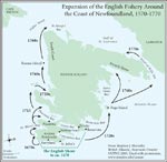
High Res Image – jpeg |
|
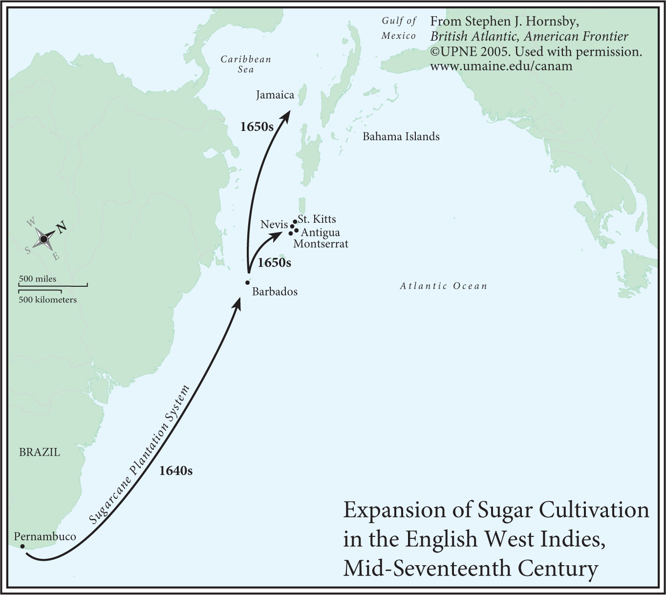
Figure 2.9
Expansion of Sugar Cultivation in the English West Indies, Mid-Seventeenth Century |
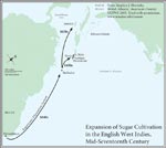
High Res Image – jpeg |
|
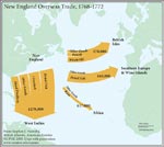
Figure 2.12
Slave Shipments from West Africa to the Caribbean and North America, 1651-1775 |
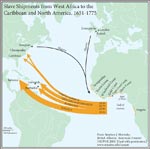
High Res Image – jpeg |
|
|
|
|
| top of page |
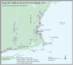
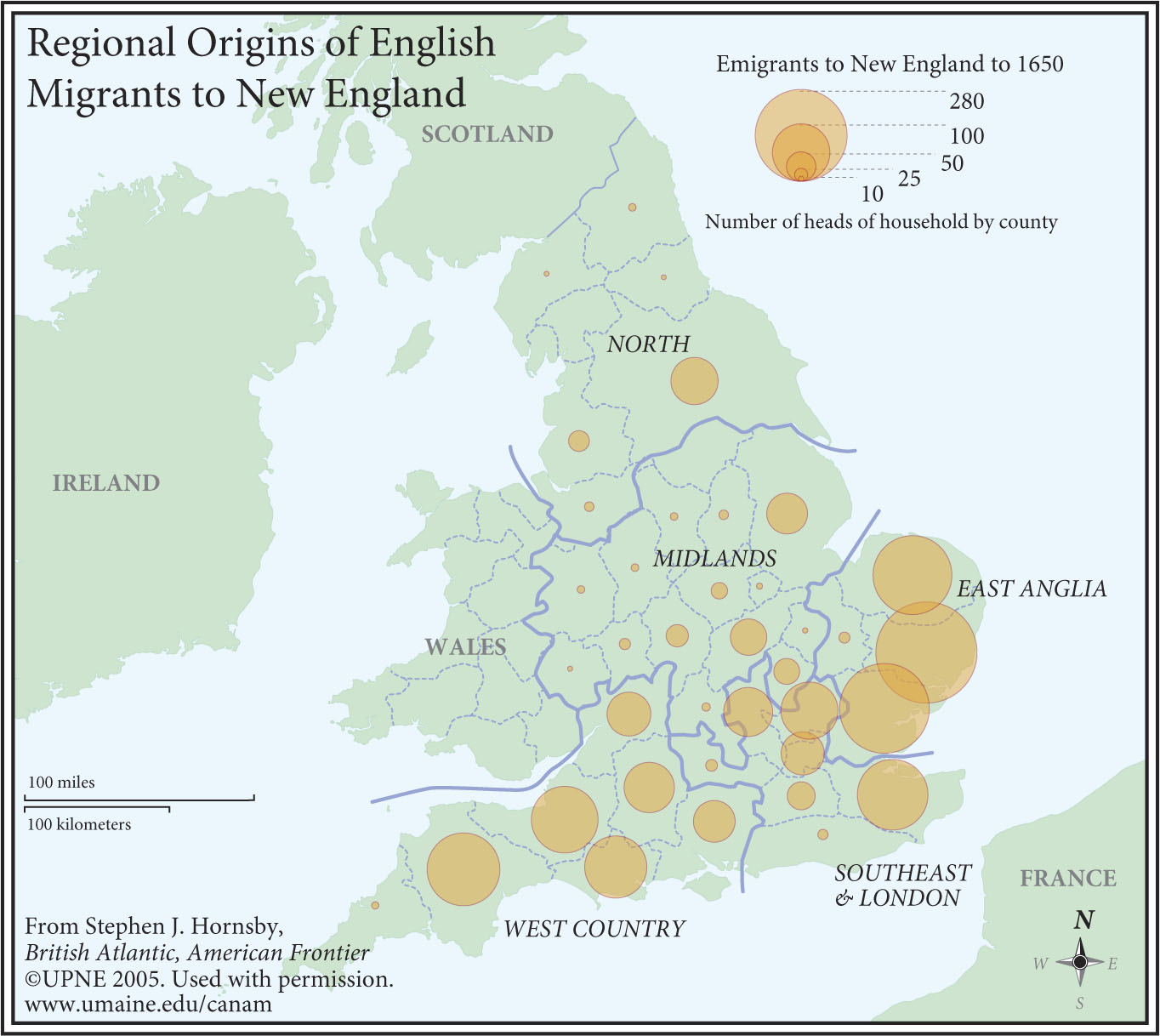
Chapter 3: Continental Staple Regions: New England, the Chesepeake,
and South Carolina |
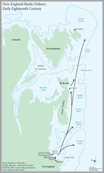
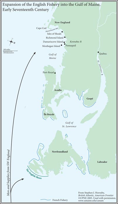
Figure 3.1
Expansion of the English Fishery into the Gulf of Maine,
Early Seventeenth Century |
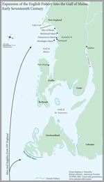
High Res Image – jpeg |
|
|
|
|
|
|
|
|
| top of page |
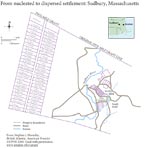
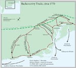
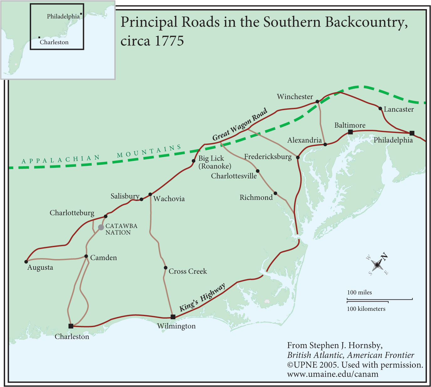
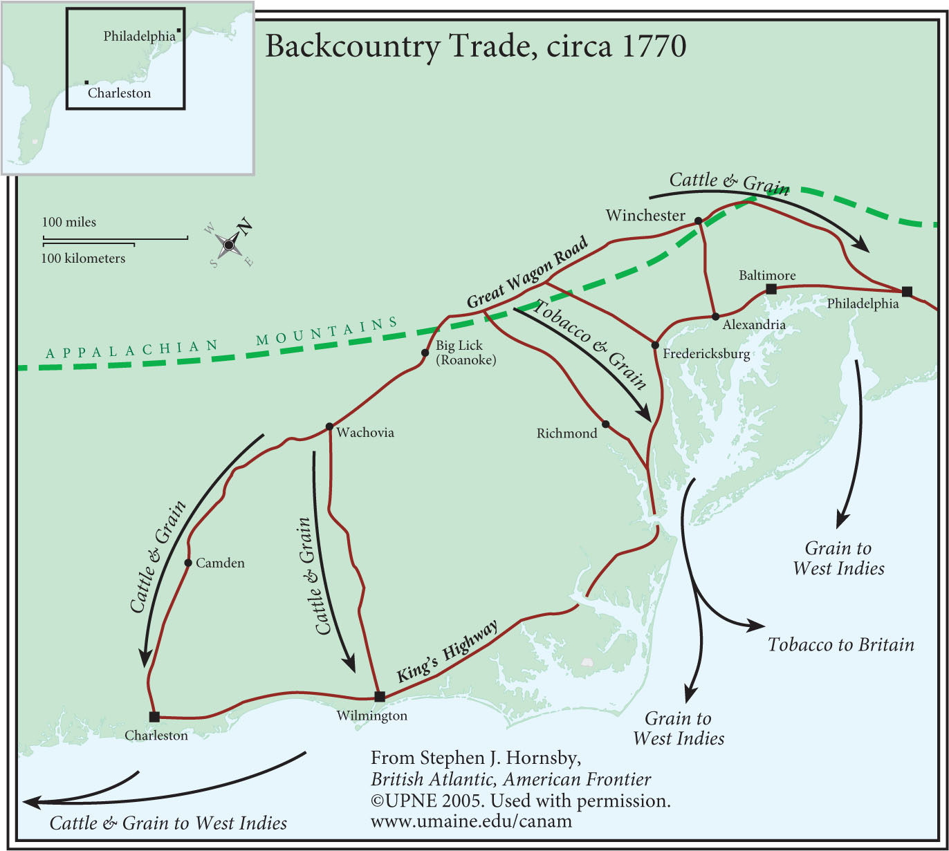
Chapter 4: Agricultural Frontiers: New England, the Mid-Atlantic,
and the Southern Backcountry |
|
|
|
|
|
|
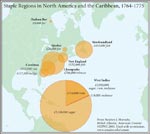
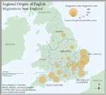
Figure 4.14
Regional Origins of Scots-Irish and German Migrants to North America, 1700-1775 |
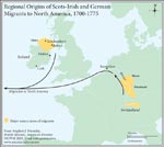
High Res Image – jpeg |
|
|
|
|
|
|
|
|
|
|
|
| top of page |
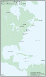
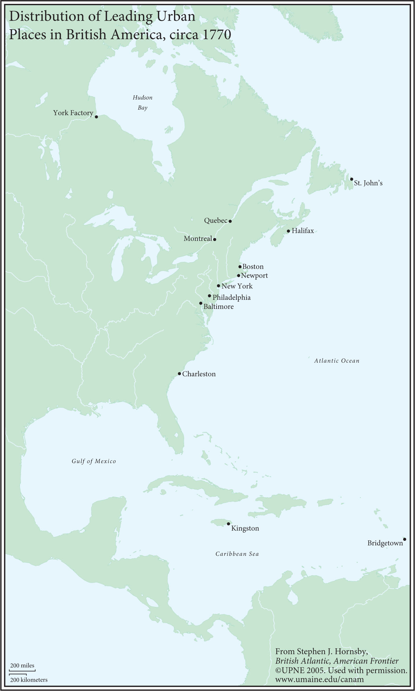
| Chapter 5: British American Towns |
|
|
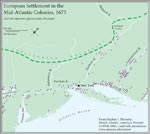
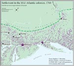
Figure 5.2
Distribution of Urban Places in New England, the Mid-Atlantic Colonies, and the Chesapeake, circa 1770 |
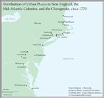
High Res Image – jpeg |
|
|
|
top of page |
| Chapter 6: The Fracturing of British America |
|
|
|
Figure 6.11
Channel Islands Migratory Fishery in the Gulf of St. Lawrence, circa 1770 |
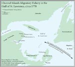
High Res Image – jpeg |
|
|
|
|
| top of page |