Historical Atlas of Maine
From ice age to digital age, ‘Historical Atlas of Maine’ completed after 15 years of work
by Emily Burnham, Bangor Daily News
After 15 years, the creation of more than maps, countless hours spent pouring over old documents and lots of careful editing, the “Historical Atlas of Maine,” a colorful, fact-packed volume detailing 15,000 years of Maine history, has finally been published by the University of Maine Press.
To view the complete article, click here.
To order the Historical Atlas of Maine, click here.
Discovering Maine
New atlas offers a unique perspective on the state’s history

Maine’s North Woods first called Henry David Thoreau in 1846, when he traveled the West Branch of the Penobscot in a bateau and scaled Mount Katahdin. Over the next 11 years, the philosopher-naturalist made two more expeditions into the Maine woods, both times with Penobscot Native guides. On those journeys, Thoreau discovered the natural wonder of Maine’s wilderness and came to a better understanding of Penobscot culture.
To view the entire article, please click here.
To order the Historical Atlas of Maine, click here.
Fifteen years in the making, new atlas tells Maine’s story with masterful depth, visuals
The book, dreamed up by a UMaine English professor and completed by colleagues after his death, covers 13,000 years of history and has more than 300 specially made maps.
by Ray Routhier, Portland Press Herald

Burton Hatlen was a poet, teacher, mentor to Stephen King and a self-described “public academic” who believed passionately in the power and imagery of language.
Where others might see the history of Maine from the last ice age to the 21st century as a collection of charts and statistics, Hatlen saw the possibility for a story, of Maine and its people, told with thoughtful words, detailed pictures and beautiful maps. In 1997, with no experience as a historian or cartographer, the English professor proposed to his University of Maine colleagues the idea of creating a comprehensive historical atlas of Maine, covering some 13,000 years of state history.
To view the entire article, please click here.
To order the Historical Atlas of Maine, click here.

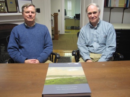
Stephen Hornsby, Director of the Canadian-American Center, and Michael Alpert, Director of the University of Maine Press, with the first copy of the Historical Atlas of Maine, which arrived at the Center on September 22, 2014.
For more information about the Historical Atlas of Maine, please see this video from 2010.